Old Maps of Kirbytown, Virginia for Metal Detecting
Plan your next treasure hunt with 17 historic maps of Kirbytown. Find old homesites, ghost towns, trails, and gathering spots that may be lost to time — perfect for identifying promising metal detecting locations.
- Locate forgotten sites: Uncover places like long-lost settlements, abandoned rail lines, or gathering spots.
- Plan better hunts: Use map overlays combined with LiDAR or satellite views to narrow in on historically rich areas.
- Made for detectorists: Thousands of hobbyists use these maps to discover relics, coins, and hidden history.
Use these historic maps to boost your research and find new opportunities beneath the surface of Kirbytown.
Kirbytown, VA maps
(17)- 1894 Map of Richmond
 1894 Richmond1894 Print · USGSThe Richmond area at the close of the nineteenth century reveals a city expanding into its rural surroundings via a complex network of turnpikes and railroads. Genealogists and historians can trace family-named sites like Hawes Shop, Hazelgrove's Store, and Gilman's Mill alongside civil war landmarks at Seven Pines and Old Cold Harbor.
 - 1895 Map of Richmond
 1895 Richmond1895 Print · USGSRichmond and Manchester thrive as bustling riverfront hubs in the 1890s, where rail lines and historic turnpikes converge on the James River. Genealogists and historians can trace family locations near Merry Oaks Church or follow the road to Old Cold Harbor and Seven Pines.5 unique versions available
 - 1934 Map of Seven Pines
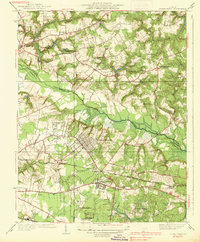
 1934 Seven Pines1934 Print · USGSHenrico and Hanover counties are seen here in the mid-1930s, documenting a landscape where historic battlegrounds met the dawn of modern aviation. Researchers can trace the legacy of local conflict through the National Cem or locate community centers like New Bridge Ch and Highland Springs.
 - 1938 Map of Seven Pines
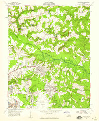
 1938 Seven Pines1938 Print · USGSEastern Henrico County and Hanover County are seen here in the mid-1930s as suburban growth began to meet rural history. Genealogists and historians can trace family landmarks like the Trent House, find rural schools such as Dry Bridge Sch, and locate the early Richard E Byrd Landing Field.3 unique versions available
 - 1943 Map of Richmond, 1972 Print
 1943 Richmond1972 Print · USGSCoastal Virginia and the state capital are shown in detail during the mid-century era of infrastructure expansion. Genealogists and historians can trace the grounds of Richmond Nat Battlefield Park, locate the Yorktown Nat Cem, or follow the many rural routes through Amelia Court House and Tappahannock.
 - 1949 Map of Richmond, 1951 Print
 1949 Richmond1951 Print · USGSCoastal Virginia in the years following World War II remained a landscape of historic river towns and expanding military bases. Genealogists and historians can trace the rail lines of the Southern Ry and locate established landmarks from Camp Lee to the remote reaches of Dragon Swamp.
 - 1956 Map of Seven Pines, 1959 Print
 1956 Seven Pines1959 Print · USGSEast of Richmond in the mid-fifties, the landscape reveals a layering of significant Civil War sites and burgeoning mid-century suburban expansion. Researchers can trace historic landmarks like the Garthright House, several old mills including Gaines Mill, and the grounds of Savage Station.
 - 1959 Map of Richmond
 1959 Richmond1959 Print · USGSMid-century Virginia is captured here at its most vital rail and river junctions, from the capital city to the Chesapeake Bay. Genealogists and historians can trace the development of colonial settlements like Williamsburg and military landmarks including Fort Monroe and Camp Lee.
 - 1964 Map of Richmond
 1964 Richmond1964 Print · USGSCoastal and central Virginia are mapped during the mid-twentieth century, showing the critical intersection of rail, river, and military life. Genealogists can trace family roots through rural county seats like Amelia or find vanished coastal neighborhoods near Phoebus and Hilton Village.
 - 1964 Map of Seven Pines, 1966 Print
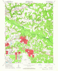 1964 Seven Pines1966 Print · USGSThe Henrico and Hanover County borderlands come alive in the mid-sixties, showing the growth of suburban communities near the expanding Byrd Field. Trace the historic landscapes of Old Cold Harbor and Savage Station, or locate family landmarks like the Garthright House and Lee-Davis High Sch.6 unique versions available
 - 1973 Map of Richmond, 1974 Print
 1973 Richmond1974 Print · USGSThe Virginia Tidewater and Piedmont come alive in the early seventies, showcasing a region defined by its great rivers and massive military installations. Researchers can trace the mid-century growth of Richmond or locate family sites near Amelia Court House and Highland Springs.2 unique versions available
 - 1984 Map of Richmond, 1986 Print
 1984 Richmond1986 Print · USGSCentral Virginia during the mid-eighties shows a landscape of rapid suburban expansion centered on the state capital and its historic riverfront. Genealogists and historians can trace institutional sites like Randolph-Macon College, the grounds of Fort Lee, and small community landmarks like Hebron Ch.3 unique versions available
 - 2010 Map of Seven Pines, 2010 Print
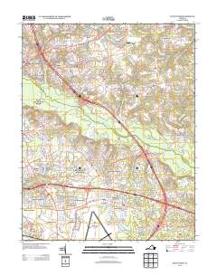
 2010 Seven Pines2010 Print · USGSCovers Kirbytown, including Mechanicsville, Highland Springs, and other nearby areas
 - 2013 Map of Seven Pines, 2013 Print
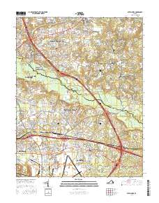
 2013 Seven Pines2013 Print · USGSCovers Kirbytown, including Mechanicsville, Highland Springs, and other nearby areas
 - 2016 Map of Seven Pines, 2016 Print
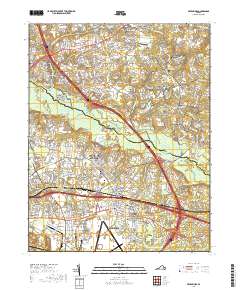
 2016 Seven Pines2016 Print · USGSCovers Kirbytown, including Mechanicsville, Highland Springs, and other nearby areas
 - 2019 Map of Seven Pines, 2019 Print
 2019 Seven Pines2019 Print · USGSCovers Kirbytown, including Mechanicsville, Highland Springs, and other nearby areas
 - 2022 Map of Seven Pines, 2022 Print
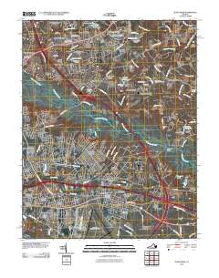
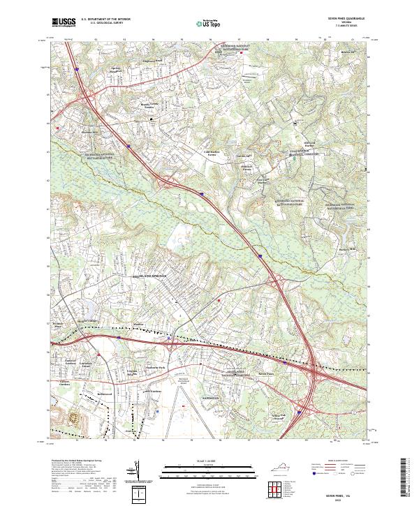 2022 Seven Pines2022 Print · USGSHenrico County is shown in detail during the early 2020s, where modern development meets the preserved grounds of the Richmond National Battlefield Park. Researchers can locate historic markers like Gaines Mill and the Cold Harbor National Cemetery.
End of results
Showing maps 1-17 of 17
Top cities near Kirbytown
- Richmond historical maps
- Mechanicsville historical maps
- Meadowbrook historical maps
- Highland Springs historical maps
- Lakeside historical maps
- Montrose historical maps
See more
Frequently asked questions
- What are the different types of historical maps available for Kirbytown?
- What is the oldest map of Kirbytown?
- Where can I purchase historical maps of Kirbytown for my home or office?
- Where can I download high-res historical maps of Kirbytown?
- Are there historical topographic maps available for Kirbytown?
- Is there historical aerial imagery available for Kirbytown?
- Where are historical maps of Kirbytown sourced from?