Old Maps of New Hampden, Virginia for Metal Detecting
Plan your next treasure hunt with 13 historic maps of New Hampden. Find old homesites, ghost towns, trails, and gathering spots that may be lost to time — perfect for identifying promising metal detecting locations.
- Locate forgotten sites: Uncover places like long-lost settlements, abandoned rail lines, or gathering spots.
- Plan better hunts: Use map overlays combined with LiDAR or satellite views to narrow in on historically rich areas.
- Made for detectorists: Thousands of hobbyists use these maps to discover relics, coins, and hidden history.
Use these historic maps to boost your research and find new opportunities beneath the surface of New Hampden.
New Hampden, VA maps
(13)- 1901 Map of Monterey, 1905 Print
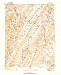
 1901 Monterey1905 Print · USGSThe high Allegheny ridges of Highland and Bath Counties are shown at the turn of the century when isolated valley settlements were linked by winding mountain gaps. Genealogists can trace early homesteads and commerce centers like Cleeks Mills, Mountaingrove, and New Hampden.8 unique versions available
 - 1941 Map of Monterey, 1963 Print
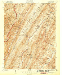
 1941 Monterey1963 Print · USGSHighland County at the start of the 1940s reveals a network of high-valley settlements and strategic turnpikes. Trace the locations of early schools and churches like Strait Creek School and Union Chapel near the South Branch of the Potomac.2 unique versions available
 - 1944 Map of Monterey
 1944 Monterey1944 Print · USGSHighland County at the height of the Second World War remains a land of high ridges and isolated mountain valleys. Genealogists can trace family footprints across Bluegrass Valley and locate landmarks like Hamilton Chapel, Possum Trot, and the Strait Creek Sch.2 unique versions available
 - 1949 Map of Charlottesville
 1949 Charlottesville1949 Print · USGSThe Shenandoah Valley and Blue Ridge appear in the late 1940s as a thriving corridor of rail and river commerce. Researchers can trace the mid-century footprints of Harrisonburg, Staunton, and Culpeper alongside the historic routes of the Southern Railway.2 unique versions available
 - 1956 Map of Charlottesville, 1966 Print
 1956 Charlottesville1966 Print · USGSThe Shenandoah Valley and Blue Ridge are captured in detail during the mid-1960s as the modern interstate system began to emerge. Genealogists and historians can trace rail-connected hubs like Waynesboro or follow the river paths of the Rapidan River and Rivanna River.4 unique versions available
 - 1969 Map of Monterey, 1971 Print
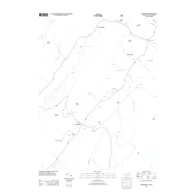
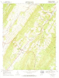 1969 Monterey1971 Print · USGSHighland County's high-mountain valleys are shown here in the late sixties as the community of Monterey thrived alongside older settlements. Genealogists can trace family names through Seybert Chapel, Union Chapel, and Hannah Airfield, or locate the Fish Hatchery and Possum Trot.3 unique versions available
 - 1986 Map of Staunton
 1986 Staunton1986 Print · USGSThe Shenandoah Valley and Allegheny Highlands meet in the mid-1980s, revealing a landscape of historic mountain towns and thermal resorts. Genealogists and historians can trace institutional landmarks like Mary Baldwin College or follow the legacy of the Chesapeake and Ohio Railroad through Craigsville and Swoope.2 unique versions available
 - 1999 Map of Monterey, 2001 Print
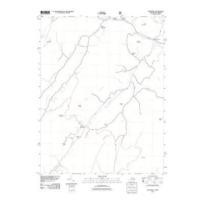
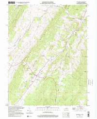 1999 Monterey2001 Print · USGSHighland County's high-mountain valleys are captured here at the close of the century, showing the rural settlement patterns of the Virginia-West Virginia border. Genealogists and local historians can trace family locations near Union Chapel, the community of New Hampden, and the landmark Trimble Knob.
 - 2011 Map of Monterey, 2011 Print
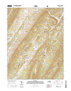
 2011 Monterey2011 Print · USGSCovers New Hampden, including Monterey, Possum Trot, and other nearby areas
 - 2013 Map of Monterey, 2013 Print
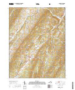
 2013 Monterey2013 Print · USGSCovers New Hampden, including Monterey, Possum Trot, and other nearby areas
 - 2016 Map of Monterey, 2016 Print
 2016 Monterey2016 Print · USGSCovers New Hampden, including Monterey, Possum Trot, and other nearby areas
 - 2019 Map of Monterey, 2019 Print
 2019 Monterey2019 Print · USGSCovers New Hampden, including Monterey, Possum Trot, and other nearby areas
 - 2022 Map of Monterey, 2022 Print
 2022 Monterey2022 Print · USGSThe Highland County seat and its surrounding mountain valleys are captured here in the early twenty-first century. Researchers can locate numerous family burial sites and landmarks like the Highland County Courthouse, Monterey Cem, and Simmons Family Cem.
End of results
Showing maps 1-13 of 13
Top cities near New Hampden
Frequently asked questions
- What are the different types of historical maps available for New Hampden?
- What is the oldest map of New Hampden?
- Where can I purchase historical maps of New Hampden for my home or office?
- Where can I download high-res historical maps of New Hampden?
- Are there historical topographic maps available for New Hampden?
- Is there historical aerial imagery available for New Hampden?
- Where are historical maps of New Hampden sourced from?