Old Maps of Palo Alto, Virginia for Genealogy
Trace your family roots with 14 historic maps of Palo Alto. These high-res maps reveal old neighborhoods, homesites, landmarks, and streets — helping you uncover where your ancestors lived and how the area evolved over time.
- Explore historic neighborhoods: Identify where your relatives may have lived in the 1800s or 1900s.
- Compare maps over time: Trace the changes in streets, buildings, and landmarks for multi-generational research.
- Perfect for genealogy & ancestry research: Used by family historians and researchers to map out lineage and migration.
These maps are an incredible resource for exploring your personal connection to Palo Alto's past.
Palo Alto, VA maps
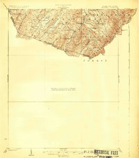
(14)- 1894 Map of Staunton, 1897 Print
 1894 Staunton1897 Print · USGSThe Shenandoah Valley was a hub of rail commerce and mountain industry in the 1890s, centered on the growing city of Staunton. Genealogists and historians can trace defunct rail stops and early industry at Giant Mills, Milnesville, and Stribling Spgs.8 unique versions available
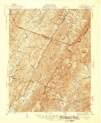
 - 1924 Map of Mc Dowell
 1924 Mc Dowell1924 Print · USGSHighland County and the Allegheny borderlands are shown in the early twenties, a time of isolated mountain communities and high-ridge forests. Genealogists can trace family footprints at St Paul Church, Mt Hull School, and the remote Crummet Church.5 unique versions available
 - 1944 Map of Mc Dowell, 1960 Print
 1944 Mc Dowell1960 Print · USGSHighland and Augusta counties appear here during the mid-forties, capturing the remote mountain settlements and river gaps of the Alleghenies. Researchers can locate family landmarks like Siron's Mill and rural centers like Mc Dowell or Doe Hill.2 unique versions available
 - 1946 Map of Mc Dowell
 1946 Mc Dowell1946 Print · USGSHighland and Augusta counties are shown in the 1940s as a landscape of ridge-top landmarks and valley crossroads. Genealogists and local historians can trace family-named sites like Simons Mill, the historic Staunton and Parkersburg Turnpike, and rural congregations at St Pauls Ch.2 unique versions available
 - 1949 Map of Charlottesville
 1949 Charlottesville1949 Print · USGSThe Shenandoah Valley and Blue Ridge appear in the late 1940s as a thriving corridor of rail and river commerce. Researchers can trace the mid-century footprints of Harrisonburg, Staunton, and Culpeper alongside the historic routes of the Southern Railway.2 unique versions available
 - 1956 Map of Charlottesville, 1966 Print
 1956 Charlottesville1966 Print · USGSThe Shenandoah Valley and Blue Ridge are captured in detail during the mid-1960s as the modern interstate system began to emerge. Genealogists and historians can trace rail-connected hubs like Waynesboro or follow the river paths of the Rapidan River and Rivanna River.4 unique versions available
 - 1969 Map of Palo Alto, 1971 Print
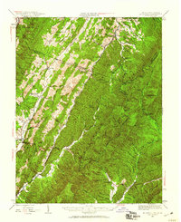
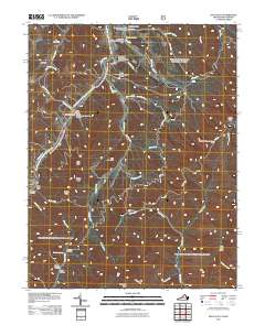
 1969 Palo Alto1971 Print · USGSThe West Virginia and Virginia border comes alive in this late-sixties study of the ridges surrounding Palo Alto. Trace rural heritage through family-named landmarks like Puffenbarger Pond, old mountain churches including Wilfong Ch, and the many hollows of Shenandoah Mountain.3 unique versions available
 - 1986 Map of Staunton
 1986 Staunton1986 Print · USGSThe Shenandoah Valley and Allegheny Highlands meet in the mid-1980s, revealing a landscape of historic mountain towns and thermal resorts. Genealogists and historians can trace institutional landmarks like Mary Baldwin College or follow the legacy of the Chesapeake and Ohio Railroad through Craigsville and Swoope.2 unique versions available
 - 1999 Map of Palo Alto, 2000 Print
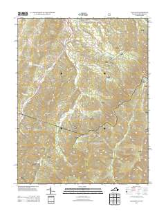
 1999 Palo Alto2000 Print · USGSThe borderlands of Augusta and Highland County meet West Virginia here in the late twentieth century, showing a landscape defined by ridges and narrow hollows. Genealogists can locate family landmarks such as Crummett Ch, Wilfong Ch, and the small settlement of Palo Alto.
 - 2011 Map of Palo Alto, 2011 Print
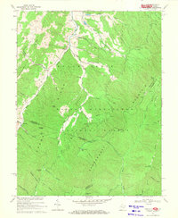
 2011 Palo Alto2011 Print · USGSCovers Palo Alto, including Augusta County, Highland County, and other nearby areas
 - 2013 Map of Palo Alto, 2013 Print
 2013 Palo Alto2013 Print · USGSCovers Palo Alto, including Augusta County, Highland County, and other nearby areas
 - 2016 Map of Palo Alto, 2016 Print
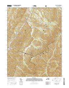 2016 Palo Alto2016 Print · USGSCovers Palo Alto, including Augusta County, Highland County, and other nearby areas
 - 2019 Map of Palo Alto, 2019 Print
 2019 Palo Alto2019 Print · USGSCovers Palo Alto, including Augusta County, Highland County, and other nearby areas
 - 2022 Map of Palo Alto, 2022 Print
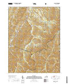
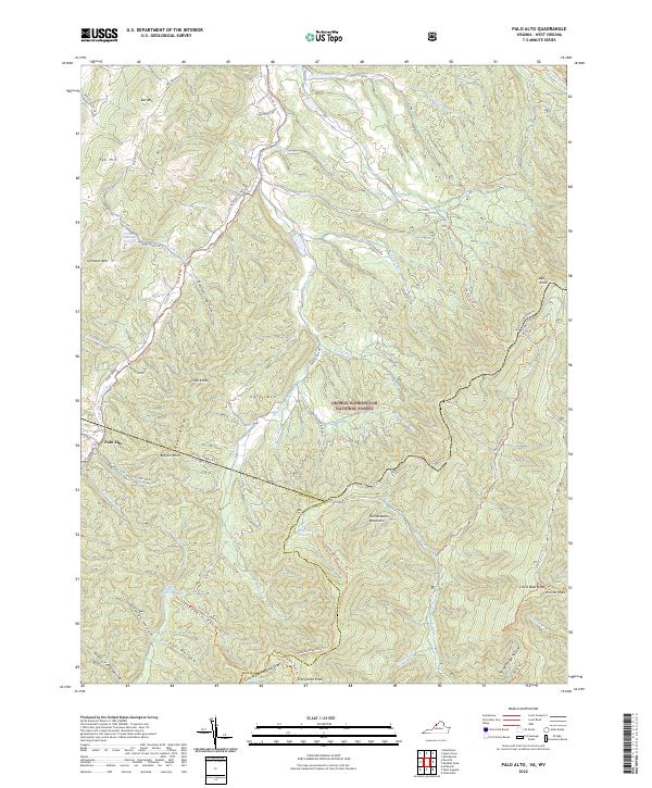 2022 Palo Alto2022 Print · USGSSettlement and forest overlap on the Virginia-West Virginia border in this recent survey of the Allegheny Highlands. Researchers can locate family landmarks like Warren Rexrode Spring and Puffenbarger Pond or trace the winding course of the S Fork S Br Potomac River.
End of results
Showing maps 1-14 of 14
Top cities near Palo Alto
Frequently asked questions
- What are the different types of historical maps available for Palo Alto?
- What is the oldest map of Palo Alto?
- Where can I purchase historical maps of Palo Alto for my home or office?
- Where can I download high-res historical maps of Palo Alto?
- Are there historical topographic maps available for Palo Alto?
- Is there historical aerial imagery available for Palo Alto?
- Where are historical maps of Palo Alto sourced from?