Old Maps of Maynards Crossroads, Virginia
Explore 11 old maps of Maynards Crossroads, spanning from 1920 to today. These high-resolution historic maps reveal how streets, neighborhoods, landmarks, and natural features evolved over time — perfect for genealogy, metal detecting, research, and local history exploration.
What you can do with these maps:
- See how Maynards Crossroads changed over time: Compare historical maps to modern-day views to trace roads, homesites, rail lines & more.
- View detailed metadata: Each map includes creators, publishers, year, scale, and archive source.
- Overlay maps with satellite & LiDAR: Visualize the past alongside modern tools to explore terrain & human change.
- Trusted historical sources: Maps sourced from the USGS, Library of Congress, and other archives.
- Access maps your way: View online, download high-res files, or order prints for personal or research use.
Start exploring old maps of Maynards Crossroads to uncover forgotten places, hidden landmarks, and the deep history beneath your feet.
Maynards Crossroads, VA maps
(11)- 1920 Map of Holland
 1920 Holland1920 Print · USGSCoastal plain life at the end of the Great War centers on the river-and-rail hubs of Franklin and Holland. Genealogists can trace family footprints across dozens of country schools like Holmes School and river crossings such as Joyners Bridge and Manning Ferry.2 unique versions available
 - 1943 Map of Holland
 1943 Holland1943 Print · USGSThe Virginia and North Carolina borderlands come alive in this mid-century survey of the Chowan River basin. Local historians can trace a network of river landings and rural schools, from Manning Ferry to the community around Stony Branch Church.
 - 1953 Map of Norfolk, 1954 Print
 1953 Norfolk1954 Print · USGSCoastal Virginia and northeastern North Carolina appear here during the post-war industrial boom, showing the critical rail-and-sea connections of Hampton Roads. Genealogists can trace family roots through rural landmarks like Gethsemane Ch, the Caledonia State Prison Farm, and the vast interior of the Dismal Swamp.4 unique versions available
 - 1957 Map of Holland, 1958 Print
 1957 Holland1958 Print · USGSThe Virginia and North Carolina borderlands come into focus in the mid-fifties, centered on the river city of Franklin and the agricultural community of Holland. Researchers can trace early river crossings like Manning Ferry (Site) and find family roots at Oberry Sch Cem or St Matthews Ch.
 - 1967 Map of Franklin, 1969 Print
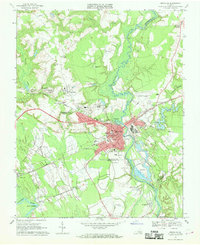 1967 Franklin1969 Print · USGSThe city of Franklin and the surrounding swamplands of the coastal plain come into sharp focus during the late sixties. Genealogists and local historians can trace rural family churches like White Oak Springs Ch and St Johns Ch or the rail-side growth of Hunterdale.5 unique versions available
 - 1985 Map of Norfolk, 1986 Print
 1985 Norfolk1986 Print · USGSThe Tidewater region in the mid-eighties shows the dense urban expansion of the coastal cities alongside the preservation of the Great Dismal Swamp. Researchers can trace rural family-named crossroads and historic transit routes like the Seaboard Coast Line or find Somerton and Lake Drummond.3 unique versions available
 - 2010 Map of Franklin, 2010 Print
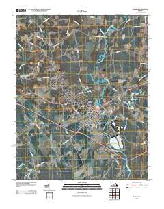 2010 Franklin2010 Print · USGSCovers Maynards Crossroads, including Franklin, Camptown, and other nearby areas
 - 2013 Map of Franklin, 2013 Print
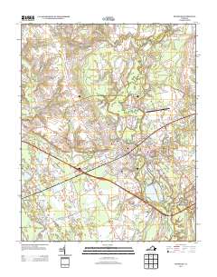 2013 Franklin2013 Print · USGSCovers Maynards Crossroads, including Franklin, Camptown, and other nearby areas
 - 2016 Map of Franklin, 2016 Print
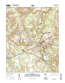 2016 Franklin2016 Print · USGSCovers Maynards Crossroads, including Franklin, Camptown, and other nearby areas
 - 2019 Map of Franklin, 2019 Print
 2019 Franklin2019 Print · USGSCovers Maynards Crossroads, including Franklin, Camptown, and other nearby areas
 - 2022 Map of Franklin, 2022 Print
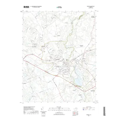
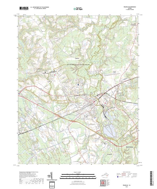 2022 Franklin2022 Print · USGSFranklin and the surrounding Southampton County landscape are shown here in the early twenty-first century. Genealogists and local historians can trace family roots through the Beale Family Cemetery or explore the riverfront heritage of Lees Mill and Camptown.
End of results
Showing maps 1-11 of 11
Top cities near Maynards Crossroads
- Franklin historical maps
- Smithfield historical maps
- Windsor historical maps
- Courtland historical maps
- Wakefield historical maps
- Camptown historical maps
See more
Frequently asked questions
- What are the different types of historical maps available for Maynards Crossroads?
- What is the oldest map of Maynards Crossroads?
- Where can I purchase historical maps of Maynards Crossroads for my home or office?
- Where can I download high-res historical maps of Maynards Crossroads?
- Are there historical topographic maps available for Maynards Crossroads?
- Is there historical aerial imagery available for Maynards Crossroads?
- Where are historical maps of Maynards Crossroads sourced from?