2022 Map of Franklin
USGS Topo · Published 2022About this map
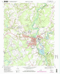
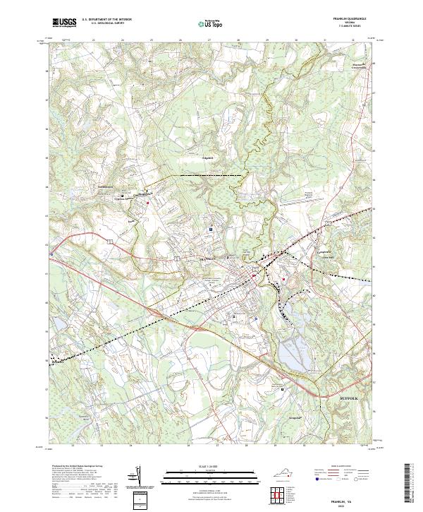
Franklin serves as the central hub of this Tidewater Virginia landscape, situated where the Blackwater River winds through a complex network of wetlands including Beaverdam Swamp and Kingsale Swamp. The city’s transition from its historic core to modern development is evident in the presence of the Paul D Camp Community College - Franklin Campus and the nearby Franklin Regional Airport. Surrounding residential areas like Hunterdale, Edgehill, and Cypress Manor illustrate the community's outward growth, while smaller settlements such as Camptown and Lees Mill maintain their distinct identities along the riverbanks.
Find a feature on this map
133 named features on this map. Tap any name to fly to it.
Don’t see what you’re looking for? This feature index may not catch every label — zoom into the map to look around manually.
Map Details
Editions of this 2022 Franklin Map
This is the sole edition of this map. No revisions or reprints were ever made.