Old Maps of Toano Trace, James City County for Hiking & Exploration
Hike through history with 28 historic maps of Toano Trace. Explore old trails, ghost towns, and forgotten backroads — perfect for outdoor adventurers and local explorers.
- Rediscover forgotten places: Map out old mining camps, roads, and footpaths that no longer exist on modern maps.
- Layer with modern tools: Combine with LiDAR or satellite views to plan hikes through historical terrain.
- Made for exploration: Popular among hikers, overlanders, and local history lovers.
Use these maps to find adventure and explore the hidden past of Toano Trace.
Toano Trace, James City County maps
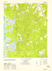
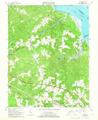
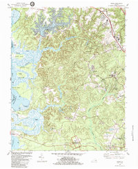
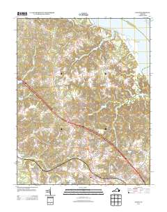
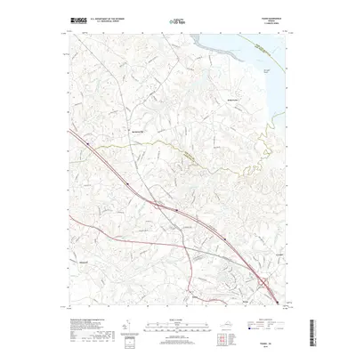
(28)- 1917 Map of Toano, 1959 Print
 1917 Toano1959 Print · USGSCoastal Virginia during the early twentieth century shows a landscape where rail lines and steamboat routes intersect. Genealogists can trace family roots through numerous sites like Hickory Neck Church, One Eye School, and Barrets Ferry.
 - 1918 Map of Toano
 1918 Toano1918 Print · USGSThe Virginia Peninsula comes alive in the years following the Great War, showing a landscape of river landings and rail-side villages. Researchers can trace the path of the Chesapeake and Ohio through Toano or locate early rural schoolhouses like One Eye School and Brickbat School.3 unique versions available
 - 1943 Map of Richmond, 1972 Print
 1943 Richmond1972 Print · USGSCoastal Virginia and the state capital are shown in detail during the mid-century era of infrastructure expansion. Genealogists and historians can trace the grounds of Richmond Nat Battlefield Park, locate the Yorktown Nat Cem, or follow the many rural routes through Amelia Court House and Tappahannock.
 - 1949 Map of Richmond, 1951 Print
 1949 Richmond1951 Print · USGSCoastal Virginia in the years following World War II remained a landscape of historic river towns and expanding military bases. Genealogists and historians can trace the rail lines of the Southern Ry and locate established landmarks from Camp Lee to the remote reaches of Dragon Swamp.
 - 1952 Map of Norge, 1958 Print
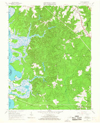
 1952 Norge1958 Print · USGSThe Virginia Peninsula comes alive in the early fifties, documenting a world of river landings and small crossroads communities. Genealogists and historians can trace family-named sites like Warren Mill, find the Brickbat School, or locate the Barretta Ferry crossing.
 - 1953 Map of Toano
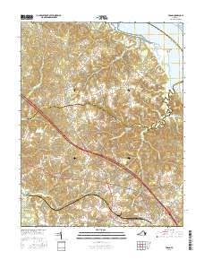
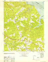 1953 Toano1953 Print · USGSThe rural Virginia Peninsula is captured here in the early fifties, where the rail-centered economy of James City and New Kent counties remains intact. Genealogists and historians can locate legacy landmarks like Hickory Neck Church, the Bock Cem, and the small siding at Diascund.
 - 1953 Map of Norge
 1953 Norge1953 Print · USGSJames City County is shown in the early fifties as the rural landscape surrounding Norge and Lightfoot began to modernize. Researchers can trace historic river access at Shipyard Landing and locate old community hubs like Warren Mill or Jerusalem Church.
 - 1958 Map of Toano
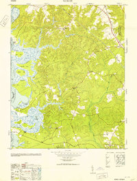
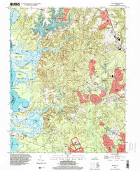
 1958 Toano1958 Print · USGSThe wooded lowlands and creek systems of James City County are shown here at mid-century, centered on the village of Toano. Researchers can trace the heritage of local congregations at Hickory Neck Church and St Johns Church, or locate family sites near Barhamsville.
 - 1959 Map of Richmond
 1959 Richmond1959 Print · USGSMid-century Virginia is captured here at its most vital rail and river junctions, from the capital city to the Chesapeake Bay. Genealogists and historians can trace the development of colonial settlements like Williamsburg and military landmarks including Fort Monroe and Camp Lee.
 - 1964 Map of Richmond
 1964 Richmond1964 Print · USGSCoastal and central Virginia are mapped during the mid-twentieth century, showing the critical intersection of rail, river, and military life. Genealogists can trace family roots through rural county seats like Amelia or find vanished coastal neighborhoods near Phoebus and Hilton Village.
 - 1965 Map of Toano, 1966 Print
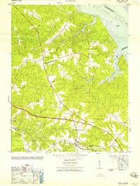
 1965 Toano1966 Print · USGSCoastal wetlands and rural rail towns define this portion of the Virginia Peninsula in the mid-sixties. Local researchers can trace old crossroads like Barhamsville and Croaker, find historic country churches such as Mt Olive Ch, or locate Branch Siding on the railroad.4 unique versions available
 - 1965 Map of Norge, 1967 Print
 1965 Norge1967 Print · USGSJames City County in the mid-1960s is a landscape of tidal river systems and quiet crossroads settlements. Genealogists and local historians can trace family locations near Norge, Lightfoot, and Jamestown Farms, or locate old landmarks like Warren Mill and Shipyard Landing.3 unique versions available
 - 1973 Map of Richmond, 1974 Print
 1973 Richmond1974 Print · USGSThe Virginia Tidewater and Piedmont come alive in the early seventies, showcasing a region defined by its great rivers and massive military installations. Researchers can trace the mid-century growth of Richmond or locate family sites near Amelia Court House and Highland Springs.2 unique versions available
 - 1973 Map of Toano, 1977 Print
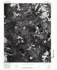
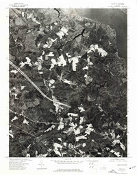 1973 Toano1977 Print · USGSVirginia's coastal plain appears in high detail during the early 1970s, showcasing the agricultural and forested landscape near the York River. Researchers can examine the exact footprint of farmsteads and transport routes as they were captured during an aerial survey in the spring of 1973.
 - 1978 Map of Norge, 1983 Print
 1978 Norge1983 Print · USGSJames City County settlement and landscape patterns are visible in this late-1970s aerial survey. Trace the growth of Norge and Lightfoot or locate sites like Warren Mill and Jolly Pond along the tidewater tributaries.
 - 1984 Map of Norge
 1984 Norge1984 Print · USGSJames City County is shown here in the mid-1980s, capturing a blend of colonial heritage sites and modern residential expansion. Genealogists and historians can trace the Green Spring Ruins, locate old congregations at James City Chapel, and explore the shoreline from Shields Point to Claybank Landing.3 unique versions available
 - 1984 Map of Williamsburg, 1985 Print
 1984 Williamsburg1985 Print · USGSThe Virginia Peninsula and Chesapeake Bay shores are shown in the mid-1980s, revealing a landscape defined by colonial heritage and massive military installations. Researchers can trace the grounds of the College of William and Mary, the Yorktown National Cemetery, and the historic Jamestown Island.3 unique versions available
 - 1994 Map of Norge, 2000 Print
 1994 Norge2000 Print · USGSJames City County was undergoing suburban growth in the 1990s while preserving its deep colonial roots. Researchers can trace historic foundations at Green Spring Ruins and locate community landmarks like James City Chapel Cem and Norge.
 - 2010 Map of Norge, 2010 Print
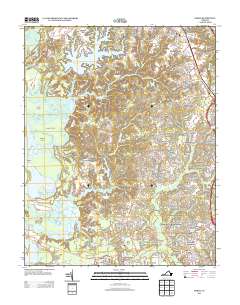
 2010 Norge2010 Print · USGSCovers Toano Trace, including Claybank Landing, Lake Toano Estates, and other nearby areas
 - 2011 Map of Toano, 2011 Print
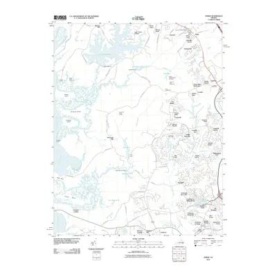
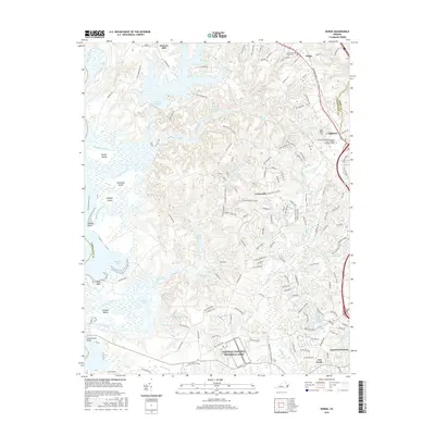
 2011 Toano2011 Print · USGSCovers Toano Trace, including Barhamsville, Holly Forks, and other nearby areas
 - 2013 Map of Toano, 2013 Print
 2013 Toano2013 Print · USGSCovers Toano Trace, including Barhamsville, Holly Forks, and other nearby areas
 - 2013 Map of Norge, 2013 Print
 2013 Norge2013 Print · USGSCovers Toano Trace, including Claybank Landing, Lake Toano Estates, and other nearby areas
 - 2016 Map of Norge, 2016 Print
 2016 Norge2016 Print · USGSCovers Toano Trace, including Claybank Landing, Lake Toano Estates, and other nearby areas
 - 2016 Map of Toano, 2016 Print
 2016 Toano2016 Print · USGSCovers Toano Trace, including Barhamsville, Holly Forks, and other nearby areas
 - 2019 Map of Toano, 2019 Print
 2019 Toano2019 Print · USGSCovers Toano Trace, including Barhamsville, Holly Forks, and other nearby areas
Showing maps 1-25 of 28
Frequently asked questions
- What are the different types of historical maps available for Toano Trace?
- What is the oldest map of Toano Trace?
- Where can I purchase historical maps of Toano Trace for my home or office?
- Where can I download high-res historical maps of Toano Trace?
- Are there historical topographic maps available for Toano Trace?
- Is there historical aerial imagery available for Toano Trace?
- Where are historical maps of Toano Trace sourced from?