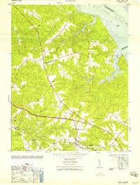
1958 Map of Toano
USGS Topo · Published 1958About this map
Toano and Barhamsville serve as the primary inland hubs in this mid-century portrait of the Virginia Peninsula. The landscape is defined by its deep hydrological system, where Wahrani Swamp, Richardson Swamp, and Bird Swamp drain eastward toward the tidal York River and Ware Creek. The transport network reflects both the modern era and the remnants of older transit, with the Chesapeake and Ohio railroad running through Toano near Branch Siding, while a Dismantled Railroad trace cuts through the center of the sheet.
Find a feature on this map
34 named features on this map. Tap any name to fly to it.
Don’t see what you’re looking for? This feature index may not catch every label — zoom into the map to look around manually.
Map Details
Editions of this 1958 Toano Map
This is the sole edition of this map. No revisions or reprints were ever made.
Other maps of this area

1906 · Williamsburg
USGS Topo · 1:62,500

1917 · Urbanna
USGS Topo · 1:62,500

1917 · Toano
USGS Topo · 1:62,500

1918 · Toano
USGS Topo · 1:62,500

1919 · New Kent
USGS Topo · 1:62,500

1943 · Richmond
USGS Topo · 1:250,000

1949 · Shacklefords
USGS Topo · 1:24,000

1949 · New Kent
USGS Topo · 1:24,000

1949 · Richmond
USGS Topo · 1:250,000

1950 · West Point
USGS Topo · 1:24,000