
1950 Map of West Point
USGS Topo · Published 1950About this map
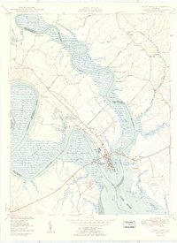
Mattaponi River and Pamunkey River converge here to form the York River, creating a distinctive maritime landscape centered on West Point. The mid-century development of the peninsula is evident in the layout of Port Richmond and the central industrial corridor served by the Southern railroad. Notable riverfront features include Waterfence Landing, Ryefield Landing, and Dixon Landing, which underscore the historic reliance on water transport along these tidal reaches. Moving away from the water, the terrain is dotted with ancestral family landmarks and rural institutions such as Ephesus Ch, Pleasant Hill Sch, and the estates at Chelsea and Romancoke. The 1950s infrastructure is anchored by the Lord Delaware Bridge and the West Point Municipal Airport, providing a clear view of the region's transportation network before modern highway expansions altered the local character.
Find a feature on this map
90 named features on this map. Tap any name to fly to it.
Don’t see what you’re looking for? This feature index may not catch every label — zoom into the map to look around manually.
Map Details
Editions of this 1950 West Point Map
2 editions found
Other maps of this area

1906 · Williamsburg
USGS Topo · 1:62,500

1917 · Urbanna
USGS Topo · 1:62,500

1917 · Toano
USGS Topo · 1:62,500

1918 · Toano
USGS Topo · 1:62,500

1919 · New Kent
USGS Topo · 1:62,500

1943 · Richmond
USGS Topo · 1:250,000
1949 · Truhart
USGS Topo · 1:24,000

1949 · Shacklefords
USGS Topo · 1:24,000
1949 · King And Queen
USGS Topo · 1:24,000
1949 · Samos
USGS Topo · 1:24,000