
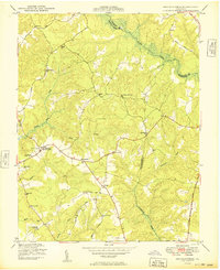
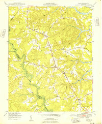
1949 Map of Shacklefords
USGS Topo · Published 1949About this map
Dragon Swamp and the Poropotank River define the eastern boundaries of this Middle Peninsula landscape, where King and Queen, Middlesex, and Gloucester counties meet. The post-war rural infrastructure is characterized by small, scattered settlements like Centerville and Cologne, linked by the Tidewater Trail and the George Washington Memorial Highway. A significant network of community pillars is visible through local congregations and education centers, including Poroporone Ch, New Hope Memorial Ch, and the Mascot Sch.
Find a feature on this map
38 named features on this map. Tap any name to fly to it.
Don’t see what you’re looking for? This feature index may not catch every label — zoom into the map to look around manually.
Map Details
Editions of this 1949 Shacklefords Map
2 editions found
Other maps of this area

1906 · Williamsburg
USGS Topo · 1:62,500

1917 · Urbanna
USGS Topo · 1:62,500

1917 · Toano
USGS Topo · 1:62,500

1918 · Toano
USGS Topo · 1:62,500

1919 · New Kent
USGS Topo · 1:62,500

1943 · Richmond
USGS Topo · 1:250,000
1946 · Urbanna
USGS Topo · 1:24,000
1949 · Truhart
USGS Topo · 1:24,000
1949 · Saluda
USGS Topo · 1:24,000
1949 · Samos
USGS Topo · 1:24,000