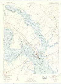
1950 Map of West Point
USGS Topo · Published 1950About this map
West Point sits at the strategic confluence where the Mattaponi River and Pamunkey River meet to form the broad York River. This mid-century survey captures the industrial and maritime character of the town, centered around the Southern Railway terminus and the shipyard facilities at Port Richmond. The landscape is dominated by the vast Eltham Marsh and the Thorofare, illustrating the complex relationship between the tidal wetlands and the developed waterfront. Genealogists and local historians can locate several family-named landmarks and community hubs, including Kentucky Farm, Pleasant Hill, and Shanghai. Religious and burial sites like Olivet Ch, Ephesus Ch, and the Sunny Slope Cem are clearly marked. The presence of the West Point Municipal Airport and the Lord Delaware Bridge signifies the era's growing infrastructure, while the inland areas remain dotted with named landings such as Ryefield Landing and Dixon Landing.
Find a feature on this map
63 named features on this map. Tap any name to fly to it.
Don’t see what you’re looking for? This feature index may not catch every label — zoom into the map to look around manually.
Map Details
Editions of this 1950 West Point Map
2 editions found

Other maps of this area

1906 · Williamsburg
USGS Topo · 1:62,500

1917 · Urbanna
USGS Topo · 1:62,500

1917 · Toano
USGS Topo · 1:62,500

1918 · Toano
USGS Topo · 1:62,500

1919 · New Kent
USGS Topo · 1:62,500

1943 · Richmond
USGS Topo · 1:250,000
1949 · Truhart
USGS Topo · 1:24,000

1949 · Shacklefords
USGS Topo · 1:24,000
1949 · King And Queen
USGS Topo · 1:24,000
1949 · Samos
USGS Topo · 1:24,000