Old Maps of Ely, Virginia for Genealogy
Trace your family roots with 17 historic maps of Ely. These high-res maps reveal old neighborhoods, homesites, landmarks, and streets — helping you uncover where your ancestors lived and how the area evolved over time.
- Explore historic neighborhoods: Identify where your relatives may have lived in the 1800s or 1900s.
- Compare maps over time: Trace the changes in streets, buildings, and landmarks for multi-generational research.
- Perfect for genealogy & ancestry research: Used by family historians and researchers to map out lineage and migration.
These maps are an incredible resource for exploring your personal connection to Ely's past.
Ely, VA maps
(17)- 1894 Map of Estillville, 1909 Print
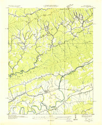
 1894 Estillville1909 Print · USGSThe Appalachian highlands at the turn of the century show a landscape of isolated mountain hollows and emerging rail hubs. Genealogists can trace family footprints across river crossings like Speer Ferry and vanished industry at Zion Mills or Brick Store.3 unique versions available
 - 1921 Map of Big Stone Gap
 1921 Big Stone Gap1921 Print · USGSIn the early 1920s, the coal and rail networks of Wise and Lee Counties were at their peak. Genealogists and historians can trace old settlements and rural hubs like Keokee, Johnsons Mill PO, and Stonega along the Southern RR and the Powell River.
 - 1922 Map of Big Stone Gap
 1922 Big Stone Gap1922 Print · USGSSouthwest Virginia's coal and rail corridors are captured here in the early 1920s, showing the height of industrial development in the Cumberland Mountains. Trace family roots and vanished landmarks near Appalachia, Keokee, and the historic Seminary School along the Powell River.
 - 1929 Map of Big Stone Gap
 1929 Big Stone Gap1929 Print · USGSThe coal and rail networks of the Kentucky-Virginia border country are frozen in time just before the Great Depression. Genealogists and historians can trace family roots through mountain settlements like Lynch, Keokee, and Appalachia, or locate landmarks such as Robbins Chapel and Cluttis Post Office.3 unique versions available
 - 1935 Map of Keokee
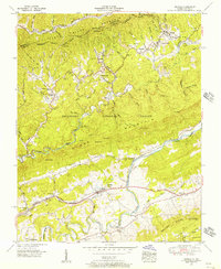
 1935 Keokee1935 Print · USGSThe Virginia and Kentucky borderlands in the 1930s reveal a landscape of deep valleys and coal-driven industry. Genealogists can trace family roots at Ely Memorial Ch and Mohawk Sch or locate mining operations at Stonega Coal No 73.
 - 1955 Map of Johnson City
 1955 Johnson City1955 Print · USGSEast Tennessee and the bordering highlands of Virginia and Kentucky appear here during the post-war industrial boom. You can trace the complex network of mountain ridges and new TVA lakes, from Johnson City to the coalfields near Middlesboro and Lynch.
 - 1955 Map of Keokee, 1956 Print
 1955 Keokee1956 Print · USGSThe Virginia-Kentucky state line was a rugged landscape of rail-fed mountain towns and valley farms in the mid-fifties. Genealogists and historians can trace the route of The Lonesome Pine Trail past Dryden or locate landmarks like Robbins Chapel School and Darnell Town.6 unique versions available
 - 1957 Map of Johnson City, 1966 Print
 1957 Johnson City1966 Print · USGSUpper East Tennessee and Southwest Virginia are shown here during the mid-sixties transition of the Appalachians. Researchers can trace the industrial rail hubs of Kingsport, the sprawling waters of Cherokee Lake, and the historic Cumberland Gap.
 - 1960 Map of Johnson City
 1960 Johnson City1960 Print · USGSUpper East Tennessee and the surrounding tri-state area are shown in the mid-fifties during the height of the TVA reservoir era. Trace the industrial rail lines of the Southern and Louisville and Nashville between Kingsport and Johnson City.
 - 1963 Map of Johnson City
 1963 Johnson City1963 Print · USGSThe Tri-Cities and the surrounding Appalachian ridges are shown in detail during the early sixties, highlighting the era's vital rail and river networks. Genealogists and historians can trace the routes of the Clinchfield RR and locate settlements from Rogersville to Elizabethton.
 - 1976 Map of Keokee, 1981 Print
 1976 Keokee1981 Print · USGSThe Virginia and Kentucky borderlands come into sharp focus in the mid-1970s, showing the intersection of ridge-top forests and valley settlements. Researchers can trace the development of riverside communities like Dryden and Keokee along the North Fork Powell River.
 - 1981 Map of Bristol
 1981 Bristol1981 Print · USGSAppalachia and the Tri-Cities region are shown at a peak of industrial and rail development in the early eighties. Researchers can trace the Clinchfield Railroad through the mountains or find local landmarks like King College and the Holston Army Ammunition Plant.2 unique versions available
 - 2011 Map of Keokee, 2011 Print
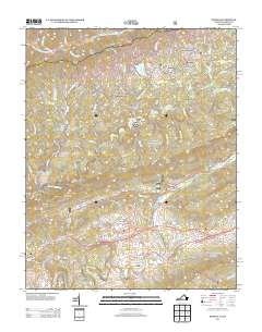
 2011 Keokee2011 Print · USGSCovers Ely, including Dryden, Keokee, and other nearby areas
 - 2013 Map of Keokee, 2013 Print
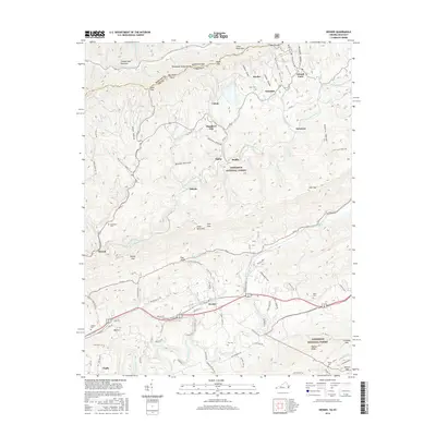
 2013 Keokee2013 Print · USGSCovers Ely, including Dryden, Keokee, and other nearby areas
 - 2016 Map of Keokee, 2016 Print
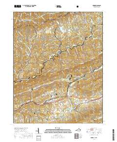
 2016 Keokee2016 Print · USGSCovers Ely, including Dryden, Keokee, and other nearby areas
 - 2019 Map of Keokee, 2019 Print
 2019 Keokee2019 Print · USGSCovers Ely, including Dryden, Keokee, and other nearby areas
 - 2022 Map of Keokee, 2022 Print
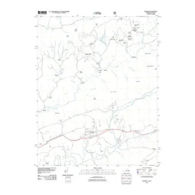
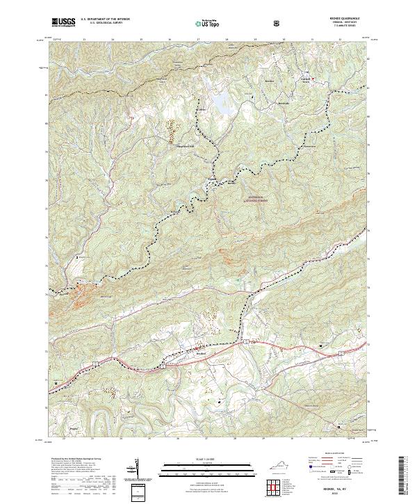 2022 Keokee2022 Print · USGSThe high ridges and deep hollows of the Kentucky-Virginia border define this corner of Lee County in the early 2020s. Researchers can trace family burial sites like Eden Cem and Baker Cem or locate valley communities such as Keokee, Rawhide, and Dryden.
End of results
Showing maps 1-17 of 17
Top cities near Ely
- Church Hill historical maps
- Big Stone Gap historical maps
- Cumberland historical maps
- Pennington Gap historical maps
- Appalachia historical maps
- Sneedville historical maps
See more
Frequently asked questions
- What are the different types of historical maps available for Ely?
- What is the oldest map of Ely?
- Where can I purchase historical maps of Ely for my home or office?
- Where can I download high-res historical maps of Ely?
- Are there historical topographic maps available for Ely?
- Is there historical aerial imagery available for Ely?
- Where are historical maps of Ely sourced from?