Old Maps of Jonesville, Virginia for Genealogy
Trace your family roots with 25 historic maps of Jonesville. These high-res maps reveal old neighborhoods, homesites, landmarks, and streets — helping you uncover where your ancestors lived and how the area evolved over time.
- Explore historic neighborhoods: Identify where your relatives may have lived in the 1800s or 1900s.
- Compare maps over time: Trace the changes in streets, buildings, and landmarks for multi-generational research.
- Perfect for genealogy & ancestry research: Used by family historians and researchers to map out lineage and migration.
These maps are an incredible resource for exploring your personal connection to Jonesville's past.
Jonesville, VA maps
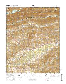
(25)- 1887 Map of Jonesville
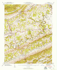
 1887 Jonesville1887 Print · USGSThe rugged borderlands of Virginia, Kentucky, and Tennessee are captured in the late nineteenth century during a time of isolated valley settlements. Genealogists and historians can trace family locations near Jonesville, Sneedville, and the remote Kyle's Ford along the Powell River.
 - 1891 Map of Jonesville
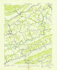
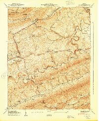
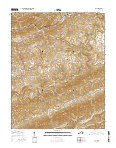
 1891 Jonesville1891 Print · USGSThe tri-state borderlands of Virginia, Kentucky, and Tennessee are captured here in the late nineteenth century. Researchers can trace early river crossings and mountain settlements like Poteet Ford, Shafers P.O., and Mt Pleasant.9 unique versions available
 - 1935 Map of Hubbard Springs
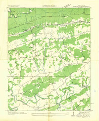 1935 Hubbard Springs1935 Print · USGSLee County, Virginia, is captured here in the mid-1930s, showing a landscape defined by mountain gaps and the winding Powell River. You can trace the historic Wilderness Trail and locate dozens of local landmarks like Spangler Cem, Ocoonita, and Hubbard Springs.
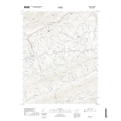
 - 1935 Map of Ben Hur
 1935 Ben Hur1935 Print · USGSLee County, Virginia, is captured in the mid-1930s as a landscape of river crossings and mountain hollows. Researchers can trace the heritage of Jonesville and Ben Hur through local landmarks like C C C Camp No 391, Chandler Mill, and Sword Cem.
 - 1946 Map of Hubbard Springs, 1957 Print
 1946 Hubbard Springs1957 Print · USGSLee County, Virginia, and the Kentucky borderlands are captured here in the mid-forties, showing a landscape defined by the Cumberland Mountain divide and the winding Powell River. Genealogists can trace family names at the Mc Clure Cem, Fleenortown, or the historic Jonesville Camp Ground.4 unique versions available
 - 1947 Map of Hubbard Springs, 1949 Print
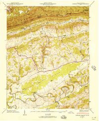
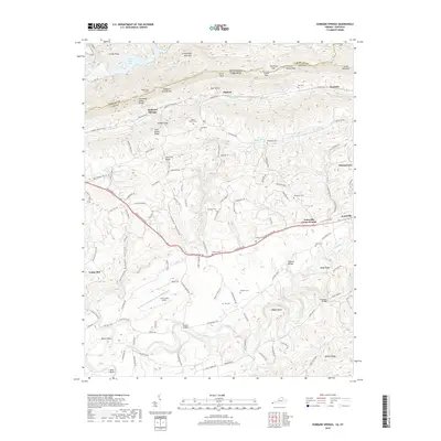
 1947 Hubbard Springs1949 Print · USGSLee County, Virginia, is captured here in the late 1940s as the rail and river geography defined its mountain communities. Genealogists and historians can trace family locations through numerous named landmarks like Wynn Cem, Russell Chapel, and the historic Boone Trail.
 - 1947 Map of Ben Hur, 1960 Print
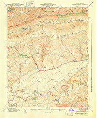
 1947 Ben Hur1960 Print · USGSLee County in the late 1940s reveals a mountain landscape defined by the Powell River and the winding Louisville and Nashville railroad. Genealogists can trace family names across Waddell Cem and Hyden Cem, or locate landmarks like Collier Mill and Poteet Ferry Bridge.4 unique versions available
 - 1949 Map of Ben Hur
 1949 Ben Hur1949 Print · USGSLee County, Virginia, in the late Forties is a landscape of mountain ridges and river crossings where the Louisville and Nashville rail line links valley settlements. Genealogists can trace family names across dozens of sites like McConnell Chapel, Ely Cem, and Waddell Cem.
 - 1955 Map of Johnson City
 1955 Johnson City1955 Print · USGSEast Tennessee and the bordering highlands of Virginia and Kentucky appear here during the post-war industrial boom. You can trace the complex network of mountain ridges and new TVA lakes, from Johnson City to the coalfields near Middlesboro and Lynch.
 - 1957 Map of Johnson City, 1966 Print
 1957 Johnson City1966 Print · USGSUpper East Tennessee and Southwest Virginia are shown here during the mid-sixties transition of the Appalachians. Researchers can trace the industrial rail hubs of Kingsport, the sprawling waters of Cherokee Lake, and the historic Cumberland Gap.
 - 1960 Map of Johnson City
 1960 Johnson City1960 Print · USGSUpper East Tennessee and the surrounding tri-state area are shown in the mid-fifties during the height of the TVA reservoir era. Trace the industrial rail lines of the Southern and Louisville and Nashville between Kingsport and Johnson City.
 - 1963 Map of Johnson City
 1963 Johnson City1963 Print · USGSThe Tri-Cities and the surrounding Appalachian ridges are shown in detail during the early sixties, highlighting the era's vital rail and river networks. Genealogists and historians can trace the routes of the Clinchfield RR and locate settlements from Rogersville to Elizabethton.
 - 1976 Map of Hubbard Springs, 1981 Print
 1976 Hubbard Springs1981 Print · USGSLee County's rural character is captured in the mid-seventies, showing the valley floor between the mountains and the river before modern development. Genealogists and local historians can locate family holdings near Hubbard Springs, Hockett, and along the winding Powell River.
 - 1976 Map of Ben Hur, 1981 Print
 1976 Ben Hur1981 Print · USGSThe Powell River valley near the bicentennial era reveals its intricate mountain-and-hollow topography in this detailed aerial study. Researchers can pinpoint property boundaries and rural crossroads near Jonesville and Ben Hur or trace the course of Wallen Creek.
 - 1977 Map of Middlesboro, 1983 Print
 1977 Middlesboro1983 Print · USGSThe tri-state border region of Kentucky, Tennessee, and Virginia is shown here in the late seventies as the rail-and-river economy hummed through the gaps. Trace local family roots and transit routes through Middlesboro, Harlan, and Cumberland Gap National Historical Park.
 - 2010 Map of Ben Hur, 2010 Print
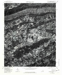
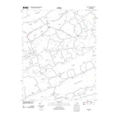 2010 Ben Hur2010 Print · USGSCovers Jonesville, including Pennington Gap, Ben Hur, and other nearby areas
 - 2011 Map of Hubbard Springs, 2011 Print
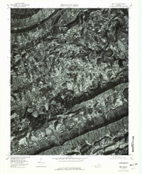
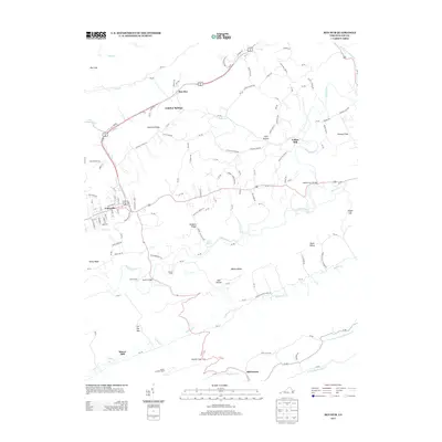
 2011 Hubbard Springs2011 Print · USGSCovers Jonesville, including Fleenortown, Hockett, and other nearby areas
 - 2013 Map of Ben Hur, 2013 Print
 2013 Ben Hur2013 Print · USGSCovers Jonesville, including Pennington Gap, Ben Hur, and other nearby areas
 - 2013 Map of Hubbard Springs, 2013 Print
 2013 Hubbard Springs2013 Print · USGSCovers Jonesville, including Fleenortown, Hockett, and other nearby areas
 - 2016 Map of Hubbard Springs, 2016 Print
 2016 Hubbard Springs2016 Print · USGSCovers Jonesville, including Fleenortown, Hockett, and other nearby areas
 - 2016 Map of Ben Hur, 2016 Print
 2016 Ben Hur2016 Print · USGSCovers Jonesville, including Pennington Gap, Ben Hur, and other nearby areas
 - 2019 Map of Ben Hur, 2019 Print
 2019 Ben Hur2019 Print · USGSCovers Jonesville, including Pennington Gap, Ben Hur, and other nearby areas
 - 2019 Map of Hubbard Springs, 2019 Print
 2019 Hubbard Springs2019 Print · USGSCovers Jonesville, including Fleenortown, Hockett, and other nearby areas
 - 2022 Map of Ben Hur, 2022 Print
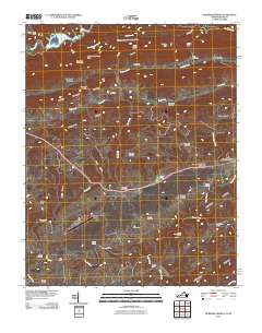
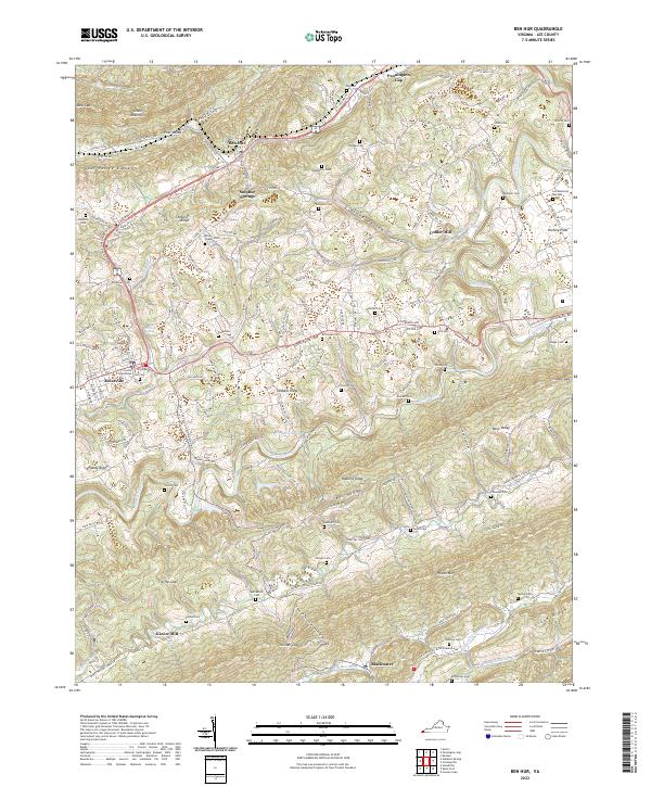 2022 Ben Hur2022 Print · USGSLee County in the early twenty-first century remains defined by its traditional mountain settlements and river valleys. Genealogists and local historians can trace family land across numerous burial sites like Hill Cem and Rutherford Cem while identifying old mill locations at Collier Mill and Kincer Mill.
 - 2022 Map of Hubbard Springs, 2022 Print
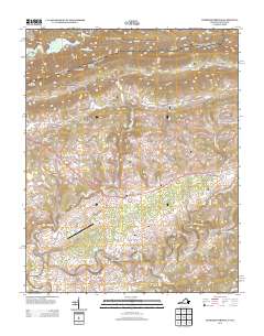
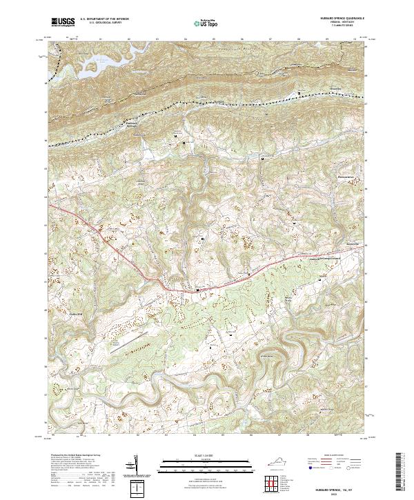 2022 Hubbard Springs2022 Print · USGSLee County, Virginia, is shown here in the 2020s, where the historic Daniel Boone Trl meets the waters of the Powell River. Genealogists and local historians can trace family sites like Noe Cem, Bethel Church, and the old settlement at Hubbard Springs.
End of results
Showing maps 1-25 of 25
Top cities near Jonesville
- Rogersville historical maps
- Harlan historical maps
- Pennington Gap historical maps
- Surgoinsville historical maps
- Sneedville historical maps
- Dryden historical maps
See more
Frequently asked questions
- What are the different types of historical maps available for Jonesville?
- What is the oldest map of Jonesville?
- Where can I purchase historical maps of Jonesville for my home or office?
- Where can I download high-res historical maps of Jonesville?
- Are there historical topographic maps available for Jonesville?
- Is there historical aerial imagery available for Jonesville?
- Where are historical maps of Jonesville sourced from?