Old Maps of Meltons, Virginia for Academic Research
Study the evolution of Meltons with 12 high-resolution historic maps. Whether you're teaching, researching, or modeling changes in land use, these maps provide essential visual documentation of urban, environmental, and geographic change.
- Analyze long-term change: Track patterns in development, transportation, and natural features.
- Ideal for environmental or urban studies: Support academic projects with primary historical map data.
- Use in the classroom or lab: Educators and researchers rely on these maps to bring historical context to life.
These maps are a powerful tool for teaching, research, and visualizing how Meltons has changed over the decades.
Meltons, VA maps
(12)- 1892 Map of Gordonsville, 1899 Print
 1892 Gordonsville1899 Print · USGSCentral Virginia’s railway hubs and mountain gaps come alive in this late nineteenth-century survey. Genealogists and historians can trace the foundations of Charlottesville and the bustling rail junctions at Gordonsville and Orange.6 unique versions available
 - 1949 Map of Charlottesville
 1949 Charlottesville1949 Print · USGSThe Shenandoah Valley and Blue Ridge appear in the late 1940s as a thriving corridor of rail and river commerce. Researchers can trace the mid-century footprints of Harrisonburg, Staunton, and Culpeper alongside the historic routes of the Southern Railway.2 unique versions available
 - 1956 Map of Charlottesville, 1966 Print
 1956 Charlottesville1966 Print · USGSThe Shenandoah Valley and Blue Ridge are captured in detail during the mid-1960s as the modern interstate system began to emerge. Genealogists and historians can trace rail-connected hubs like Waynesboro or follow the river paths of the Rapidan River and Rivanna River.4 unique versions available
 - 1961 Map of Gordonsville, 1962 Print
 1961 Gordonsville1962 Print · USGSCentral Virginia in the early sixties remains a landscape of deep historical roots and rail-based commerce. Genealogists and researchers can trace family names through landmarks like Boswells Tavern, the James Madison Grave, and rural sites like Liberty Mills.2 unique versions available
 - 1970 Map of Boswells Tavern, 1972 Print
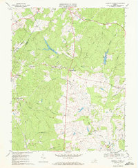 1970 Boswells Tavern1972 Print · USGSLouisa and Albemarle counties are captured in the early seventies as traditional rural communities evolved alongside the South Anna River. Researchers can locate established landmarks like Boswells Tavern, the Green Springs Sch, and Pleasant Plain Ch.4 unique versions available
 - 1977 Map of Boswells Tavern, 1982 Print
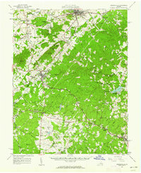
 1977 Boswells Tavern1982 Print · USGSLouisa County in the late seventies is revealed through this aerial survey, showing the land's transition between forest and farm. Genealogists and local historians can trace the rural layouts of Boswells Tavern, Waldrop, and Meltons.
 - 1986 Map of Charlottesville
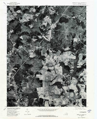
 1986 Charlottesville1986 Print · USGSCentral Virginia in the mid-eighties shows a landscape balanced between the growing city centers of the Piedmont and the protected ridges of the Blue Ridge. Trace the historic rail lines of the Chesapeake and Ohio Railway or locate local landmarks like Monticello Mountain and Bridgewater College.3 unique versions available
 - 2010 Map of Boswells Tavern, 2010 Print
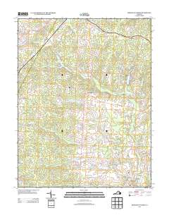
 2010 Boswells Tavern2010 Print · USGSCovers Meltons, including Medlock, Waldrop, and other nearby areas
 - 2013 Map of Boswells Tavern, 2013 Print
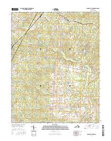
 2013 Boswells Tavern2013 Print · USGSCovers Meltons, including Medlock, Waldrop, and other nearby areas
 - 2016 Map of Boswells Tavern, 2016 Print
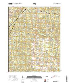
 2016 Boswells Tavern2016 Print · USGSCovers Meltons, including Medlock, Waldrop, and other nearby areas
 - 2019 Map of Boswells Tavern, 2019 Print
 2019 Boswells Tavern2019 Print · USGSCovers Meltons, including Medlock, Waldrop, and other nearby areas
 - 2022 Map of Boswells Tavern, 2022 Print
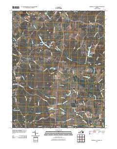
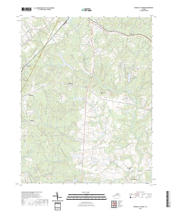 2022 Boswells Tavern2022 Print · USGSLouisa and Albemarle counties are shown here in the early twenty-first century, a landscape of historic crossroads and winding river forks. Researchers can trace family roots at the Alberts Family Cem or locate old community centers like Waldrop and Green Springs.
End of results
Showing maps 1-12 of 12
Top cities near Meltons
- Lake Monticello historical maps
- Orange historical maps
- Rivanna historical maps
- Louisa historical maps
- Gordonsville historical maps
- Ruckersville historical maps
See more
Frequently asked questions
- What are the different types of historical maps available for Meltons?
- What is the oldest map of Meltons?
- Where can I purchase historical maps of Meltons for my home or office?
- Where can I download high-res historical maps of Meltons?
- Are there historical topographic maps available for Meltons?
- Is there historical aerial imagery available for Meltons?
- Where are historical maps of Meltons sourced from?