Old Maps of Mineral, Virginia for Hiking & Exploration
Hike through history with 22 historic maps of Mineral. Explore old trails, ghost towns, and forgotten backroads — perfect for outdoor adventurers and local explorers.
- Rediscover forgotten places: Map out old mining camps, roads, and footpaths that no longer exist on modern maps.
- Layer with modern tools: Combine with LiDAR or satellite views to plan hikes through historical terrain.
- Made for exploration: Popular among hikers, overlanders, and local history lovers.
Use these maps to find adventure and explore the hidden past of Mineral.
Mineral, VA maps
(22)- 1887 Map of Spottsylvania
 1887 Spottsylvania1887 Print · USGSCentral Virginia in the late 1880s remains a landscape of river fords and crossroads shops before modern development. Genealogists and historians can trace the locations of the Vaucluse Gold Mine, Wilderness Tavern, and the path of the Narrow Gauge Railroad.
 - 1890 Map of Goochland
 1890 Goochland1890 Print · USGSGoochland and the surrounding Virginia Piedmont are captured here in the late nineteenth century as the river-and-rail economy thrived. Researchers can trace the paths of the Chesapeake and Ohio Railroad and find landmarks like Hopeful Church or the Coal Pits.
 - 1892 Map of Spottsylvania
 1892 Spottsylvania1892 Print · USGSCentral Virginia’s post-war landscape is captured here in the late nineteenth century, showing a rural economy defined by gold mining and river crossings. Genealogists can trace family footprints at Todds Tavern, the Vaucluse Gold Mine, and along the Narrow Gauge Railroad.6 unique versions available
 - 1892 Map of Goochland
 1892 Goochland1892 Print · USGSThe rural heart of central Virginia is captured here in the decade before the turn of the century, showing a landscape shaped by major rivers and early rail lines. Genealogists can trace family names and early settlements like Negro Foot, Mabelton, and the historic Hanover Academy.8 unique versions available
 - 1942 Map of Mineral
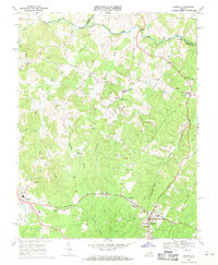
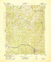 1942 Mineral1942 Print · USGSLouisa County during the early years of the war shows a landscape of rural crossroads and established rail hubs. Trace local history through family landmarks like Bibbs Store, Holladay Mill, and the many churches like Miners Chapel along the Chesapeake and Ohio line.2 unique versions available
 - 1942 Map of Pendleton, 1958 Print
 1942 Pendleton1958 Print · USGSLouisa County in the early 1940s was a landscape of small crossroads and river crossings. Genealogists and historians can trace the foundations of Yanceyville, locate the Chesapeake and Ohio tracks at Pendleton, and find rural landmarks like Goodwins Store.
 - 1943 Map of Pendleton
 1943 Pendleton1943 Print · USGSLouisa County’s rural landscape is captured here during the Second World War, showing the agricultural heart of the Virginia Piedmont. Researchers can trace historic church sites like Gilboa Church and Yanceyville Church or locate landmarks like Goodwins Store and Smiths Mill.
 - 1943 Map of Richmond, 1972 Print
 1943 Richmond1972 Print · USGSCoastal Virginia and the state capital are shown in detail during the mid-century era of infrastructure expansion. Genealogists and historians can trace the grounds of Richmond Nat Battlefield Park, locate the Yorktown Nat Cem, or follow the many rural routes through Amelia Court House and Tappahannock.
 - 1948 Map of Washington
 1948 Washington1948 Print · USGSThe Potomac and Chesapeake regions in the late 1940s reveal a landscape of expanding military reach and deep-rooted Tidewater settlements. Trace old rail corridors like the Richmond Fredericksburg & Potomac RR or locate landmarks like the Wakefield Washington Monument and St. Marys College.2 unique versions available
 - 1949 Map of Richmond, 1951 Print
 1949 Richmond1951 Print · USGSCoastal Virginia in the years following World War II remained a landscape of historic river towns and expanding military bases. Genealogists and historians can trace the rail lines of the Southern Ry and locate established landmarks from Camp Lee to the remote reaches of Dragon Swamp.
 - 1957 Map of Washington, 1966 Print
 1957 Washington1966 Print · USGSThe mid-Atlantic region during the mid-fifties and early sixties reveals a landscape of growing suburbs and vital military outposts. Researchers can trace historic river towns and shorelines from Alexandria to the Hooper Islands and St Clements Island.5 unique versions available
 - 1959 Map of Richmond
 1959 Richmond1959 Print · USGSMid-century Virginia is captured here at its most vital rail and river junctions, from the capital city to the Chesapeake Bay. Genealogists and historians can trace the development of colonial settlements like Williamsburg and military landmarks including Fort Monroe and Camp Lee.
 - 1961 Map of Washington
 1961 Washington1961 Print · USGSThe mid-Atlantic region in the late fifties is presented in remarkable detail, from the Blue Ridge foothills to the Chesapeake Eastern Shore. Researchers can trace historic river landings and military sites like Mount Vernon, Fort Belvoir, and Point Lookout.2 unique versions available
 - 1964 Map of Richmond
 1964 Richmond1964 Print · USGSCoastal and central Virginia are mapped during the mid-twentieth century, showing the critical intersection of rail, river, and military life. Genealogists can trace family roots through rural county seats like Amelia or find vanished coastal neighborhoods near Phoebus and Hilton Village.
 - 1968 Map of Pendleton, 1970 Print
 1968 Pendleton1970 Print · USGSLouisa County’s rural crossroads and river valleys are captured here in the late sixties as the region maintained its traditional landscape. Genealogists and historians can locate family landmarks like Richardson High Sch, Goodwins Store, and several historic congregations such as Ebenezer Ch.2 unique versions available
 - 1969 Map of Mineral, 1971 Print
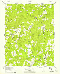
 1969 Mineral1971 Print · USGSThe Piedmont landscape of Louisa County comes into focus in the late sixties, showcasing the rail-connected hubs of Mineral and Louisa. Researchers can trace the path of the Chesapeake and Ohio or locate rural landmarks like Dickinson Store and Enon Ch.5 unique versions available
 - 1973 Map of Richmond, 1974 Print
 1973 Richmond1974 Print · USGSThe Virginia Tidewater and Piedmont come alive in the early seventies, showcasing a region defined by its great rivers and massive military installations. Researchers can trace the mid-century growth of Richmond or locate family sites near Amelia Court House and Highland Springs.2 unique versions available
 - 1983 Map of Fredericksburg, 1984 Print
 1983 Fredericksburg1984 Print · USGSThe Virginia and Maryland tidewater region comes into sharp focus during the early 1980s, centered on the historic Rappahannock and Potomac river valleys. Researchers can trace the boundaries of the Fredericksburg-Spotsylvania National Military Park alongside growing residential areas and military sites like Fort A.P. Hill Military Reservation.2 unique versions available
 - 1984 Map of Richmond, 1986 Print
 1984 Richmond1986 Print · USGSCentral Virginia during the mid-eighties shows a landscape of rapid suburban expansion centered on the state capital and its historic riverfront. Genealogists and historians can trace institutional sites like Randolph-Macon College, the grounds of Fort Lee, and small community landmarks like Hebron Ch.3 unique versions available
 - 1989 Map of Washington
 1989 Washington1989 Print · USGSThe Potomac River valley and Chesapeake Bay are shown in comprehensive detail during the late 1980s. Genealogists and historians can trace the transition from urban Alexandria to the rural Northern Neck, locating landmarks like Mount Vernon and Stratford Hall.
 - 2022 Map of Pendleton, 2022 Print
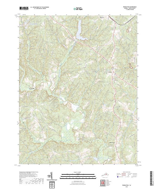 2022 Pendleton2022 Print · USGSLouisa County’s rural crossroads are captured in the early 2020s, showing the enduring structure of the Virginia piedmont landscape. Genealogists and historians can trace family-named routes and the relationship between communities like Cuckoo, Apple Grove, and Yanceyville.
 - 2022 Map of Mineral, 2022 Print
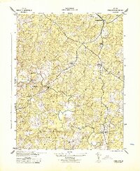
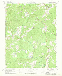
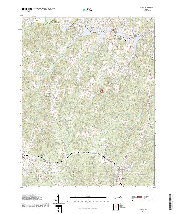 2022 Mineral2022 Print · USGSThe Piedmont region of central Virginia is captured here in the early twenty-first century, centered on the growing towns of Mineral and Louisa. Researchers can trace local heritage at Prospect Hill Cem or explore the developed shoreline of Lake Anna near Martins Point.
End of results
Showing maps 1-22 of 22
Top cities near Mineral
Frequently asked questions
- What are the different types of historical maps available for Mineral?
- What is the oldest map of Mineral?
- Where can I purchase historical maps of Mineral for my home or office?
- Where can I download high-res historical maps of Mineral?
- Are there historical topographic maps available for Mineral?
- Is there historical aerial imagery available for Mineral?
- Where are historical maps of Mineral sourced from?