Old Maps of Yanceyville, Virginia for Academic Research
Study the evolution of Yanceyville with 16 high-resolution historic maps. Whether you're teaching, researching, or modeling changes in land use, these maps provide essential visual documentation of urban, environmental, and geographic change.
- Analyze long-term change: Track patterns in development, transportation, and natural features.
- Ideal for environmental or urban studies: Support academic projects with primary historical map data.
- Use in the classroom or lab: Educators and researchers rely on these maps to bring historical context to life.
These maps are a powerful tool for teaching, research, and visualizing how Yanceyville has changed over the decades.
Yanceyville, VA maps
(16)- 1890 Map of Goochland
 1890 Goochland1890 Print · USGSGoochland and the surrounding Virginia Piedmont are captured here in the late nineteenth century as the river-and-rail economy thrived. Researchers can trace the paths of the Chesapeake and Ohio Railroad and find landmarks like Hopeful Church or the Coal Pits.
 - 1892 Map of Goochland
 1892 Goochland1892 Print · USGSThe rural heart of central Virginia is captured here in the decade before the turn of the century, showing a landscape shaped by major rivers and early rail lines. Genealogists can trace family names and early settlements like Negro Foot, Mabelton, and the historic Hanover Academy.8 unique versions available
 - 1942 Map of Pendleton, 1958 Print
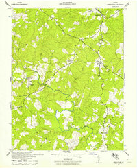 1942 Pendleton1958 Print · USGSLouisa County in the early 1940s was a landscape of small crossroads and river crossings. Genealogists and historians can trace the foundations of Yanceyville, locate the Chesapeake and Ohio tracks at Pendleton, and find rural landmarks like Goodwins Store.
 - 1943 Map of Pendleton
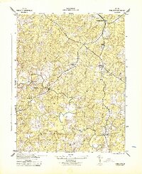 1943 Pendleton1943 Print · USGSLouisa County’s rural landscape is captured here during the Second World War, showing the agricultural heart of the Virginia Piedmont. Researchers can trace historic church sites like Gilboa Church and Yanceyville Church or locate landmarks like Goodwins Store and Smiths Mill.
 - 1943 Map of Richmond, 1972 Print
 1943 Richmond1972 Print · USGSCoastal Virginia and the state capital are shown in detail during the mid-century era of infrastructure expansion. Genealogists and historians can trace the grounds of Richmond Nat Battlefield Park, locate the Yorktown Nat Cem, or follow the many rural routes through Amelia Court House and Tappahannock.
 - 1949 Map of Richmond, 1951 Print
 1949 Richmond1951 Print · USGSCoastal Virginia in the years following World War II remained a landscape of historic river towns and expanding military bases. Genealogists and historians can trace the rail lines of the Southern Ry and locate established landmarks from Camp Lee to the remote reaches of Dragon Swamp.
 - 1959 Map of Richmond
 1959 Richmond1959 Print · USGSMid-century Virginia is captured here at its most vital rail and river junctions, from the capital city to the Chesapeake Bay. Genealogists and historians can trace the development of colonial settlements like Williamsburg and military landmarks including Fort Monroe and Camp Lee.
 - 1964 Map of Richmond
 1964 Richmond1964 Print · USGSCoastal and central Virginia are mapped during the mid-twentieth century, showing the critical intersection of rail, river, and military life. Genealogists can trace family roots through rural county seats like Amelia or find vanished coastal neighborhoods near Phoebus and Hilton Village.
 - 1968 Map of Pendleton, 1970 Print
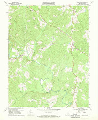 1968 Pendleton1970 Print · USGSLouisa County’s rural crossroads and river valleys are captured here in the late sixties as the region maintained its traditional landscape. Genealogists and historians can locate family landmarks like Richardson High Sch, Goodwins Store, and several historic congregations such as Ebenezer Ch.2 unique versions available
 - 1973 Map of Richmond, 1974 Print
 1973 Richmond1974 Print · USGSThe Virginia Tidewater and Piedmont come alive in the early seventies, showcasing a region defined by its great rivers and massive military installations. Researchers can trace the mid-century growth of Richmond or locate family sites near Amelia Court House and Highland Springs.2 unique versions available
 - 1984 Map of Richmond, 1986 Print
 1984 Richmond1986 Print · USGSCentral Virginia during the mid-eighties shows a landscape of rapid suburban expansion centered on the state capital and its historic riverfront. Genealogists and historians can trace institutional sites like Randolph-Macon College, the grounds of Fort Lee, and small community landmarks like Hebron Ch.3 unique versions available
 - 2011 Map of Pendleton, 2011 Print
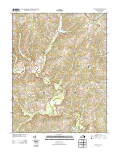
 2011 Pendleton2011 Print · USGSCovers Yanceyville, including Mineral, Cuckoo, and other nearby areas
 - 2013 Map of Pendleton, 2013 Print
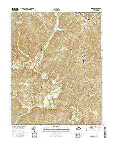
 2013 Pendleton2013 Print · USGSCovers Yanceyville, including Mineral, Cuckoo, and other nearby areas
 - 2016 Map of Pendleton, 2016 Print
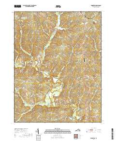
 2016 Pendleton2016 Print · USGSCovers Yanceyville, including Mineral, Cuckoo, and other nearby areas
 - 2019 Map of Pendleton, 2019 Print
 2019 Pendleton2019 Print · USGSCovers Yanceyville, including Mineral, Cuckoo, and other nearby areas
 - 2022 Map of Pendleton, 2022 Print
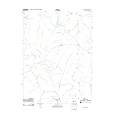
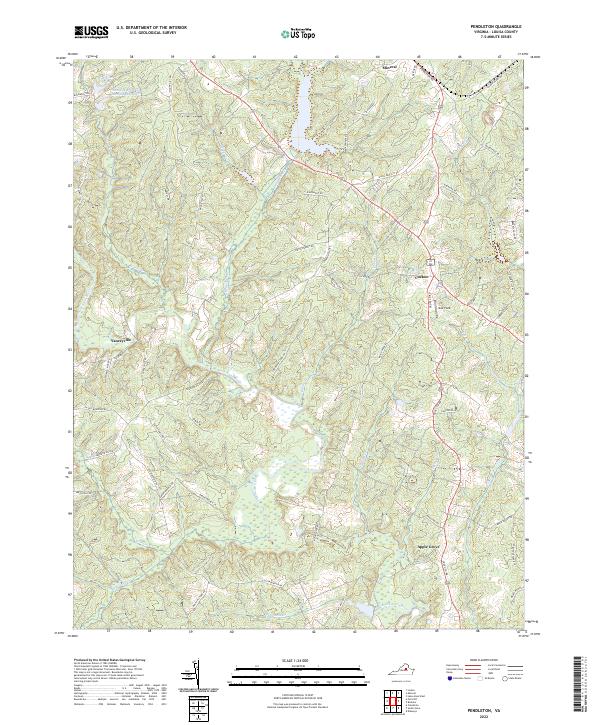 2022 Pendleton2022 Print · USGSLouisa County’s rural crossroads are captured in the early 2020s, showing the enduring structure of the Virginia piedmont landscape. Genealogists and historians can trace family-named routes and the relationship between communities like Cuckoo, Apple Grove, and Yanceyville.
End of results
Showing maps 1-16 of 16
Top cities near Yanceyville
- Louisa historical maps
- Gordonsville historical maps
- Blue Ridge Shores historical maps
- Mineral historical maps
- Columbia historical maps
Frequently asked questions
- What are the different types of historical maps available for Yanceyville?
- What is the oldest map of Yanceyville?
- Where can I purchase historical maps of Yanceyville for my home or office?
- Where can I download high-res historical maps of Yanceyville?
- Are there historical topographic maps available for Yanceyville?
- Is there historical aerial imagery available for Yanceyville?
- Where are historical maps of Yanceyville sourced from?