2000s (21st Century) Maps of Middlesex County, Virginia
Explore 11 historic maps of Middlesex County from the 2000s (21st Century). These maps offer a rare glimpse into what life looked like during the 2000s — showing old roads, neighborhoods, homes, and landmarks that have changed or disappeared over time.
Whether you're researching your family's past, planning a metal detecting trip, or studying how Middlesex County's landscape evolved across the 2000s, these high-resolution maps are a powerful tool for exploring the history of this region.
- Focus on a specific era: All maps on this page are from the 2000s, giving you a focused view of this time period.
- See what’s changed: Compare century-old streets, trails, and buildings to today's modern landscape using overlays and satellite layers.
- Research with precision: Use these maps for genealogy, historical research, land use analysis, or educational projects.
- View, download, or print: Maps are fully viewable online in high resolution, and can be downloaded or printed for your own records.
Start exploring Middlesex County's history through authentic maps from the 2000s. This is your window into the past.
Middlesex County, VA maps
(11)- 2022 Map of Truhart, 2022 Print
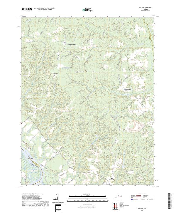 2022 Truhart2022 Print · USGSThe King and Queen County countryside and the winding Mattaponi River are captured here in the contemporary era. Researchers can trace rural landmarks and family-named crossroads such as Dragonville, Exol Cem, and the wetlands of Allens Millpond.
 - 2022 Map of East of Deltaville, 2022 Print
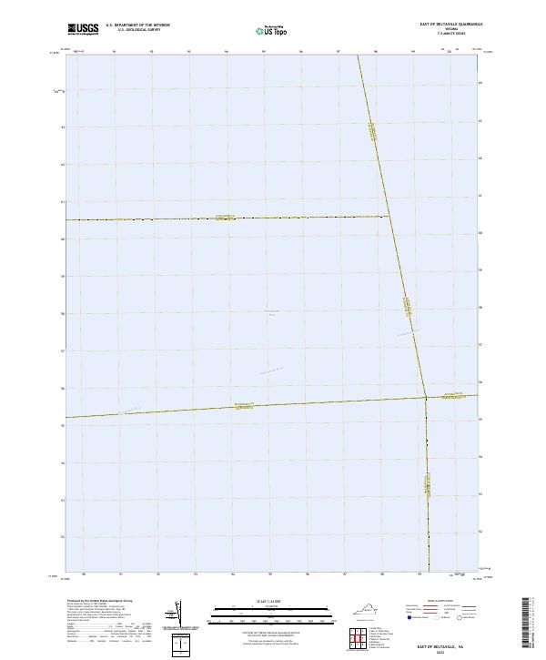 2022 East of Deltaville2022 Print · USGSCoastal Virginia waters are the focus of this maritime-centered study from the early 2020s. Genealogists and historians can trace the aquatic boundaries between five counties where the Piankatank River meets the open Chesapeake Bay.
 - 2022 Map of Church View, 2022 Print
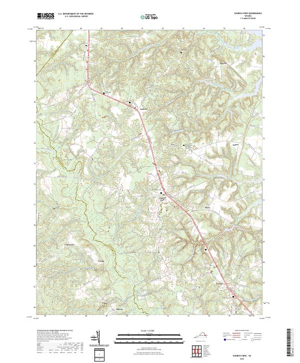 2022 Church View2022 Print · USGSMiddlesex County's rural heartland and extensive wetlands are preserved here as they appeared in the early 2020s. Trace the generations at Glebe Landing Cemetery or explore the reach of Dragon Swamp near settlements like Jamaica and Church View.
 - 2022 Map of Urbanna, 2022 Print
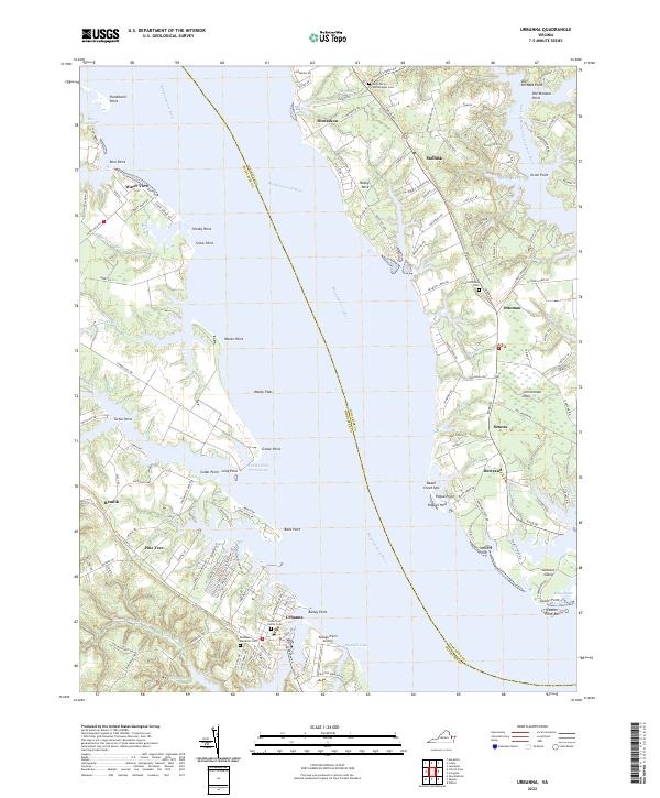 2022 Urbanna2022 Print · USGSThe Rappahannock River waterfront and Northern Neck settlements are captured in high detail during the early twenty-first century. Researchers can trace family sites from the Arthur Lee Family Cem in Urbanna to the historic Saint Marys Whitechapel Cem near Monaskon.
 - 2022 Map of Lively, 2022 Print
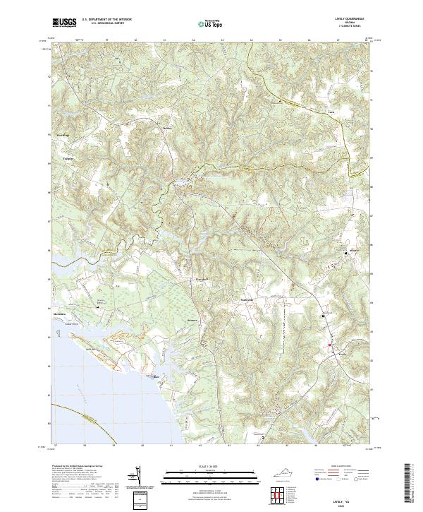 2022 Lively2022 Print · USGSThe Rappahannock River shoreline and Northern Neck settlements are captured in this modern survey of the Virginia coast. Genealogists can trace family sites at Norwood Baptist Church Cem or locate old landings and mills at Morattico Old Mill Pond and Boer.
 - 2022 Map of Irvington, 2022 Print
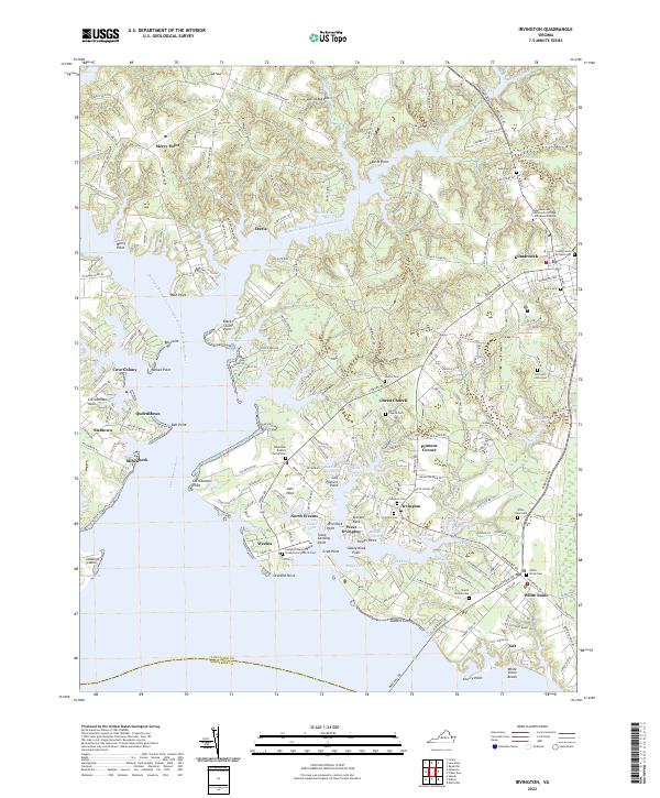 2022 Irvington2022 Print · USGSLancaster County's Northern Neck shoreline is captured here in detail, showcasing the historic river towns and tidal coves of the Rappahannock estuary. Genealogists and local historians can trace family locations and burial sites at Christ Church Cem, Grace Cem, and the old settlement of Merry Point.
 - 2022 Map of Shacklefords, 2022 Print
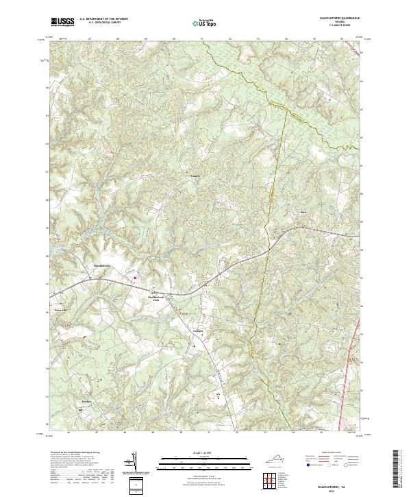 2022 Shacklefords2022 Print · USGSCoastal Virginia's Middle Peninsula is documented here in the early twenty-first century, showing the rural crossroads and marshlands where three counties meet. Genealogists and local historians can trace family locations near Shacklefords, Hockley Cem, and the winding Dragon Swamp.
 - 2022 Map of Morattico, 2022 Print
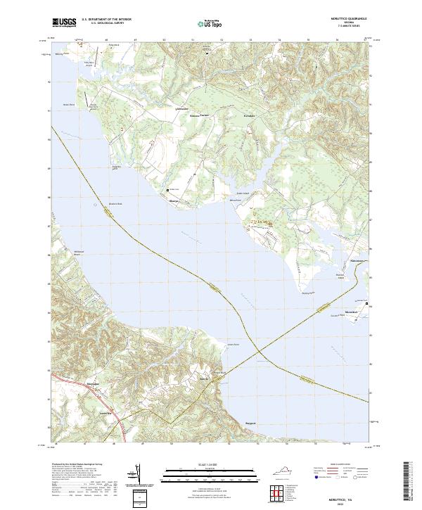 2022 Morattico2022 Print · USGSThe Rappahannock River shoreline and the crossroads of the Virginia Northern Neck are captured here in the early twenty-first century. Genealogists and historians can trace family roots through the Ebenezer Baptist Church Cem, Milden Cem, and the old river landing at Sharps.
 - 2022 Map of Deltaville, 2022 Print
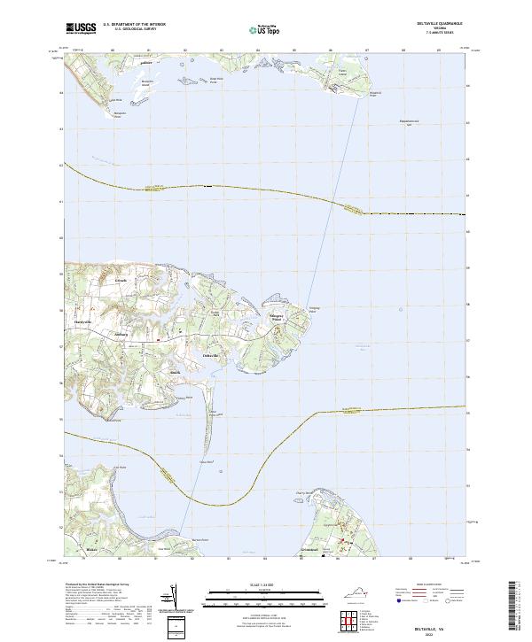 2022 Deltaville2022 Print · USGSDeltaville and the lower Chesapeake Bay tidewater are shown here as they appeared in 2022. Local researchers can trace waterfront settlements from Grinels and Ruark down to Grimstead on Gwynn Island, or locate the historic Gwynn's Island Cem.
 - 2022 Map of Saluda, 2022 Print
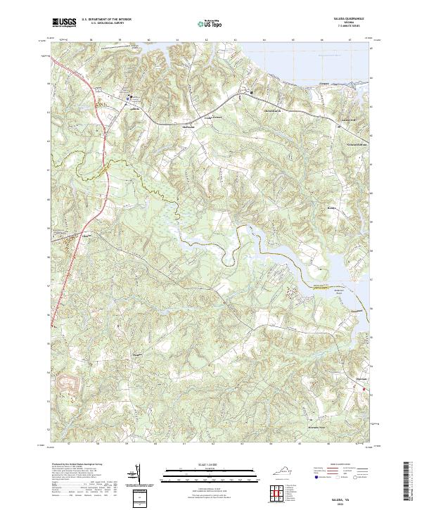 2022 Saluda2022 Print · USGSCoastal Virginia life at the start of the 2020s is shaped by the tidal reaches of the Rappahannock and Piankatank. Local researchers can trace old family roots through Antioch Baptist Church Cem and explore the historic seat at the Middlesex County Courthouse.
 - 2022 Map of Wilton, 2022 Print
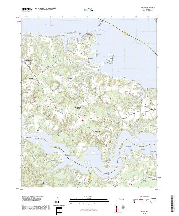 2022 Wilton2022 Print · USGSCoastal Virginia life at the start of the 2020s is mapped here between the Rappahannock and Piankatank Rivers. Researchers can locate local landmarks like Hummel Field, Ebenezer Baptist Church Cem, and the community of Harmony Village.
End of results
Showing maps 1-11 of 11
Top cities of Middlesex County
Frequently asked questions
- What are the different types of historical maps available for Middlesex County?
- What is the oldest map of Middlesex County?
- Where can I purchase historical maps of Middlesex County for my home or office?
- Where can I download high-res historical maps of Middlesex County?
- Are there historical topographic maps available for Middlesex County?
- Is there historical aerial imagery available for Middlesex County?
- Where are historical maps of Middlesex County sourced from?