Old Maps of Middlesex County, Virginia for Hiking & Exploration
Hike through history with 48 historic maps of Middlesex County. Explore old trails, ghost towns, and forgotten backroads — perfect for outdoor adventurers and local explorers.
- Rediscover forgotten places: Map out old mining camps, roads, and footpaths that no longer exist on modern maps.
- Layer with modern tools: Combine with LiDAR or satellite views to plan hikes through historical terrain.
- Made for exploration: Popular among hikers, overlanders, and local history lovers.
Use these maps to find adventure and explore the hidden past of Middlesex County.
Middlesex County, VA maps
(48)- 1916 Map of Kilmarnock
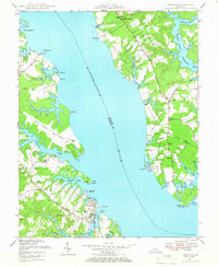
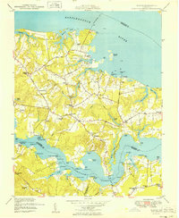
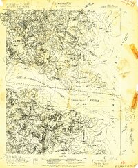 1916 Kilmarnock1916 Print · USGSBefore the era of modern bridges, this coastal Virginia region relied on a busy steamboat route network connecting the Northern Neck and Middle Peninsula. Genealogists can locate family landmarks like Wharton Grove Camp, White Chapel Church, and numerous landings including Morattico Wharf.2 unique versions available
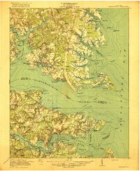
 - 1917 Map of Urbanna
 1917 Urbanna1917 Print · USGSMiddlesex and Lancaster Counties come alive in this survey of the Virginia Tidewater during the Great War era. Researchers can trace ancestral roots through dozens of local landmarks like Christ Church, Healys Mill, and Royal Oak School.3 unique versions available
 - 1917 Map of Morattico
 1917 Morattico1917 Print · USGSThe Northern Neck of Virginia is shown here in the years before the Great War, when the Rappahannock River was a busy Steamboat Route. Genealogists can locate family landmarks like Gordys Millpond, Lively, and the Marvin Grove Camp in this detailed look at early rural life.
 - 1917 Map of Kilmarnock
 1917 Kilmarnock1917 Print · USGSThe Northern Neck and Middle Peninsula of Virginia are shown during the height of the steamboat era. Genealogists can locate family-named landmarks and essential community hubs like the Old Brick Church, Harmony Village, and Kilmarnock Wharf.4 unique versions available
 - 1918 Map of Morattico
 1918 Morattico1918 Print · USGSThe Northern Neck region relied heavily on the Rappahannock waterfront during the early twentieth century, when steamboats were still the primary connection to the outside world. Researchers can trace ancestral home sites and community centers from Lodge and Nuttsville to historic landmarks like Gibeon Church and Downings Mill.3 unique versions available
 - 1919 Map of New Kent
 1919 New Kent1919 Print · USGSThe Virginia tidewater comes to life in the years following the Great War, showing the convergence of the Mattaponi and Pamunkey rivers. Genealogists can trace family roots through the Pamunkey Indian Reservation, West Point, and rural landmarks like Mattaponi Church or Frazier Ferry.3 unique versions available
 - 1926 Map of Morattico, 1943 Print
 1926 Morattico1943 Print · USGSThe Rappahannock River and Northern Neck are captured in the mid-1920s, showing a landscape defined by tidewater commerce and rural tradition. Genealogists can trace family roots through numerous churches and schools like Totuskey Church, Folly School, and Sharps.
 - 1942 Map of Kilmarnock
 1942 Kilmarnock1942 Print · USGSThe Virginia Tidewater in the early 1940s was a world of steamboat routes and bustling river landings. Trace the maritime history of the Northern Neck through Whitestone Wharf, the Shipleys Ferry crossing, and the grounds of Christ Church.
 - 1943 Map of Richmond, 1972 Print
 1943 Richmond1972 Print · USGSCoastal Virginia and the state capital are shown in detail during the mid-century era of infrastructure expansion. Genealogists and historians can trace the grounds of Richmond Nat Battlefield Park, locate the Yorktown Nat Cem, or follow the many rural routes through Amelia Court House and Tappahannock.
 - 1944 Map of Morattico
 1944 Morattico1944 Print · USGSThe Rappahannock River divides the tidewater counties of Virginia during the mid-1940s, showing a landscape of maritime landings and small rural communities. Researchers can trace historic sites like True Reformers Hall, the Ebenezer Ch and Sch, and landings at Oakley Landing.2 unique versions available
 - 1946 Map of Urbanna, 1966 Print
 1946 Urbanna1966 Print · USGSThe Rappahannock River waterfront comes alive in the mid-1940s, showing the bustling port of Urbanna and the nearby estates of Corbin Hall. Researchers can trace old coastal landings and rural crossroads like Mollusk, Ottoman, and the Remlik Wharf area.
 - 1948 Map of Deltaville
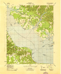
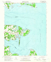
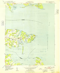 1948 Deltaville1948 Print · USGSDeltaville and the surrounding Middlesex County shoreline are documented here in the late 1940s, showing a maritime landscape shaped by the Chesapeake Bay. Researchers can trace historic fishing communities and coastal markers such as Stingray Point LH, the village of Amburg, and Fleets Island.2 unique versions available
 - 1948 Map of Litwalton
 1948 Litwalton1948 Print · USGSCoastal Lancaster and Richmond counties appear in the late 1940s as a region of tidal creeks and quiet crossroads. Researchers can trace rural life through landmarks like Lively Sch, the waters at Chinns Pond, and Griffins Landing on the river.2 unique versions available
 - 1949 Map of Truhart
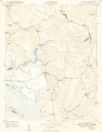
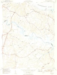
 1949 Truhart1949 Print · USGSMid-century King and Queen County is shown here during a time of rural stability along the Mattaponi River. Researchers can trace old family locations and community landmarks from Exol Ch and Zion Sch to the crossroads at Dragonville.
 - 1949 Map of Irvington
 1949 Irvington1949 Print · USGSCoastal Lancaster County was a thriving network of maritime landings and crossroads villages in the years following World War II. Researchers can trace family sites from Kilmarnock down to Whitestone, locating landmarks like Christ Church, Dunton Mill, and the Wharton Grove Camp.2 unique versions available
 - 1949 Map of Saluda
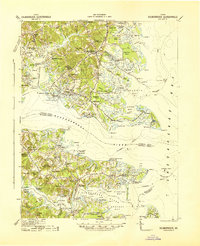
 1949 Saluda1949 Print · USGSCoastal Middlesex and Gloucester counties are captured here in the late 1940s, situated between the Rappahannock and Piankatank rivers. Genealogists and local historians can locate early homesteads near Saluda, the historic Christ Church (PO), and landmarks like Burhans Wharf or the Air Field at Harcum.2 unique versions available
 - 1949 Map of Shacklefords
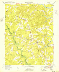
 1949 Shacklefords1949 Print · USGSMid-century King and Queen County comes alive in this survey of the Virginia Middle Peninsula, where the Tidewater Trail connects small rural crossroads. Genealogists can locate family-named settlements like Bakers and community hubs such as Hockley PO and Snow Hill Sch.2 unique versions available
 - 1949 Map of Wilton
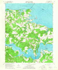
 1949 Wilton1949 Print · USGSCoastal Middlesex County comes alive in this post-war survey of the peninsulas between the Rappahannock and Piankatank rivers. Genealogists and historians can trace old landings and community hubs like Blands Wharf, Old Brick Ch, and Harmony Village.
 - 1949 Map of Samos
 1949 Samos1949 Print · USGSMid-century Middlesex County is documented here at a time when rural life centered on small crossroads and local parishes. Genealogists can trace family connections to numerous historic sites like Glebe Landing Ch, Union Shiloh Sch, and the settlement at Church View.2 unique versions available
 - 1949 Map of Urbanna
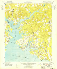
 1949 Urbanna1949 Print · USGSThe Rappahannock River waterfront was a busy network of wharves and small settlements in the years following World War II. Genealogists and historians can trace family locations near Corbin Hall, St Marys Chapel, and the working waterfront at Remlik Wharf.
 - 1949 Map of Richmond, 1951 Print
 1949 Richmond1951 Print · USGSCoastal Virginia in the years following World War II remained a landscape of historic river towns and expanding military bases. Genealogists and historians can trace the rail lines of the Southern Ry and locate established landmarks from Camp Lee to the remote reaches of Dragon Swamp.
 - 1959 Map of Richmond
 1959 Richmond1959 Print · USGSMid-century Virginia is captured here at its most vital rail and river junctions, from the capital city to the Chesapeake Bay. Genealogists and historians can trace the development of colonial settlements like Williamsburg and military landmarks including Fort Monroe and Camp Lee.
 - 1964 Map of Richmond
 1964 Richmond1964 Print · USGSCoastal and central Virginia are mapped during the mid-twentieth century, showing the critical intersection of rail, river, and military life. Genealogists can trace family roots through rural county seats like Amelia or find vanished coastal neighborhoods near Phoebus and Hilton Village.
 - 1964 Map of Deltaville, 1966 Print
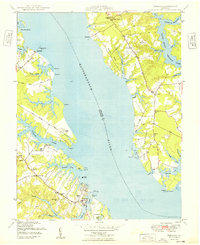
 1964 Deltaville1966 Print · USGSThe Middlesex County coastline in the mid-sixties reveals a landscape defined by its relation to the Chesapeake. Genealogists and historians can trace family locations near Deltaville, find local landmarks like Philippi Ch, or locate old landings at Stingray Point and Westland.4 unique versions available
 - 1964 Map of Wilton, 1966 Print
 1964 Wilton1966 Print · USGSThe Virginia Middle Peninsula in the mid-1960s reveals a tidewater landscape of small settlements and riverfront landings. Genealogists and historians can locate rural landmarks such as Old Brick Ch, Stampers Wharf Sch, and Barricks Millpond.4 unique versions available
Showing maps 1-25 of 48
Top cities of Middlesex County
Frequently asked questions
- What are the different types of historical maps available for Middlesex County?
- What is the oldest map of Middlesex County?
- Where can I purchase historical maps of Middlesex County for my home or office?
- Where can I download high-res historical maps of Middlesex County?
- Are there historical topographic maps available for Middlesex County?
- Is there historical aerial imagery available for Middlesex County?
- Where are historical maps of Middlesex County sourced from?