Old Maps of Northampton County, Virginia for Metal Detecting
Plan your next treasure hunt with 165 historic maps of Northampton County. Find old homesites, ghost towns, trails, and gathering spots that may be lost to time — perfect for identifying promising metal detecting locations.
- Locate forgotten sites: Uncover places like long-lost settlements, abandoned rail lines, or gathering spots.
- Plan better hunts: Use map overlays combined with LiDAR or satellite views to narrow in on historically rich areas.
- Made for detectorists: Thousands of hobbyists use these maps to discover relics, coins, and hidden history.
Use these historic maps to boost your research and find new opportunities beneath the surface of Northampton County.
Northampton County, VA maps
(165)- 1907 Map of Norfolk
 1907 Norfolk1907 Print · USGSCoastal Virginia is mapped here at the dawn of the twentieth century, during the bustle of the great Jamestown Exposition. Researchers can trace the early rail-and-canal economy through the Albemarle and Chesapeake Canal, the Navy Yard, and historic outposts like the Cape Henry Light.
 - 1941 Map of Broadwater
 1941 Broadwater1941 Print · USGSThe Virginia barrier islands appear here just before the mid-century, showing the isolated settlement of Broadwater on Hog Island. Researchers can trace old coastal infrastructure and maritime landmarks like the Little Machipongo Inlet C G S and Great Machipongo Inlet.
 - 1942 Map of Cheriton
 1942 Cheriton1942 Print · USGSThe Virginia Eastern Shore comes alive in this wartime-era survey of Northampton County, showing the region's transition from maritime hub to rail-connected agricultural center. Genealogists and historians can trace family roots through settlements like Cheriton, Pat Town, and Stumptown or explore the coastal inlets near Oyster.
 - 1942 Map of Cobb Island, 1952 Print
 1942 Cobb Island1952 Print · USGSThe barrier islands of the Eastern Shore are captured in the early 1940s, showing a landscape of shifting dunes and tidal marshes. Researchers can locate coastal markers like The Spit Light or trace the winding Man and Boy Channel and Elkins Marsh.
 - 1942 Map of Great Machipongo Inlet, 1952 Print
 1942 Great Machipongo Inlet1952 Print · USGSThe Virginia coast at the height of the 1940s reveals a landscape defined by shifting sands and vital maritime passages. Trace the early coastal infrastructure of Cobb Island and the navigation channels leading to the Great Machipongo Inlet Entrance Light.
 - 1942 Map of Little Machipongo Inlet, 1962 Print
 1942 Little Machipongo Inlet1962 Print · USGSThe Virginia barrier islands at the height of the Second World War reveal a landscape of shifting sands and isolated maritime settlements. Researchers can trace the layout of Broadwater on Hog Island and locate nearby landmarks like the Cem and Rogue Island.
 - 1942 Map of Nassawadox, 1962 Print
 1942 Nassawadox1962 Print · USGSCoastal Northampton County at the onset of the 1940s reveals a landscape defined by the Pennsylvania railroad and the vast marshes of the Eastern Shore. Trace early settlement patterns around Nassawadox and Weirwood, or locate historical maritime sites like Thomas Wharf.
 - 1943 Map of Nassawadox
 1943 Nassawadox1943 Print · USGSThe Virginia Eastern Shore during the early 1940s reveals a landscape defined by the intersection of the Pennsylvania R R and the Atlantic marshes. Researchers can trace the layout of small rail-side communities like Nassawadox or locate coastal landmarks such as Thomas Wharf and The Deeps Light.
 - 1943 Map of Jamesville
 1943 Jamesville1943 Print · USGSThe Virginia Eastern Shore is revealed in the early 1940s as a thriving network of waterfront wharves and small neck settlements. Genealogists and historians can trace the deep maritime roots of Jamesville while locating family-named landmarks like James Wharf and Davis Whf.2 unique versions available
 - 1943 Map of Elliots Creek
 1943 Elliots Creek1943 Print · USGSNorthampton County's coastline during the Second World War shows a landscape of vital lighthouses and tidal creeks. Genealogists and maritime historians can locate the small settlements of Spree and Willis or trace the waters of Old Plantation Cr and Elliots Creek.2 unique versions available
 - 1943 Map of Townsend
 1943 Townsend1943 Print · USGSThe tip of the Delmarva Peninsula thrived during the mid-forties as a mix of coastal farming villages and strategic military outposts. Researchers can locate family landmarks like Hopeville Church and trace the rail lines connecting Townsend to Fort John Custis.
 - 1943 Map of Franktown
 1943 Franktown1943 Print · USGSNorthampton County's coastal necks and railroad hamlets are captured here during the Second World War. Researchers can trace family sites near Treherneville and Machipongo or locate vanished landmarks like The Saltworks and Kellam Field.2 unique versions available
 - 1943 Map of Exmore, 1962 Print
 1943 Exmore1962 Print · USGSThe Virginia Eastern Shore is captured here during the 1940s, showing a landscape defined by the PENNSYLVANIA railroad and tidal creeks. Researchers can locate family landmarks like Willis Wharf, Savage Town, and numerous schools including Painter H S.
 - 1943 Map of Richmond, 1972 Print
 1943 Richmond1972 Print · USGSCoastal Virginia and the state capital are shown in detail during the mid-century era of infrastructure expansion. Genealogists and historians can trace the grounds of Richmond Nat Battlefield Park, locate the Yorktown Nat Cem, or follow the many rural routes through Amelia Court House and Tappahannock.
 - 1944 Map of Exmore
 1944 Exmore1944 Print · USGSCoastal Virginia during the Second World War reveals a landscape of tidal creeks and rail-side hamlets. Researchers can trace the maritime economy through Cedar View Wharf and the Pennsylvania railroad line connecting Exmore and Painter.
 - 1946 Map of Eastville, 1971 Print
 1946 Eastville1971 Print · USGSCoastal Virginia and the Outer Banks are captured here during a period of expanding naval and aerospace presence. Researchers can trace the path of the Penn Central railroad through Chincoteague and Modest Town, or locate landmarks like the Wright Brothers National Memorial.
 - 1948 Map of Cape Charles
 1948 Cape Charles1948 Print · USGSThe tip of the Virginia peninsula at the end of the 1940s reveals a landscape shaped by coastal defense and maritime navigation. You can trace the military layout of Fort John Custis and locate maritime landmarks like the Cape Charles LH and Smith Island C G Sta.2 unique versions available
 - 1949 Map of Richmond, 1951 Print
 1949 Richmond1951 Print · USGSCoastal Virginia in the years following World War II remained a landscape of historic river towns and expanding military bases. Genealogists and historians can trace the rail lines of the Southern Ry and locate established landmarks from Camp Lee to the remote reaches of Dragon Swamp.
 - 1953 Map of Ship Shoal Inlet
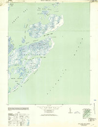 1953 Ship Shoal Inlet1953 Print · USGSThe Virginia barrier islands appear in detail on the eve of the mid-century, showing a landscape of dunes and tidal marshes. Researchers can trace early maritime outposts like the Coast Guard Lookout Station and isolated dwellings such as the Gable S Shack or Shack on piles.
 - 1955 Map of Elliotts Creek, 1956 Print
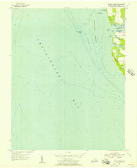 1955 Elliotts Creek1956 Print · USGSThe Eastern Shore of Virginia reveals its maritime character in the mid-fifties as navigation lights guided ships into the Chesapeake. Genealogists and historians can locate the Arlington Tomb of Custis and trace the coastal waters of Old Plantation Cr and Elliots Creek.
 - 1955 Map of Cape Charles, 1956 Print
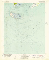 1955 Cape Charles1956 Print · USGSCoastal Virginia at the southern tip of the Eastern Shore shows a landscape defined by military defense and maritime navigation in the mid-fifties. Researchers can trace the footprint of the Fisherman Island Naval Base and Cape Charles Air Force Base alongside landforms like The Isaacs and Wise Point.2 unique versions available
 - 1955 Map of Cheriton, 1956 Print
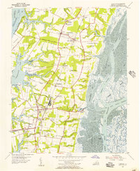 1955 Cheriton1956 Print · USGSThe Virginia Eastern Shore is captured here in the mid-1950s, showing the agricultural 'necks' and maritime settlements between the bay and the Atlantic. Researchers can locate family landmarks like James Crossroads and Stumptown, or trace rail history at Cape Junction.
 - 1955 Map of Townsend, 1957 Print
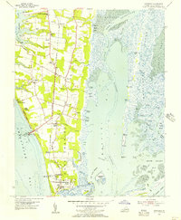 1955 Townsend1957 Print · USGSThe tip of the Virginia Eastern Shore is captured here in the mid-fifties, showing the transition from agricultural land to military and maritime sites. Genealogists and local historians can trace family-named sites like Dalbys, Arlington Wharf, and the Lower Northampton Ch while exploring the footprint of the Cape Charles Air Force Base.
 - 1959 Map of Richmond
 1959 Richmond1959 Print · USGSMid-century Virginia is captured here at its most vital rail and river junctions, from the capital city to the Chesapeake Bay. Genealogists and historians can trace the development of colonial settlements like Williamsburg and military landmarks including Fort Monroe and Camp Lee.
 - 1961 Map of Eastville
 1961 Eastville1961 Print · USGSThe Eastern Shore and Outer Banks are captured here in the mid-twentieth century, showing a maritime landscape of lighthouses, rail-linked towns, and naval outposts. Researchers can trace the Pennsylvania Railroad through Parksley or locate historical sites like Chincoteague Field Naval Auxiliary Air Station and Tangier Island.
Showing maps 1-25 of 165
Top cities of Northampton County
- Exmore historical maps
- Cape Charles historical maps
- Nassawadox historical maps
- Cheriton historical maps
- Eastville historical maps
- Willis Wharf historical maps
See more
Frequently asked questions
- What are the different types of historical maps available for Northampton County?
- What is the oldest map of Northampton County?
- Where can I purchase historical maps of Northampton County for my home or office?
- Where can I download high-res historical maps of Northampton County?
- Are there historical topographic maps available for Northampton County?
- Is there historical aerial imagery available for Northampton County?
- Where are historical maps of Northampton County sourced from?