Old Maps of Orange County, Virginia for Metal Detecting
Plan your next treasure hunt with 132 historic maps of Orange County. Find old homesites, ghost towns, trails, and gathering spots that may be lost to time — perfect for identifying promising metal detecting locations.
- Locate forgotten sites: Uncover places like long-lost settlements, abandoned rail lines, or gathering spots.
- Plan better hunts: Use map overlays combined with LiDAR or satellite views to narrow in on historically rich areas.
- Made for detectorists: Thousands of hobbyists use these maps to discover relics, coins, and hidden history.
Use these historic maps to boost your research and find new opportunities beneath the surface of Orange County.
Orange County, VA maps
(132)- 1887 Map of Spottsylvania
 1887 Spottsylvania1887 Print · USGSCentral Virginia in the late 1880s remains a landscape of river fords and crossroads shops before modern development. Genealogists and historians can trace the locations of the Vaucluse Gold Mine, Wilderness Tavern, and the path of the Narrow Gauge Railroad.
 - 1892 Map of Spottsylvania
 1892 Spottsylvania1892 Print · USGSCentral Virginia’s post-war landscape is captured here in the late nineteenth century, showing a rural economy defined by gold mining and river crossings. Genealogists can trace family footprints at Todds Tavern, the Vaucluse Gold Mine, and along the Narrow Gauge Railroad.6 unique versions available
 - 1892 Map of Gordonsville, 1899 Print
 1892 Gordonsville1899 Print · USGSCentral Virginia’s railway hubs and mountain gaps come alive in this late nineteenth-century survey. Genealogists and historians can trace the foundations of Charlottesville and the bustling rail junctions at Gordonsville and Orange.6 unique versions available
 - 1930 Map of Madison
 1930 Madison1930 Print · USGSThe Blue Ridge foothills of Madison and Greene counties are captured here just as Shenandoah National Park was being established. Researchers can trace the early mountain communities around Graves Mill, Criglersville, and the remote Upper Pocosin Mission.3 unique versions available
 - 1933 Map of Madison
 1933 Madison1933 Print · USGSThe Virginia Piedmont meets the Blue Ridge in the early thirties, just as the national park is taking shape. Genealogists can trace family names across Eppards Mill, The Presidents Camp, and remote schools like the Upper Pocosin Mission.3 unique versions available
 - 1935 Map of Charlottesville
 1935 Charlottesville1935 Print · USGSAlbemarle County's landscape is meticulously detailed in the mid-1930s, centered on the historic crossroads and river forks surrounding the city. Genealogists and local historians can trace family-named landmarks and essential community sites like Monticello, the Rosenwald Sch, and the rail junction at Barboursville.2 unique versions available
 - 1939 Map of Charlottesville
 1939 Charlottesville1939 Print · USGSAlbemarle and Orange Counties come alive in the late 1930s, showing a Piedmont landscape defined by the Southwest Mountains and historic river valleys. Genealogists can locate family landmarks from Monticello to the Rosenwald Sch, alongside dozens of rural churches like Bethany Ch.3 unique versions available
 - 1942 Map of Mineral
 1942 Mineral1942 Print · USGSLouisa County during the early years of the war shows a landscape of rural crossroads and established rail hubs. Trace local history through family landmarks like Bibbs Store, Holladay Mill, and the many churches like Miners Chapel along the Chesapeake and Ohio line.2 unique versions available
 - 1942 Map of Lahore
 1942 Lahore1942 Print · USGSOrange County and the surrounding borderlands were a network of rural hamlets and airway navigation markers during the early 1940s. Genealogists can locate family landmarks like Terrells Store, North Pamunkey Church, and the Isabella Lightfoot Training School.2 unique versions available
 - 1942 Map of Belmont
 1942 Belmont1942 Print · USGSSpotsylvania and Orange Counties are captured here during the early years of the war, revealing a landscape of rural crossroads and mining operations. Researchers can trace family roots through landmarks like Richards Shop, Bells Cross Road, and the Valzinco Mine.2 unique versions available
 - 1943 Map of Germanna Bridge, 1957 Print
 1943 Germanna Bridge1957 Print · USGSCulpeper County and the surrounding river borders are captured here during the early 1940s as a landscape of crossroads stores and river crossings. Genealogists can trace family footprints through sites like Lignum, South Lignum School, and the historic Kellys Ford.2 unique versions available
 - 1943 Map of Chancellorsville, 1957 Print
 1943 Chancellorsville1957 Print · USGSSpotsylvania and Orange counties are captured during the early 1940s, highlighting the preserved grounds of the Wilderness National Military Park. Genealogists can trace family footprints at Paynes Store, Zion Hill Church, and the Parker School located near the Ni River.
 - 1943 Map of Culpeper, 1961 Print
 1943 Culpeper1961 Print · USGSCulpeper and its surroundings are documented here during the early 1940s as a bustling railroad and county hub. Researchers can locate specific local landmarks like the U S National Cem, tracing the rail lines through Brandy or visiting rural outposts like Batna.
 - 1943 Map of Mine Run, 1961 Print
 1943 Mine Run1961 Print · USGSOrange County and the surrounding tri-county area are shown here during the early years of the Second World War. Researchers can locate local landmarks like Zoar Sch, the Wilderness National Military Park, and rural centers at Golddale and Locustgrove.
 - 1943 Map of Unionville, 1961 Print
 1943 Unionville1961 Print · USGSOrange County and Culpeper County were largely defined by small crossroads communities and river crossings during the early 1940s. Genealogists can trace family locations near Raccoon Ford, Unionville, and rural houses of worship like Mt Pisgah Ch.
 - 1944 Map of Culpeper
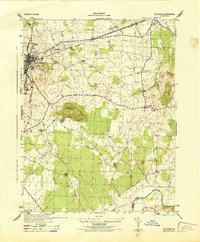 1944 Culpeper1944 Print · USGSCulpeper and the surrounding Piedmont landscape are captured here during the mid-1940s. Genealogists and local historians can locate family landmarks like Cedar Grove Church and the U S National Cemetery, or trace the old Southern rail line through Stevensburg.
 - 1944 Map of Unionville
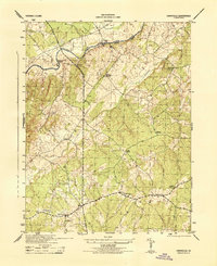 1944 Unionville1944 Print · USGSOrange County and the banks of the Rapidan River are captured here during the 1940s. Local researchers can trace old crossroads and community sites like Unionville, Raccoon Ford, and Sleets Shop, along with rural landmarks such as Palmyra Church.
 - 1944 Map of Mine Run
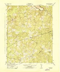 1944 Mine Run1944 Print · USGSCentral Virginia at the height of the war reveals a landscape of small crossroads and rural schoolhouses. Researchers can locate the Zoar School, early settlements like Locustgrove and Gold Dale, and the wartime presence of a CCC Camp.
 - 1944 Map of Chancellorsville
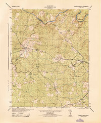 1944 Chancellorsville1944 Print · USGSSpotsylvania County is documented during the mid-1940s, highlighting the overlapping layers of Civil War history and rural Virginia life. Researchers can trace the grounds of Wilderness National Military Park or locate local landmarks like Wilderness Church and Parker School.
 - 1944 Map of Richardsville
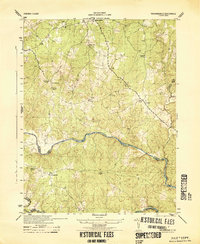 1944 Richardsville1944 Print · USGSRichardsville and the surrounding Virginia Piedmont are captured here in the 1940s as the river-riven borders of four counties meet. Researchers can trace the legacy of rural life through landmarks like Oakland Church, the Goldvein School, and Harding Mill.
 - 1944 Map of Germanna Bridge
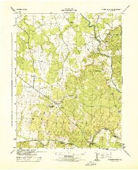 1944 Germanna Bridge1944 Print · USGSCulpeper and Fauquier counties are captured here in the mid-1940s as rural river-bound communities. Genealogists and local historians can trace the road networks connecting Kellys Ford, Lignum, and the historic crossing at Germanna Bridge.
 - 1948 Map of Washington
 1948 Washington1948 Print · USGSThe Potomac and Chesapeake regions in the late 1940s reveal a landscape of expanding military reach and deep-rooted Tidewater settlements. Trace old rail corridors like the Richmond Fredericksburg & Potomac RR or locate landmarks like the Wakefield Washington Monument and St. Marys College.2 unique versions available
 - 1949 Map of Charlottesville
 1949 Charlottesville1949 Print · USGSThe Shenandoah Valley and Blue Ridge appear in the late 1940s as a thriving corridor of rail and river commerce. Researchers can trace the mid-century footprints of Harrisonburg, Staunton, and Culpeper alongside the historic routes of the Southern Railway.2 unique versions available
 - 1949 Map of Charlottesville, 1962 Print
 1949 Charlottesville1962 Print · USGSMid-century Albemarle County is captured here during a period of steady growth, anchored by the expansion of the Charlottesville area and its surrounding ridges. Researchers can locate rural landmarks like Advance Mills, the Albemarle Training Sch, and the historic Spotswood Trail.
 - 1953 Map of Richardsville
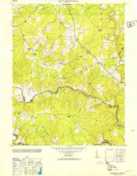 1953 Richardsville1953 Print · USGSThe rural borderlands of Fauquier and Culpeper counties are frozen in time just after the war, centered on the historic river convergence. Genealogists can trace family connections through numerous landmarks like Old School Church, Goldvein School, and Harding Mill.
Showing maps 1-25 of 132
Top cities of Orange County
- Lake of the Woods historical maps
- Orange historical maps
- Gordonsville historical maps
- Barboursville historical maps
Frequently asked questions
- What are the different types of historical maps available for Orange County?
- What is the oldest map of Orange County?
- Where can I purchase historical maps of Orange County for my home or office?
- Where can I download high-res historical maps of Orange County?
- Are there historical topographic maps available for Orange County?
- Is there historical aerial imagery available for Orange County?
- Where are historical maps of Orange County sourced from?