Old Maps of Pittsylvania County, Virginia
Explore 62 old maps of Pittsylvania County, spanning from 1890 to today. These high-resolution historic maps reveal how streets, neighborhoods, landmarks, and natural features evolved over time — perfect for genealogy, metal detecting, research, and local history exploration.
What you can do with these maps:
- See how Pittsylvania County changed over time: Compare historical maps to modern-day views to trace roads, homesites, rail lines & more.
- View detailed metadata: Each map includes creators, publishers, year, scale, and archive source.
- Overlay maps with satellite & LiDAR: Visualize the past alongside modern tools to explore terrain & human change.
- Trusted historical sources: Maps sourced from the USGS, Library of Congress, and other archives.
- Access maps your way: View online, download high-res files, or order prints for personal or research use.
Start exploring old maps of Pittsylvania County to uncover forgotten places, hidden landmarks, and the deep history beneath your feet.
Pittsylvania County, VA maps
(62)- 1890 Map of Roanoke
 1890 Roanoke1890 Print · USGSCovers Pittsylvania County, including Roanoke, Hollins, and other nearby areas
 - 1891 Map of Roanoke
 1891 Roanoke1891 Print · USGSCovers Pittsylvania County, including Roanoke, Hollins, and other nearby areas8 unique versions available
 - 1892 Map of Lynchburg
 1892 Lynchburg1892 Print · USGSCovers Pittsylvania County, including Lynchburg, Timberlake, and other nearby areas6 unique versions available
 - 1921 Map of Chatham
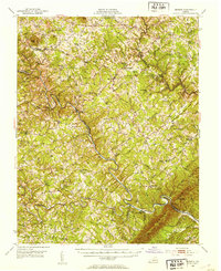
 1921 Chatham1921 Print · USGSCovers Pittsylvania County, including Chatham, Gretna, and other nearby areas
 - 1922 Map of Callands
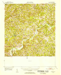
 1922 Callands1922 Print · USGSCovers Pittsylvania County, including Union Hall, Penhook, and other nearby areas
 - 1923 Map of Danville
 1923 Danville1923 Print · USGSCovers Pittsylvania County, including Danville, Mount Hermon, and other nearby areas
 - 1923 Map of Chatham
 1923 Chatham1923 Print · USGSCovers Pittsylvania County, including Chatham, Gretna, and other nearby areas3 unique versions available
 - 1924 Map of Draper
 1924 Draper1924 Print · USGSCovers Pittsylvania County, including Eden, Axton, and other nearby areas
 - 1924 Map of Callands
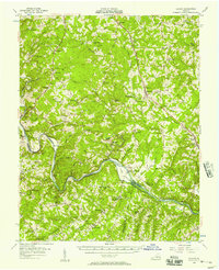
 1924 Callands1924 Print · USGSCovers Pittsylvania County, including Union Hall, Penhook, and other nearby areas3 unique versions available
 - 1925 Map of Danville
 1925 Danville1925 Print · USGSCovers Pittsylvania County, including Danville, Mount Hermon, and other nearby areas3 unique versions available
 - 1926 Map of Draper
 1926 Draper1926 Print · USGSCovers Pittsylvania County, including Eden, Axton, and other nearby areas3 unique versions available
 - 1944 Map of Draper
 1944 Draper1944 Print · USGSCovers Pittsylvania County, including Eden, Axton, and other nearby areas
 - 1944 Map of Callands
 1944 Callands1944 Print · USGSCovers Pittsylvania County, including Union Hall, Penhook, and other nearby areas
 - 1947 Map of Roanoke, 1948 Print
 1947 Roanoke1948 Print · USGSCovers Pittsylvania County, including Roanoke, Lynchburg, and other nearby areas2 unique versions available
 - 1951 Map of Moneta, 1953 Print
 1951 Moneta1953 Print · USGSCovers Pittsylvania County, including North Shore, Westlake Corner, and other nearby areas3 unique versions available
 - 1951 Map of Altavista, 1953 Print
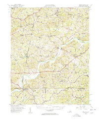
 1951 Altavista1953 Print · USGSCovers Pittsylvania County, including Altavista, Hurt, and other nearby areas2 unique versions available
 - 1952 Map of Milton, 1953 Print
 1952 Milton1953 Print · USGSCovers Pittsylvania County, including Yanceyville, Milton, and other nearby areas
 - 1953 Map of Greensboro, 1981 Print
 1953 Greensboro1981 Print · USGSCovers Pittsylvania County, including Greensboro, Durham, and other nearby areas
 - 1954 Map of Greensboro
 1954 Greensboro1954 Print · USGSCovers Pittsylvania County, including Greensboro, Durham, and other nearby areas
 - 1954 Map of Riceville, 1956 Print
 1954 Riceville1956 Print · USGSCovers Pittsylvania County, including Henrys Mill, Java, and other nearby areas
 - 1956 Map of Gladys, 1957 Print
 1956 Gladys1957 Print · USGSCovers Pittsylvania County, including Altavista, Green Hill, and other nearby areas2 unique versions available
 - 1956 Map of Milton, 1957 Print
 1956 Milton1957 Print · USGSCovers Pittsylvania County, including Yanceyville, Milton, and other nearby areas2 unique versions available
 - 1959 Map of Roanoke
 1959 Roanoke1959 Print · USGSCovers Pittsylvania County, including Roanoke, Lynchburg, and other nearby areas
 - 1962 Map of Greensboro
 1962 Greensboro1962 Print · USGSCovers Pittsylvania County, including Greensboro, Durham, and other nearby areas
 - 1963 Map of Roanoke
 1963 Roanoke1963 Print · USGSCovers Pittsylvania County, including Roanoke, Lynchburg, and other nearby areas
Showing maps 1-25 of 62
Top cities of Pittsylvania County
- Mount Hermon historical maps
- Chatham historical maps
- Gretna historical maps
- Hurt historical maps
- Motley historical maps
Frequently asked questions
- What are the different types of historical maps available for Pittsylvania County?
- What is the oldest map of Pittsylvania County?
- Where can I purchase historical maps of Pittsylvania County for my home or office?
- Where can I download high-res historical maps of Pittsylvania County?
- Are there historical topographic maps available for Pittsylvania County?
- Is there historical aerial imagery available for Pittsylvania County?
- Where are historical maps of Pittsylvania County sourced from?