Old Maps of Pittsylvania County, Virginia for Academic Research
Study the evolution of Pittsylvania County with 98 high-resolution historic maps. Whether you're teaching, researching, or modeling changes in land use, these maps provide essential visual documentation of urban, environmental, and geographic change.
- Analyze long-term change: Track patterns in development, transportation, and natural features.
- Ideal for environmental or urban studies: Support academic projects with primary historical map data.
- Use in the classroom or lab: Educators and researchers rely on these maps to bring historical context to life.
These maps are a powerful tool for teaching, research, and visualizing how Pittsylvania County has changed over the decades.
Pittsylvania County, VA maps
(98)- 1890 Map of Roanoke
 1890 Roanoke1890 Print · USGSThe Roanoke Valley in the late nineteenth century was a growing rail and mining hub shaped by the Blue Ridge. Researchers can trace the early industrial footprint of the Rorer Mines or locate old community anchors like Dillons Mill and Hales Bridge.
 - 1891 Map of Roanoke
 1891 Roanoke1891 Print · USGSVirginia's Blue Ridge and Roanoke Valley come alive in the late nineteenth century, showing a landscape defined by new rail lines and old river crossings. Genealogists and local researchers can trace family landmarks and forgotten transport nodes like Rorer Mines, Hollins Inst., and Blackwater Ford.8 unique versions available
 - 1892 Map of Lynchburg
 1892 Lynchburg1892 Print · USGSCentral Virginia in the 1890s centered on the vital rail and river junction of Lynchburg and its surrounding tobacco-growing counties. Family historians can trace ancestral crossings at Wards Road Ferry, locate the Academy church, and follow the early Virginia Midland Rail Road through Evington.6 unique versions available
 - 1921 Map of Chatham
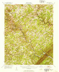
 1921 Chatham1921 Print · USGSPittsylvania County's rural heartland is captured here in the early twenties, anchored by the railway and the ridge of White Oak Mountain. Genealogists and historians can locate dozens of country landmarks like Tight Squeeze, Whittles Depot, and Mountain Spring Church.
 - 1922 Map of Callands
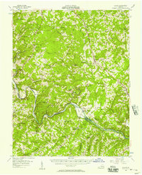
 1922 Callands1922 Print · USGSIn the early 1920s, this pocket of rural Virginia was a landscape of river fords, local stores, and family-named mills. Researchers can trace the roots of small communities at Callands and Swansonville or locate long-standing landmarks like Boones Chapel and La Prades Mill.
 - 1923 Map of Danville
 1923 Danville1923 Print · USGSThe Virginia and North Carolina borderlands come alive in the 1920s as the Dan River winds through a landscape of rail-driven trade and rural education. Genealogists can trace family roots through numerous landmark schools and stores, including Lovelace Hall School, Gibsons Store, and Sandy Creek Church.
 - 1923 Map of Chatham
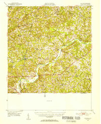
 1923 Chatham1923 Print · USGSPittsylvania County's rural heartland is captured here in the early twenties, centered on the strategic rail hub of Chatham. Researchers can trace the heritage of local industry and community life through sites like Bennett Mine, Tight Squeeze, and the County Poor Farm.3 unique versions available
 - 1924 Map of Draper
 1924 Draper1924 Print · USGSThe rural Piedmont of Southside Virginia is mapped here during the mid-twenties, showcasing a landscape of small tobacco farms and river-valley settlements. Researchers can trace family sites like Laceys Store, the Soapstone Quarry, and early depots at Leaksville Junction.
 - 1924 Map of Callands
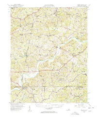
 1924 Callands1924 Print · USGSSouthern Virginia in the early twenties shows a landscape of ridges and river bends at the borders of Franklin, Henry, and Pittsylvania counties. Researchers can trace old family sites and rural infrastructure including Swansons Mill, Burnt Chimney, and the Fralin Bridge over the Pigg River.3 unique versions available
 - 1925 Map of Danville
 1925 Danville1925 Print · USGSThe borderlands of Pittsylvania County and North Carolina appear here in the mid-1920s, centered on the growing industrial hub of Danville. Genealogists and historians can trace neighborhood developments in Schoolfield and locate rural landmarks like Laniers Mill and Lovelace Hall School.3 unique versions available
 - 1926 Map of Draper
 1926 Draper1926 Print · USGSThe Virginia and North Carolina borderlands come alive in the mid-1920s, showing a landscape of small tobacco farms and rail-dependent hamlets. Genealogists can trace family roots through numerous local landmarks like Swansonville, Bachelors Hall Church, and the Danville and Western rail line.3 unique versions available
 - 1944 Map of Draper
 1944 Draper1944 Print · USGSThe Virginia and North Carolina borderlands come alive in the 1940s, showing the industrial and rail corridor stretching from Spray to Draper. Researchers can trace the Danville and Western Ry route through old stops like Cascade Station and discover dozens of rural community hubs like Stony Mill and Anderson Chapel.
 - 1944 Map of Callands
 1944 Callands1944 Print · USGSThe rural Virginia Piedmont comes to life in the 1940s as schools, mills, and mountain gaps define the landscape near the Pigg River. Researchers can trace ancestral home sites and community hubs like Union Hall, Giles Mill, and the Mayflower Sch.
 - 1947 Map of Roanoke, 1948 Print
 1947 Roanoke1948 Print · USGSCentral Virginia in the late 1940s reveals a region defined by its great mountain ridges and the powerful river-and-rail economy connecting Roanoke to Lynchburg. Researchers can trace the path of the Virginian RR and locate historic county seats like Charlotte Court House.2 unique versions available
 - 1951 Map of Moneta, 1953 Print
 1951 Moneta1953 Print · USGSMid-century Bedford and Franklin counties are shown here before the inundation of the Roanoke valley. Genealogists and historians can trace the foundations of rural life through landmarks like Davis Mill, the VIRGINIAN rail line, and Emmaus Sch.3 unique versions available
 - 1951 Map of Altavista, 1953 Print
 1951 Altavista1953 Print · USGSThe Roanoke River valley in the early fifties shows a region defined by its rail-and-river economy and tight-knit rural communities. Genealogists and local historians can trace family roots through landmarks like Bethlehem Ch, Lynch Sta, and Greasy Sch.2 unique versions available
 - 1952 Map of Milton, 1953 Print
 1952 Milton1953 Print · USGSThe Dan River valley at the start of the 1950s reveals a landscape of tobacco farms and rural schoolhouses across the Virginia-North Carolina line. Genealogists and local historians can trace family roots through landmarks like Sutherlin Millpond, Mercy Seat Ch, and the Tan-yard.
 - 1953 Map of Greensboro, 1981 Print
 1953 Greensboro1981 Print · USGSThe Piedmont borderlands of North Carolina and Virginia show a landscape defined by new reservoirs and old rail lines. Trace family roots and the changing river geography through Elon College, the John H Kerr Reservoir, and South Boston.
 - 1954 Map of Greensboro
 1954 Greensboro1954 Print · USGSThe Piedmont borderlands of North Carolina and Virginia come alive in this mid-fifties study of a region defined by its rivers and rails. Researchers can trace the growing Buggs Island Lake or follow the paths of the Southern Ry and Seaboard Air Line RR through towns like Oxford and Reidsville.
 - 1954 Map of Riceville, 1956 Print
 1954 Riceville1956 Print · USGSCentral Virginia in the mid-1950s is captured here, showing the rural landscape along the Banister River. Local researchers can locate family landmarks like Henrys Mill, the Carter Glass Sch, and County Line Cem Ch.
 - 1956 Map of Gladys, 1957 Print
 1956 Gladys1957 Print · USGSSouthern Campbell County in the mid-fifties is captured here as a landscape of rail-junction towns and river-bottom farms. Genealogists can trace family roots through numerous local landmarks like Mitchell Mill, Organ Chapel, and the Franklin Cem.2 unique versions available
 - 1956 Map of Milton, 1957 Print
 1956 Milton1957 Print · USGSThe borderlands of Caswell County and southern Virginia are captured here in the mid-1950s as a landscape of river-driven commerce and rail depots. Researchers can trace family sites from Milton to Ghent, locating landmarks like Sutherlin Millpond and the Archibald Murphy Sch.2 unique versions available
 - 1959 Map of Roanoke
 1959 Roanoke1959 Print · USGSCentral Virginia and the Blue Ridge appear in great detail during the late fifties, showcasing the transition from mountain industry to Piedmont farmland. Trace the path of the Norfolk and Western railroad or find old river towns like Appomattox and Amelia Court House.
 - 1962 Map of Greensboro
 1962 Greensboro1962 Print · USGSThe Piedmont region along the Virginia and North Carolina border comes alive in the early 1960s, showing a landscape defined by industry and new reservoirs. Trace the path of the Virginian RR or explore the early development of Greensboro and Durham.
 - 1963 Map of Roanoke
 1963 Roanoke1963 Print · USGSCentral Virginia and the Blue Ridge front appear here in the early sixties, caught between their deep railroad roots and new postwar developments. Genealogists and historians can trace the rail lines of the Norfolk and Western through towns like Bedford and Altavista, or locate family landmarks near Smith Mountain Lake.
Showing maps 1-25 of 98
Top cities of Pittsylvania County
- Mount Hermon historical maps
- Chatham historical maps
- Gretna historical maps
- Hurt historical maps
- Motley historical maps
Frequently asked questions
- What are the different types of historical maps available for Pittsylvania County?
- What is the oldest map of Pittsylvania County?
- Where can I purchase historical maps of Pittsylvania County for my home or office?
- Where can I download high-res historical maps of Pittsylvania County?
- Are there historical topographic maps available for Pittsylvania County?
- Is there historical aerial imagery available for Pittsylvania County?
- Where are historical maps of Pittsylvania County sourced from?