Old Maps of Powhatan County, Virginia
Explore 114 old maps of Powhatan County, spanning from 1890 to today. These high-resolution historic maps reveal how streets, neighborhoods, landmarks, and natural features evolved over time — perfect for genealogy, metal detecting, research, and local history exploration.
What you can do with these maps:
- See how Powhatan County changed over time: Compare historical maps to modern-day views to trace roads, homesites, rail lines & more.
- View detailed metadata: Each map includes creators, publishers, year, scale, and archive source.
- Overlay maps with satellite & LiDAR: Visualize the past alongside modern tools to explore terrain & human change.
- Trusted historical sources: Maps sourced from the USGS, Library of Congress, and other archives.
- Access maps your way: View online, download high-res files, or order prints for personal or research use.
Start exploring old maps of Powhatan County to uncover forgotten places, hidden landmarks, and the deep history beneath your feet.
Powhatan County, VA maps
(114)- 1890 Map of Goochland
 1890 Goochland1890 Print · USGSGoochland and the surrounding Virginia Piedmont are captured here in the late nineteenth century as the river-and-rail economy thrived. Researchers can trace the paths of the Chesapeake and Ohio Railroad and find landmarks like Hopeful Church or the Coal Pits.
 - 1891 Map of Palmyra
 1891 Palmyra1891 Print · USGSCentral Virginia during the late nineteenth century was a landscape of river-driven industry and railroad expansion along the James. Genealogists and historians can locate old processing sites like Arvonia Slate Quarry, remote outposts like Boyds Tavern, and the track of the Richmond and Alleghany Railroad.
 - 1891 Map of Farmville
 1891 Farmville1891 Print · USGSSouth-central Virginia's rail and river networks come alive in the 1890s, centered on the bustling hub of Farmville. Genealogists can trace family roots through old courthouse seats like Cumberland C.H. and vanished stops like Jennings Ordinary or Rice Depot.
 - 1892 Map of Goochland
 1892 Goochland1892 Print · USGSThe rural heart of central Virginia is captured here in the decade before the turn of the century, showing a landscape shaped by major rivers and early rail lines. Genealogists can trace family names and early settlements like Negro Foot, Mabelton, and the historic Hanover Academy.8 unique versions available
 - 1893 Map of Farmville
 1893 Farmville1893 Print · USGSThe Virginia Piedmont at the end of the nineteenth century centers on the rail junction at Farmville and the winding Appomattox River. Genealogists can trace family lands near Hampden Sidney, Guinea Mills, and the old tavern site at Joppings Ordinary.8 unique versions available
 - 1895 Map of Palmyra
 1895 Palmyra1895 Print · USGSThe James and Rivanna River valleys of central Virginia are captured here in the 1890s, revealing a landscape of rail-connected river towns and rural mills. Researchers can trace the Richmond and Alleghany Railroad and locate landmarks like the Arvon Slate Quarry or Flanagan Mill.
 - 1897 Map of Amelia
 1897 Amelia1897 Print · USGSThe rural interior of central Virginia comes into focus in the late nineteenth century, as the Appomattox River corridor transitions from a river-based economy to a rail-centered one. Researchers can trace ancestral property lines near Giles Mill, locate the rail hub at Mosley Junction, or find old river crossings like Goode Bridge.5 unique versions available
 - 1897 Map of Palmyra
 1897 Palmyra1897 Print · USGSCentral Virginia during the late 1880s is defined by its deep river valleys and the industrial reach of the James and Rivanna. Genealogists and historians can trace the growth of river towns like Scottsville or explore industrial roots at the Slate Quarry and Union Mills.7 unique versions available
 - 1943 Map of Goochland
 1943 Goochland1943 Print · USGSGoochland County and the James River valley are shown here during the early 1940s, highlighting the area's river-and-rail infrastructure. Genealogists can trace family landmarks like Leakes Mill, Ragland Memorial Church, and the rural community of Three Square.2 unique versions available
 - 1943 Map of Fine Creek Mills
 1943 Fine Creek Mills1943 Print · USGSThe rural landscape of Powhatan and Goochland counties is captured here in the mid-1940s, highlighting a river-and-rail economy along the James River. Genealogists and historians can trace community hubs like Fine Creek Mills and Subletts, or locate rural landmarks such as Quinns Store and Subletts School.2 unique versions available
 - 1943 Map of Powhatan
 1943 Powhatan1943 Print · USGSPowhatan County at the height of the Second World War shows a rural landscape of crossroads communities and riverside academies. Genealogists can locate family landmarks like Goodwins Store, the St Emma School, and the segregated Powhatan County High School.2 unique versions available
 - 1943 Map of Perkinsville
 1943 Perkinsville1943 Print · USGSGoochland County at the height of the Second World War remains a landscape of rural stores and riverside rail transport. Genealogists and historians can trace the foundations of State Farm, find old community hubs like Gammons Store, or locate country parishes such as Hebron Church.2 unique versions available
 - 1943 Map of Hallsboro
 1943 Hallsboro1943 Print · USGSCentral Virginia is seen here during the mid-forties, centered on the rural crossing at Hallsboro. Genealogists and local historians can trace family roots through landmarks like Tomahawk Church, the Southern rail line, and Cheathams Hatchery.2 unique versions available
 - 1943 Map of Clayville, 1961 Print
 1943 Clayville1961 Print · USGSIn the early 1940s, this pocket of Central Virginia was a landscape of river-bend settlements and timberlands along the Appomattox River. Researchers can trace old family locations and community hubs like Grange Hall High Sch, Mattoax, and the rural Beulah Ch.
 - 1943 Map of Midlothian, 1961 Print
 1943 Midlothian1961 Print · USGSMidlothian and the James River valley are shown here during the early 1940s, when river islands and rail lines defined the local geography. Genealogists and local historians can trace the foundations of Midlothian, locate the Granite Quarries, and identify rural landmarks like Winfree Ch and Manakin Sch.
 - 1943 Map of Chula, 1961 Print
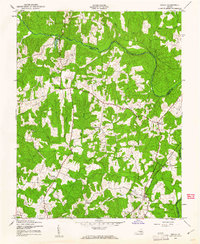 1943 Chula1961 Print · USGSAmelia County and the banks of the Appomattox River are captured here during the Second World War. Genealogists and local historians can trace family-named sites like Masons Corner or locate rural landmarks such as Grub Hill Ch and the settlement of Chula.
 - 1943 Map of Richmond, 1972 Print
 1943 Richmond1972 Print · USGSCoastal Virginia and the state capital are shown in detail during the mid-century era of infrastructure expansion. Genealogists and historians can trace the grounds of Richmond Nat Battlefield Park, locate the Yorktown Nat Cem, or follow the many rural routes through Amelia Court House and Tappahannock.
 - 1944 Map of Chula
 1944 Chula1944 Print · USGSAmelia County and the southern banks of the Appomattox River appear here during the mid-1940s, showing a landscape of traditional farming and local milling. Genealogists can trace family landmarks and rural life through locations like Giles Mill, Grub Hill Church, and the depot at Chula.
 - 1944 Map of Midlothian
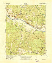 1944 Midlothian1944 Print · USGSMid-1940s Virginia reveals a river-driven landscape where the James River and the Chesapeake and Ohio railroad define regional growth. Genealogists can trace family landmarks like Tuckahoe Estate, Watkins Nurseries, and the Huguenot Monument.
 - 1944 Map of Clayville
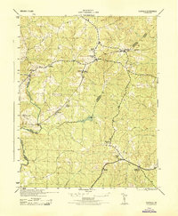 1944 Clayville1944 Print · USGSMid-century Chesterfield and Powhatan counties show a landscape of railroad hamlets and river crossings during the 1940s. Genealogists can locate family landmarks like Grange Hall High School, Skinquarter Church, and the river site of Genito Mill.
 - 1947 Map of Roanoke, 1948 Print
 1947 Roanoke1948 Print · USGSCentral Virginia in the late 1940s reveals a region defined by its great mountain ridges and the powerful river-and-rail economy connecting Roanoke to Lynchburg. Researchers can trace the path of the Virginian RR and locate historic county seats like Charlotte Court House.2 unique versions available
 - 1949 Map of Richmond, 1951 Print
 1949 Richmond1951 Print · USGSCoastal Virginia in the years following World War II remained a landscape of historic river towns and expanding military bases. Genealogists and historians can trace the rail lines of the Southern Ry and locate established landmarks from Camp Lee to the remote reaches of Dragon Swamp.
 - 1958 Map of Jetersville, 1959 Print
 1958 Jetersville1959 Print · USGSAmelia and Cumberland counties in the late 1950s show a landscape of traditional mills and rail-side settlements along the Appomattox River. Genealogists can trace family connections at Clarke Cem or study community hubs like Paineveille Sch and Hobsons Chapel.2 unique versions available
 - 1959 Map of Roanoke
 1959 Roanoke1959 Print · USGSCentral Virginia and the Blue Ridge appear in great detail during the late fifties, showcasing the transition from mountain industry to Piedmont farmland. Trace the path of the Norfolk and Western railroad or find old river towns like Appomattox and Amelia Court House.
 - 1959 Map of Richmond
 1959 Richmond1959 Print · USGSMid-century Virginia is captured here at its most vital rail and river junctions, from the capital city to the Chesapeake Bay. Genealogists and historians can trace the development of colonial settlements like Williamsburg and military landmarks including Fort Monroe and Camp Lee.
Showing maps 1-25 of 114
Top cities of Powhatan County
Frequently asked questions
- What are the different types of historical maps available for Powhatan County?
- What is the oldest map of Powhatan County?
- Where can I purchase historical maps of Powhatan County for my home or office?
- Where can I download high-res historical maps of Powhatan County?
- Are there historical topographic maps available for Powhatan County?
- Is there historical aerial imagery available for Powhatan County?
- Where are historical maps of Powhatan County sourced from?