1900s (20th Century) Maps of Powhatan County, Virginia
Explore 46 historic maps of Powhatan County from the 1900s (20th Century). These maps offer a rare glimpse into what life looked like during the 1900s — showing old roads, neighborhoods, homes, and landmarks that have changed or disappeared over time.
Whether you're researching your family's past, planning a metal detecting trip, or studying how Powhatan County's landscape evolved across the 1900s, these high-resolution maps are a powerful tool for exploring the history of this region.
- Focus on a specific era: All maps on this page are from the 1900s, giving you a focused view of this time period.
- See what’s changed: Compare century-old streets, trails, and buildings to today's modern landscape using overlays and satellite layers.
- Research with precision: Use these maps for genealogy, historical research, land use analysis, or educational projects.
- View, download, or print: Maps are fully viewable online in high resolution, and can be downloaded or printed for your own records.
Start exploring Powhatan County's history through authentic maps from the 1900s. This is your window into the past.
Powhatan County, VA maps
(46)- 1943 Map of Goochland
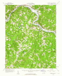
 1943 Goochland1943 Print · USGSGoochland County and the James River valley are shown here during the early 1940s, highlighting the area's river-and-rail infrastructure. Genealogists can trace family landmarks like Leakes Mill, Ragland Memorial Church, and the rural community of Three Square.2 unique versions available
 - 1943 Map of Fine Creek Mills
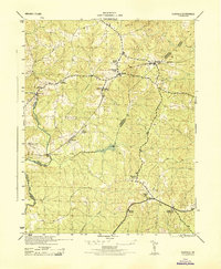
 1943 Fine Creek Mills1943 Print · USGSThe rural landscape of Powhatan and Goochland counties is captured here in the mid-1940s, highlighting a river-and-rail economy along the James River. Genealogists and historians can trace community hubs like Fine Creek Mills and Subletts, or locate rural landmarks such as Quinns Store and Subletts School.2 unique versions available
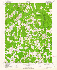
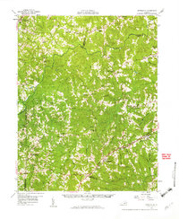
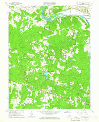
 - 1943 Map of Powhatan
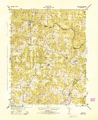
 1943 Powhatan1943 Print · USGSPowhatan County at the height of the Second World War shows a rural landscape of crossroads communities and riverside academies. Genealogists can locate family landmarks like Goodwins Store, the St Emma School, and the segregated Powhatan County High School.2 unique versions available
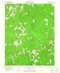
 - 1943 Map of Perkinsville
 1943 Perkinsville1943 Print · USGSGoochland County at the height of the Second World War remains a landscape of rural stores and riverside rail transport. Genealogists and historians can trace the foundations of State Farm, find old community hubs like Gammons Store, or locate country parishes such as Hebron Church.2 unique versions available
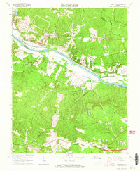
 - 1943 Map of Hallsboro
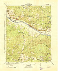
 1943 Hallsboro1943 Print · USGSCentral Virginia is seen here during the mid-forties, centered on the rural crossing at Hallsboro. Genealogists and local historians can trace family roots through landmarks like Tomahawk Church, the Southern rail line, and Cheathams Hatchery.2 unique versions available
 - 1943 Map of Clayville, 1961 Print
 1943 Clayville1961 Print · USGSIn the early 1940s, this pocket of Central Virginia was a landscape of river-bend settlements and timberlands along the Appomattox River. Researchers can trace old family locations and community hubs like Grange Hall High Sch, Mattoax, and the rural Beulah Ch.
 - 1943 Map of Midlothian, 1961 Print
 1943 Midlothian1961 Print · USGSMidlothian and the James River valley are shown here during the early 1940s, when river islands and rail lines defined the local geography. Genealogists and local historians can trace the foundations of Midlothian, locate the Granite Quarries, and identify rural landmarks like Winfree Ch and Manakin Sch.
 - 1943 Map of Chula, 1961 Print
 1943 Chula1961 Print · USGSAmelia County and the banks of the Appomattox River are captured here during the Second World War. Genealogists and local historians can trace family-named sites like Masons Corner or locate rural landmarks such as Grub Hill Ch and the settlement of Chula.
 - 1943 Map of Richmond, 1972 Print
 1943 Richmond1972 Print · USGSCoastal Virginia and the state capital are shown in detail during the mid-century era of infrastructure expansion. Genealogists and historians can trace the grounds of Richmond Nat Battlefield Park, locate the Yorktown Nat Cem, or follow the many rural routes through Amelia Court House and Tappahannock.
 - 1944 Map of Chula
 1944 Chula1944 Print · USGSAmelia County and the southern banks of the Appomattox River appear here during the mid-1940s, showing a landscape of traditional farming and local milling. Genealogists can trace family landmarks and rural life through locations like Giles Mill, Grub Hill Church, and the depot at Chula.
 - 1944 Map of Midlothian
 1944 Midlothian1944 Print · USGSMid-1940s Virginia reveals a river-driven landscape where the James River and the Chesapeake and Ohio railroad define regional growth. Genealogists can trace family landmarks like Tuckahoe Estate, Watkins Nurseries, and the Huguenot Monument.
 - 1944 Map of Clayville
 1944 Clayville1944 Print · USGSMid-century Chesterfield and Powhatan counties show a landscape of railroad hamlets and river crossings during the 1940s. Genealogists can locate family landmarks like Grange Hall High School, Skinquarter Church, and the river site of Genito Mill.
 - 1947 Map of Roanoke, 1948 Print
 1947 Roanoke1948 Print · USGSCentral Virginia in the late 1940s reveals a region defined by its great mountain ridges and the powerful river-and-rail economy connecting Roanoke to Lynchburg. Researchers can trace the path of the Virginian RR and locate historic county seats like Charlotte Court House.2 unique versions available
 - 1949 Map of Richmond, 1951 Print
 1949 Richmond1951 Print · USGSCoastal Virginia in the years following World War II remained a landscape of historic river towns and expanding military bases. Genealogists and historians can trace the rail lines of the Southern Ry and locate established landmarks from Camp Lee to the remote reaches of Dragon Swamp.
 - 1958 Map of Jetersville, 1959 Print
 1958 Jetersville1959 Print · USGSAmelia and Cumberland counties in the late 1950s show a landscape of traditional mills and rail-side settlements along the Appomattox River. Genealogists can trace family connections at Clarke Cem or study community hubs like Paineveille Sch and Hobsons Chapel.2 unique versions available
 - 1959 Map of Roanoke
 1959 Roanoke1959 Print · USGSCentral Virginia and the Blue Ridge appear in great detail during the late fifties, showcasing the transition from mountain industry to Piedmont farmland. Trace the path of the Norfolk and Western railroad or find old river towns like Appomattox and Amelia Court House.
 - 1959 Map of Richmond
 1959 Richmond1959 Print · USGSMid-century Virginia is captured here at its most vital rail and river junctions, from the capital city to the Chesapeake Bay. Genealogists and historians can trace the development of colonial settlements like Williamsburg and military landmarks including Fort Monroe and Camp Lee.
 - 1960 Map of Lakeside Village, 1962 Print
 1960 Lakeside Village1962 Print · USGSThe James River and the Chesapeake and Ohio railroad shaped the Cumberland and Goochland borderlands during the early 1960s. Genealogists can trace family names and social centers through landmarks like Flippen Millpond, Little Fork Ch, and Muddy Creek Cem.2 unique versions available
 - 1963 Map of Roanoke
 1963 Roanoke1963 Print · USGSCentral Virginia and the Blue Ridge front appear here in the early sixties, caught between their deep railroad roots and new postwar developments. Genealogists and historians can trace the rail lines of the Norfolk and Western through towns like Bedford and Altavista, or locate family landmarks near Smith Mountain Lake.
 - 1963 Map of Hallsboro, 1965 Print
 1963 Hallsboro1965 Print · USGSChesterfield County's rural character is well-preserved in the early sixties, showing the transition from agricultural landscapes to early motorsports. Researchers can trace family sites and community hubs like Winterpock, Mt Hermon Ch, and the Southside Speedway.5 unique versions available
 - 1964 Map of Richmond
 1964 Richmond1964 Print · USGSCoastal and central Virginia are mapped during the mid-twentieth century, showing the critical intersection of rail, river, and military life. Genealogists can trace family roots through rural county seats like Amelia or find vanished coastal neighborhoods near Phoebus and Hilton Village.
 - 1964 Map of Midlothian, 1965 Print
 1964 Midlothian1965 Print · USGSMid-century Chesterfield and Goochland counties are captured here as suburban growth begins to reach outward from the river. Researchers can trace historic church sites like Manakin Ch (Cem) and rail corridors including the Chesapeake and Ohio.5 unique versions available
 - 1964 Map of Clayville, 1966 Print
 1964 Clayville1966 Print · USGSChesterfield and Powhatan counties are shown in the mid-1960s as the Appomattox River defined the rural landscape. Genealogists and historians can trace rail-side communities like Moseley and Mattoax or locate landmarks like Grange Hall Sch and Skinquarter Ch.3 unique versions available
 - 1964 Map of Fine Creek Mills, 1966 Print
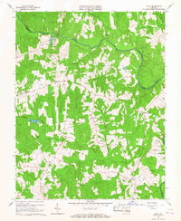
 1964 Fine Creek Mills1966 Print · USGSThe James River corridor in the mid-sixties reveals a rural landscape of family cemeteries and riverside industry. Genealogists and researchers can locate Old Powhatan Ch, the Watkins Cem, and the historic community at Fine Creek Mills.4 unique versions available
 - 1966 Map of Chula, 1967 Print
 1966 Chula1967 Print · USGSAmelia and Powhatan counties appear in the mid-sixties as a landscape of rural crossroads and riverfront farms. Genealogists and historians can trace family locations near Chula, Fieldstown, and numerous country churches including Grub Hill Ch and Mattoax Ch.3 unique versions available
Showing maps 1-25 of 46
Top cities of Powhatan County
Frequently asked questions
- What are the different types of historical maps available for Powhatan County?
- What is the oldest map of Powhatan County?
- Where can I purchase historical maps of Powhatan County for my home or office?
- Where can I download high-res historical maps of Powhatan County?
- Are there historical topographic maps available for Powhatan County?
- Is there historical aerial imagery available for Powhatan County?
- Where are historical maps of Powhatan County sourced from?