2020s Maps of Prince Edward County, Virginia
Explore 15 historic maps of Prince Edward County from the 2020s. These maps offer a rare glimpse into what life looked like during the 2020s — showing old roads, neighborhoods, homes, and landmarks that have changed or disappeared over time.
Whether you're researching your family's past, planning a metal detecting trip, or studying how Prince Edward County's landscape evolved across the 2020s, these high-resolution maps are a powerful tool for exploring the history of this region.
- Focus on a specific era: All maps on this page are from the 2020s, giving you a focused view of this time period.
- See what’s changed: Compare century-old streets, trails, and buildings to today's modern landscape using overlays and satellite layers.
- Research with precision: Use these maps for genealogy, historical research, land use analysis, or educational projects.
- View, download, or print: Maps are fully viewable online in high resolution, and can be downloaded or printed for your own records.
Start exploring Prince Edward County's history through authentic maps from the 2020s. This is your window into the past.
Prince Edward County, VA maps
(15)- 2022 Map of Meherrin, 2022 Print
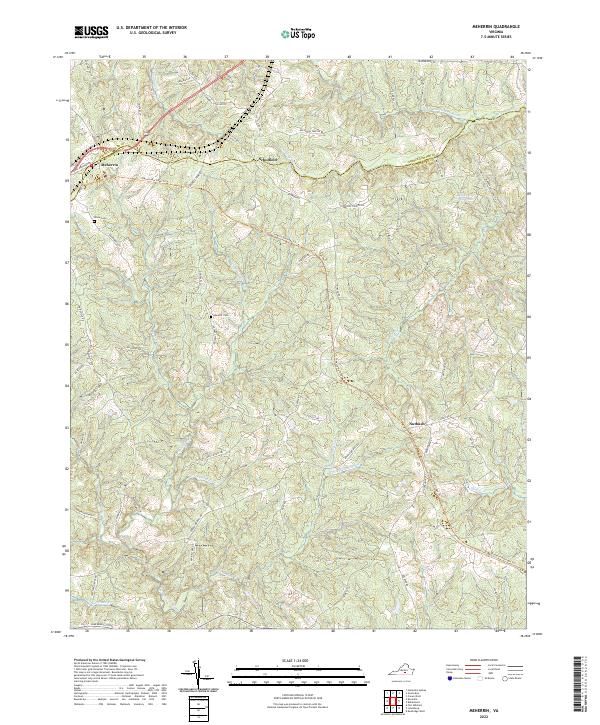 2022 Meherrin2022 Print · USGSMeherrin and the surrounding Lunenburg County countryside are documented here in the early twenty-first century as historic rail routes transition to recreation. Genealogists and local historians can locate Bruce Cem, Nutbush, and the headwaters of the N Meherrin River.
 - 2022 Map of Pamplin, 2022 Print
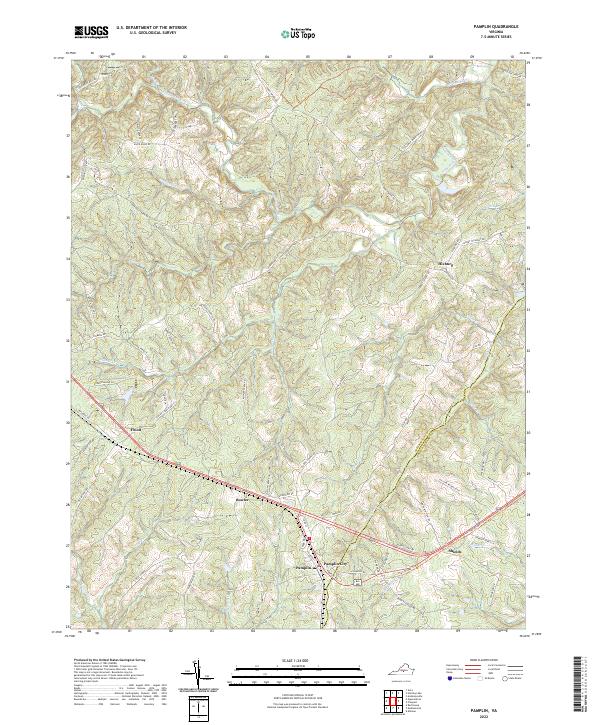 2022 Pamplin2022 Print · USGSThe rural border of Appomattox and Prince Edward Counties comes into focus during the early twenty-first century, centered on the historic crossroads of Pamplin City. Researchers can trace the drainage of the Appomattox River and locate local landmarks such as High Bridge Trl, Hixburg, and the Old Grist Mill Rd.
 - 2022 Map of Deatonville, 2022 Print
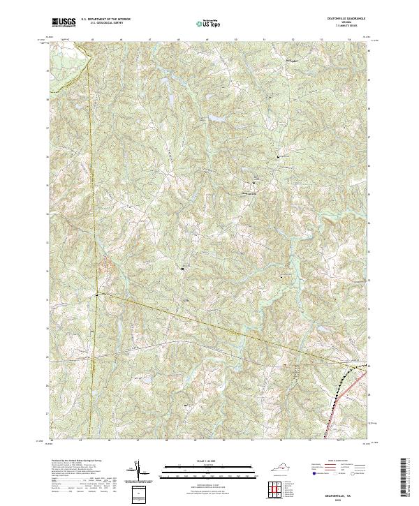 2022 Deatonville2022 Print · USGSThe Amelia County countryside near Deatonville is captured here in the early twenty-first century, showing a landscape of deep-rooted settlements and family lands. Genealogists can trace rural history through numerous sites like Bethel Cem, Gills, and Southall Cem.
 - 2022 Map of Rubermont, 2022 Print
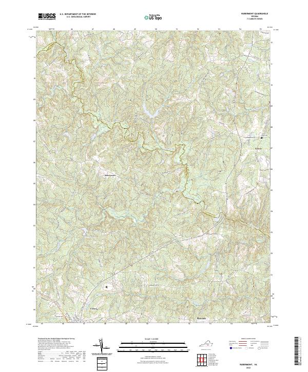 2022 Rubermont2022 Print · USGSLunenburg and Nottoway counties are shown here in the contemporary era, centered on the winding Nottoway River. Researchers can trace local landmarks like Saint Marks Cem and the historic path of Lewiston Plank Rd near the town of Victoria.
 - 2022 Map of Madisonville, 2022 Print
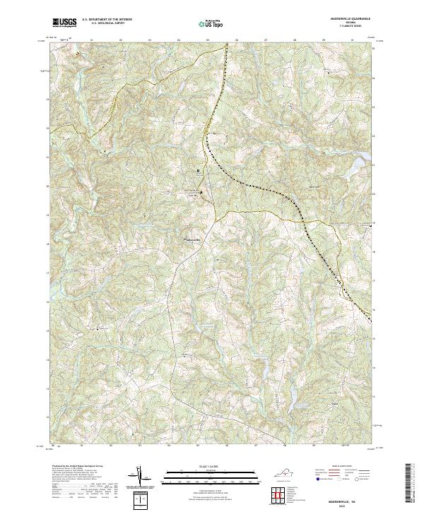 2022 Madisonville2022 Print · USGSMadisonville and the rural landscapes of Charlotte County are shown here in the early twenty-first century. Researchers can trace family roots at Salem Cem, visit the Mount-Lyle Baptist Church, or explore the terrain surrounding Lyle Mtn and Baker Mtn.
 - 2022 Map of Andersonville, 2022 Print
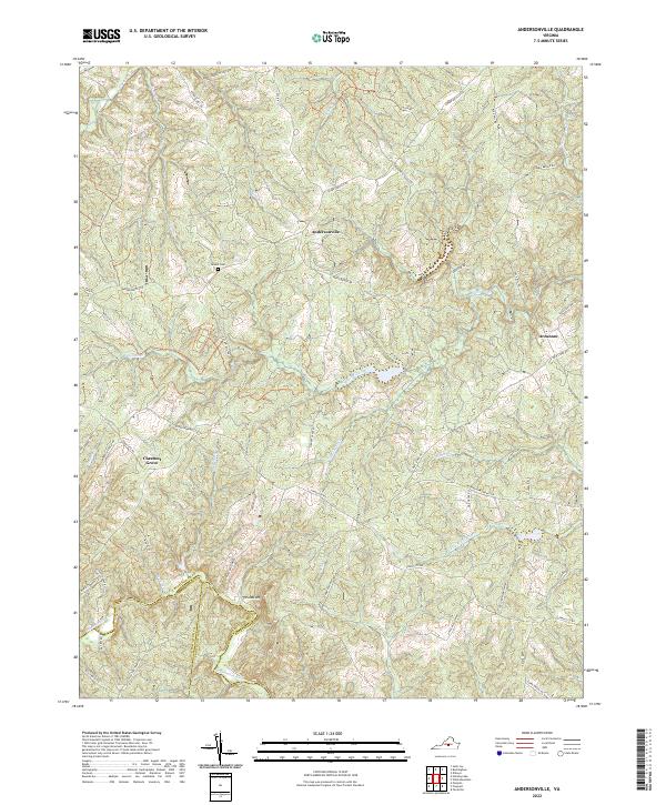 2022 Andersonville2022 Print · USGSBuckingham County and its neighbors are mapped here in the early twenty-first century, showing a landscape shaped by the headwaters of the Willis River. You can trace the ancestral roads of Andersonville and Chestnut Grove, locating landmarks like Bethel Cem and Woods Mtn.
 - 2022 Map of Crewe West, 2022 Print
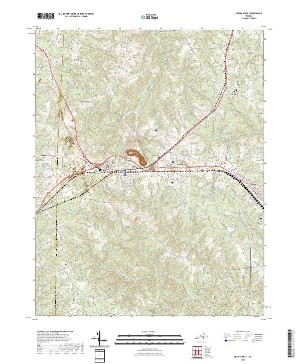 2022 Crewe West2022 Print · USGSNottoway County’s transition from railroad crossroads to modern rural community is captured here in the early twenty-first century. Genealogists and historians can locate numerous family burial sites like Wards Chapel Cem and Olive Branch Cem near the junction of Burkeville.
 - 2022 Map of Abilene, 2022 Print
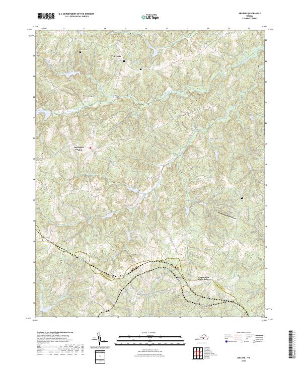 2022 Abilene2022 Print · USGSThe rural Piedmont landscape of Prince Edward and Charlotte counties comes to life in this recent survey. Researchers can trace local heritage through numerous family and church burial sites like Bethpeor Cem and settlements at Abilene and Five Forks.
 - 2022 Map of Prospect, 2022 Print
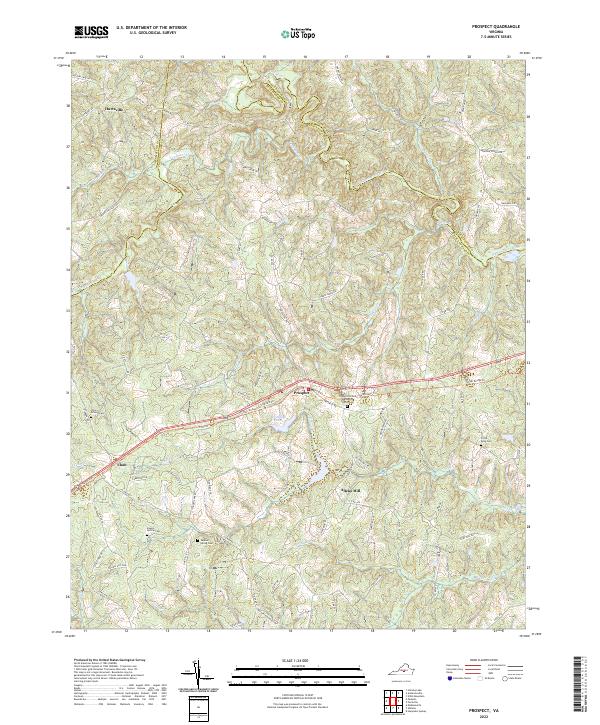 2022 Prospect2022 Print · USGSThe crossroads of Prince Edward and Buckingham counties come into focus in the early twenty-first century, centered on the historic High Bridge Trl. Researchers can trace old family roots at Sulphur Spring Cem, find the site of Allens Mill, or follow the winding Appomattox River.
 - 2022 Map of Green Bay, 2022 Print
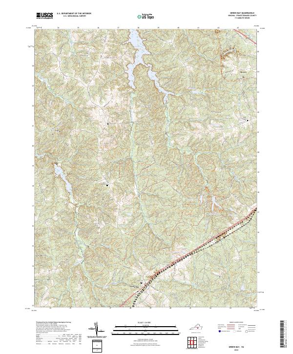 2022 Green Bay2022 Print · USGSThe rural crossroads of Prince Edward County are captured here in the early twenty-first century, showing a landscape shaped by creek valleys and quiet woodlots. Genealogists can locate several local burial sites like Sharon Cem and Liberty Cem near the banks of Hicks Lake and the Sandy River.
 - 2022 Map of Rice, 2022 Print
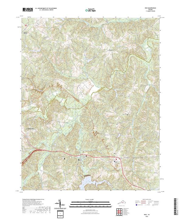 2022 Rice2022 Print · USGSPrince Edward and Cumberland counties come into focus in this contemporary survey of the Virginia Piedmont. Genealogists and local historians can trace family locations near Rice, Raines Tavern, and the Bethel Grove Cem along the Appomattox River.
 - 2022 Map of Keysville, 2022 Print
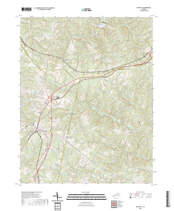 2022 Keysville2022 Print · USGSThe town of Keysville and the Southside Virginia Community College - John H Daniel Campus anchor this modern survey of the Virginia Piedmont. Genealogists can trace family landmarks at Ash Camp Memorial Cem and Mount Ellis Cem while following the Tobacco Heritage Trl.
 - 2022 Map of Hampden Sydney, 2022 Print
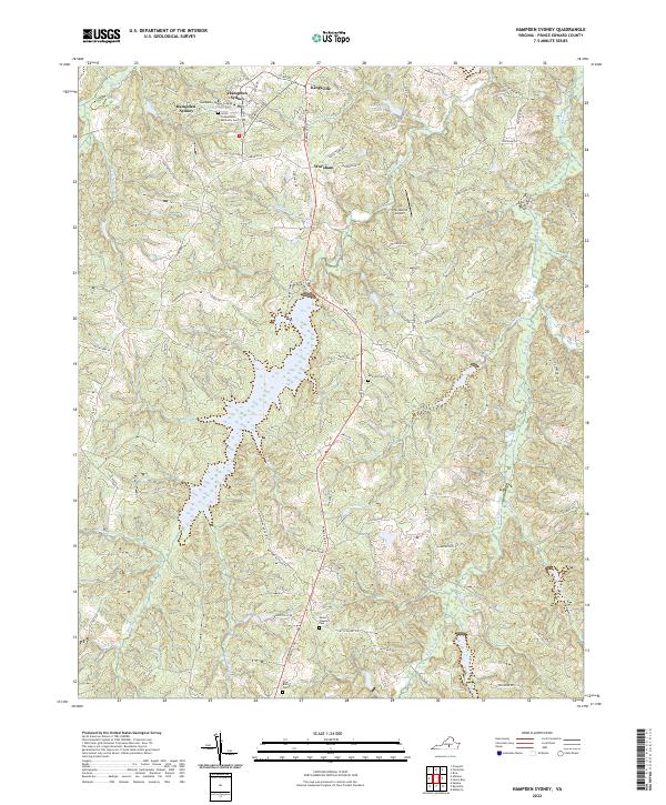 2022 Hampden Sydney2022 Print · USGSPrince Edward County, Virginia, is shown here in the early 2020s, centered on the campus of Hampden-Sydney College. Genealogists and historians can trace local landmarks like the Union Presbyterian Seminary Cem, Worsham, and the shores of Briery Lake.
 - 2022 Map of Eureka, 2022 Print
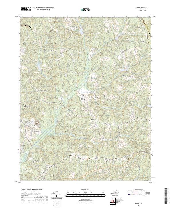 2022 Eureka2022 Print · USGSCharlotte County’s rolling landscape is shown here in the early twenty-first century, centered on the historic seat and the small village of Eureka. Researchers can trace family-named roads and landmarks like Gethsemane Church Ave, Eureka Airport, and the Tobacco Heritage Trl.
 - 2022 Map of Farmville, 2022 Print
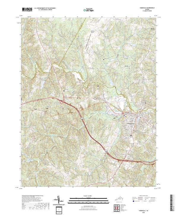 2022 Farmville2022 Print · USGSFarmville and its surrounding countryside are captured here in the early 2020s, highlighting the area's transition from a rail-hub to a modern university town. Researchers can trace local heritage at the Confederate Cemetery or follow the High Bridge Trail past the Appomattox River.
End of results
Showing maps 1-15 of 15
Top cities of Prince Edward County
Frequently asked questions
- What are the different types of historical maps available for Prince Edward County?
- What is the oldest map of Prince Edward County?
- Where can I purchase historical maps of Prince Edward County for my home or office?
- Where can I download high-res historical maps of Prince Edward County?
- Are there historical topographic maps available for Prince Edward County?
- Is there historical aerial imagery available for Prince Edward County?
- Where are historical maps of Prince Edward County sourced from?