Old Maps of Prince Edward County, Virginia for Genealogy
Trace your family roots with 44 historic maps of Prince Edward County. These high-res maps reveal old neighborhoods, homesites, landmarks, and streets — helping you uncover where your ancestors lived and how the area evolved over time.
- Explore historic neighborhoods: Identify where your relatives may have lived in the 1800s or 1900s.
- Compare maps over time: Trace the changes in streets, buildings, and landmarks for multi-generational research.
- Perfect for genealogy & ancestry research: Used by family historians and researchers to map out lineage and migration.
These maps are an incredible resource for exploring your personal connection to Prince Edward County's past.
Prince Edward County, VA maps
(44)- 1891 Map of Farmville
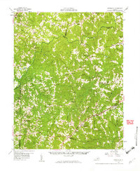
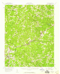
 1891 Farmville1891 Print · USGSSouth-central Virginia's rail and river networks come alive in the 1890s, centered on the bustling hub of Farmville. Genealogists can trace family roots through old courthouse seats like Cumberland C.H. and vanished stops like Jennings Ordinary or Rice Depot.
 - 1892 Map of Appomattox
 1892 Appomattox1892 Print · USGSCentral Virginia in the 1890s appears as a landscape of small agricultural hubs and vital river crossings. Genealogists can trace family names and landmarks like Morris Church, the Grave of Patrick Henry, and crossings such as Beazleys Ford.6 unique versions available
 - 1893 Map of Farmville
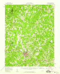
 1893 Farmville1893 Print · USGSThe Virginia Piedmont at the end of the nineteenth century centers on the rail junction at Farmville and the winding Appomattox River. Genealogists can trace family lands near Hampden Sidney, Guinea Mills, and the old tavern site at Joppings Ordinary.8 unique versions available
 - 1947 Map of Roanoke, 1948 Print
 1947 Roanoke1948 Print · USGSCentral Virginia in the late 1940s reveals a region defined by its great mountain ridges and the powerful river-and-rail economy connecting Roanoke to Lynchburg. Researchers can trace the path of the Virginian RR and locate historic county seats like Charlotte Court House.2 unique versions available
 - 1956 Map of Charlotte Court House, 1957 Print
 1956 Charlotte Court House1957 Print · USGSCharlotte County in the mid-fifties is captured here as a landscape of crossroads settlements and historic rail lines. Researchers can trace the layout of Charlotte Court House, locate the VPI Experimental Farm, and find rural landmarks like Wards Fork Mill.2 unique versions available
 - 1958 Map of Farmville, 1959 Print
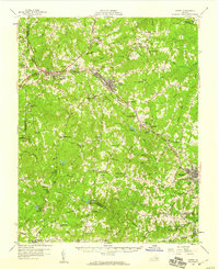
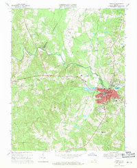
 1958 Farmville1959 Print · USGSThe town of Farmville and its surrounding river counties are captured here in the late fifties. Researchers can trace the layout of Longwood College, locate rural landmarks like High Bridge, and identify numerous country schools such as Moton Sch.2 unique versions available
 - 1958 Map of Jetersville, 1959 Print
 1958 Jetersville1959 Print · USGSAmelia and Cumberland counties in the late 1950s show a landscape of traditional mills and rail-side settlements along the Appomattox River. Genealogists can trace family connections at Clarke Cem or study community hubs like Paineveille Sch and Hobsons Chapel.2 unique versions available
 - 1958 Map of Crewe, 1959 Print
 1958 Crewe1959 Print · USGSNottoway County thrived as a railroad crossroads in the late fifties, centered on the busy rail hubs of Crewe and Burkeville. Researchers can trace old family sites and rural landmarks like the Piedmont Sanatorium, Jennings Ordinary, and Wards Chapel.2 unique versions available
 - 1958 Map of Keysville, 1959 Print
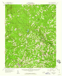
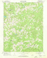
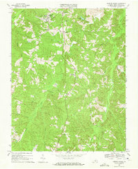
 1958 Keysville1959 Print · USGSIn the late fifties, the Southside Virginia landscape around Keysville was a busy crossroads of the Southern and Virginian railroads. Genealogists and historians can trace old community life through Hampden Sydney College, local landmarks like Arvins Store, and numerous rural sanctuaries including Briery Ch.
 - 1958 Map of Pamplin City, 1960 Print
 1958 Pamplin City1960 Print · USGSThe Virginia Piedmont in the late fifties is captured here through its network of forest reserves and small rail-side communities. Trace local family history through numerous landmarks like Pamplin City, Peaks Sch, and the Colonial Trail.
 - 1959 Map of Roanoke
 1959 Roanoke1959 Print · USGSCentral Virginia and the Blue Ridge appear in great detail during the late fifties, showcasing the transition from mountain industry to Piedmont farmland. Trace the path of the Norfolk and Western railroad or find old river towns like Appomattox and Amelia Court House.
 - 1963 Map of Roanoke
 1963 Roanoke1963 Print · USGSCentral Virginia and the Blue Ridge front appear here in the early sixties, caught between their deep railroad roots and new postwar developments. Genealogists and historians can trace the rail lines of the Norfolk and Western through towns like Bedford and Altavista, or locate family landmarks near Smith Mountain Lake.
 - 1967 Map of Andersonville, 1971 Print
 1967 Andersonville1971 Print · USGSBuckingham County's wooded hills and headwaters are captured in the late sixties as state and experimental forests began to dominate the local landscape. Genealogists and historians can trace rural family sites near Andersonville, New Store, and Second Liberty Ch.3 unique versions available
 - 1967 Map of Prospect, 1972 Print
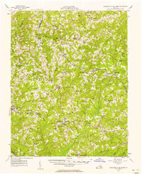
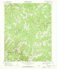
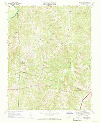
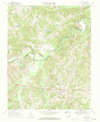
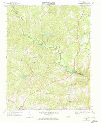
 1967 Prospect1972 Print · USGSThe rural landscape of Prince Edward County is captured here in the late sixties as the NORFOLK AND WESTERN railroad linked communities like Prospect and Elam. Genealogists and local historians can locate several country churches, including St Pauls Ch, alongside river landmarks like Beazley Ford.3 unique versions available
 - 1968 Map of Farmville, 1971 Print
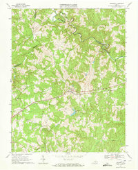
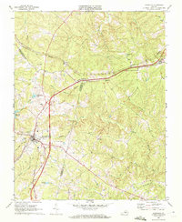
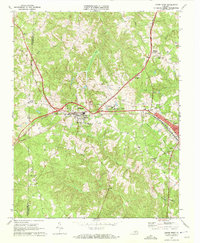
 1968 Farmville1971 Print · USGSFarmville and the surrounding Piedmont countryside are captured here during the late sixties, showing a town defined by education and the railroad. Researchers can trace the grounds of Longwood College, locate the old Raines Tavern, or find family names at Westview Cemetery and Sharon Ch.4 unique versions available
 - 1968 Map of Deatonville, 1971 Print
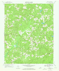
 1968 Deatonville1971 Print · USGSAmelia and Prince Edward counties are captured here in the late sixties, showing a landscape defined by the Appomattox River. You can trace the grounds of Saylers Creek Battlefield State Park and locate historic community centers like Deatonville and Gravel Hill Ch.2 unique versions available
 - 1968 Map of Eureka, 1971 Print
 1968 Eureka1971 Print · USGSCharlotte County’s rural landscape is captured in the late sixties, showing a period of quiet continuity between the historic county seat and the rail lines. Genealogists can locate family sites like Greenfield Plantation or trace church histories at St Michaels Ch and St Douglas Ch.3 unique versions available
 - 1968 Map of Abilene, 1971 Print
 1968 Abilene1971 Print · USGSThe border of Prince Edward and Charlotte Counties is captured here in the late sixties, showing a landscape of small rail-side hamlets and rural churches. Genealogists and historians can trace local roots at Bethpeor Ch, Abilene, and St Ann Cem.3 unique versions available
 - 1968 Map of Rice, 1971 Print
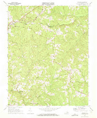
 1968 Rice1971 Print · USGSPrince Edward and Cumberland counties are shown here in the late sixties, a landscape shaped by the Appomattox River and the railroad. Genealogists can trace rural communities through local landmarks like Raines Tavern, Old Green Creek Ch, and the iconic High Bridge.4 unique versions available
 - 1968 Map of Meherrin, 1972 Print
 1968 Meherrin1972 Print · USGSThe borderlands of Lunenburg and Prince Edward counties are captured here in the late sixties, where the Norfolk and Western railroad meets the Southern line at Meherrin. Researchers can trace rural community foundations through Aryins Store, Springfield Ch, and the crossroads at Double Bridges.2 unique versions available
 - 1968 Map of Keysville, 1972 Print
 1968 Keysville1972 Print · USGSKeysville sat at a bustling railway crossroads in the late sixties, where the Southern and Norfolk and Western lines converged. Genealogists and local historians can trace the rural landscape through landmarks like Ash Camp Ch, Simplicity, and the old Drive-in Theatre.3 unique versions available
 - 1968 Map of Madisonville, 1972 Print
 1968 Madisonville1972 Print · USGSMadisonville and the surrounding Virginia countryside appear in detail during the late sixties, showing a landscape of small rural settlements and parish churches. Genealogists can trace family connections at Vincent Corner, locate landmarks like Wards Fork Mill, and follow the Norfolk and Western line to Maloney Siding.2 unique versions available
 - 1968 Map of Rubermont, 1972 Print
 1968 Rubermont1972 Print · USGSLunenburg and Nottoway counties are documented here in the late sixties, showing a rural Virginia landscape shaped by the Nottoway River. Researchers can trace family history through numerous landmarks like Jeffress Store, Mt Olive Ch, and the Norfolk and Western rail corridor.2 unique versions available
 - 1968 Map of Crewe West, 1972 Print
 1968 Crewe West1972 Print · USGSNottoway County’s rail-driven landscape comes into focus during the late sixties as the lines of the Southern and Norfolk and Western cross at Burkeville. Genealogists and historians can locate rural landmarks such as Burkes Tavern, Jennings Ordinary, and First Nottoway Ch.3 unique versions available
 - 1968 Map of Hampden Sydney, 1972 Print
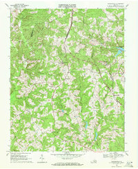
 1968 Hampden Sydney1972 Print · USGSPrince Edward County during the late sixties shows a landscape defined by collegiate tradition and small Piedmont crossroads. Researchers can trace the grounds of Hampden-Sydney College or locate rural landmarks like Redd Shop and Mercy Seat Ch.3 unique versions available
Showing maps 1-25 of 44
Top cities of Prince Edward County
Frequently asked questions
- What are the different types of historical maps available for Prince Edward County?
- What is the oldest map of Prince Edward County?
- Where can I purchase historical maps of Prince Edward County for my home or office?
- Where can I download high-res historical maps of Prince Edward County?
- Are there historical topographic maps available for Prince Edward County?
- Is there historical aerial imagery available for Prince Edward County?
- Where are historical maps of Prince Edward County sourced from?