1900s (20th Century) Maps of Loch Haven, Virginia
Explore 9 historic maps of Loch Haven from the 1900s (20th Century). These maps offer a rare glimpse into what life looked like during the 1900s — showing old roads, neighborhoods, homes, and landmarks that have changed or disappeared over time.
Whether you're researching your family's past, planning a metal detecting trip, or studying how Loch Haven's landscape evolved across the 1900s, these high-resolution maps are a powerful tool for exploring the history of this region.
- Focus on a specific era: All maps on this page are from the 1900s, giving you a focused view of this time period.
- See what’s changed: Compare century-old streets, trails, and buildings to today's modern landscape using overlays and satellite layers.
- Research with precision: Use these maps for genealogy, historical research, land use analysis, or educational projects.
- View, download, or print: Maps are fully viewable online in high resolution, and can be downloaded or printed for your own records.
Start exploring Loch Haven's history through authentic maps from the 1900s. This is your window into the past.
Loch Haven, VA maps
(9)- 1929 Map of Salem
 1929 Salem1929 Print · USGSThe Roanoke River valley and surrounding mountain ridges are captured here in the late 1920s as the railroad and highway networks expanded. Genealogists and researchers can trace local landmarks like Catawba Sanatorium, Webb Mill, and old schoolhouses including Rubles Sch.2 unique versions available
 - 1932 Map of Salem
 1932 Salem1932 Print · USGSThe Roanoke Valley and the high ridges of the Blue Ridge meet in this early 1930s survey of the Salem area. Genealogists can locate family landmarks like Webbs Mill, the Catawba Sanatorium, and numerous rural churches including New Hope Church.3 unique versions available
 - 1955 Map of Bluefield
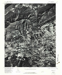
 1955 Bluefield1955 Print · USGSThe Central Appalachian borderlands come alive in the mid-fifties, showing the coal and rail networks connecting Bluefield to Beckley. Researchers can trace the industrial landscape of the New River Ordnance Plant and the terrain of Burkes Garden.
 - 1957 Map of Bluefield, 1967 Print
 1957 Bluefield1967 Print · USGSThe heart of Central Appalachia in the mid-fifties is defined by the winding rail lines and river valleys of the coalfields. Researchers can trace the industrial footprints of towns like Welch and Princeton or locate landmarks such as the Bluestone Reservoir and Claytor Lake.2 unique versions available
 - 1961 Map of Bluefield
 1961 Bluefield1961 Print · USGSThe coalfields and mountain ridges of southern West Virginia and southwest Virginia are captured in the early sixties. Genealogists can trace family ties through rail-linked towns like Princeton and Richlands or along the shores of Bluestone Reservoir.
 - 1963 Map of Salem, 1965 Print
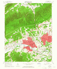 1963 Salem1965 Print · USGSSalem and the western edge of Roanoke are captured here in the early sixties, showing a period of significant suburban and industrial growth. Researchers can locate long-standing institutions like Roanoke College, the grounds of Lakeside Amusement Park, and the Veterans Administration Hospital.4 unique versions available
 - 1977 Map of Salem, 1983 Print
 1977 Salem1983 Print · USGSThe Roanoke Valley in the late seventies reveals a landscape of rapid suburban growth nestled against the Appalachian ridges. Trace the development of Salem and Beverly Heights along the Roanoke River or the rural reaches of Mason Cove.
 - 1982 Map of Radford, 1983 Print
 1982 Radford1983 Print · USGSThe New River Valley and surrounding highlands are shown during a period of significant regional growth in the early eighties. Genealogists and historians can trace the development of VPI, locate historic sites like Yellow Sulphur Springs, and follow the Norfolk and Western rail lines through the gaps.2 unique versions available
 - 1994 Map of Salem, 1999 Print
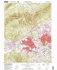 1994 Salem1999 Print · USGSSalem and the Roanoke River valley are shown in the 1990s as suburban expansion reaches the foot of the Blue Ridge. Trace family history and local landmarks like Roanoke College, the Veterans Administration Hospital, and Sherwood Burial Park.
End of results
Showing maps 1-9 of 9
Top cities near Loch Haven
- Roanoke historical maps
- Salem historical maps
- Cave Spring historical maps
- Hollins historical maps
- Vinton historical maps
- Cloverdale historical maps
See more
Frequently asked questions
- What are the different types of historical maps available for Loch Haven?
- What is the oldest map of Loch Haven?
- Where can I purchase historical maps of Loch Haven for my home or office?
- Where can I download high-res historical maps of Loch Haven?
- Are there historical topographic maps available for Loch Haven?
- Is there historical aerial imagery available for Loch Haven?
- Where are historical maps of Loch Haven sourced from?