2020s Maps of Manry, Virginia
Explore 1 historic maps of Manry from the 2020s. These maps offer a rare glimpse into what life looked like during the 2020s — showing old roads, neighborhoods, homes, and landmarks that have changed or disappeared over time.
Whether you're researching your family's past, planning a metal detecting trip, or studying how Manry's landscape evolved across the 2020s, these high-resolution maps are a powerful tool for exploring the history of this region.
- Focus on a specific era: All maps on this page are from the 2020s, giving you a focused view of this time period.
- See what’s changed: Compare century-old streets, trails, and buildings to today's modern landscape using overlays and satellite layers.
- Research with precision: Use these maps for genealogy, historical research, land use analysis, or educational projects.
- View, download, or print: Maps are fully viewable online in high resolution, and can be downloaded or printed for your own records.
Start exploring Manry's history through authentic maps from the 2020s. This is your window into the past.
Manry, VA maps
(1)- 2022 Map of Manry, 2022 Print
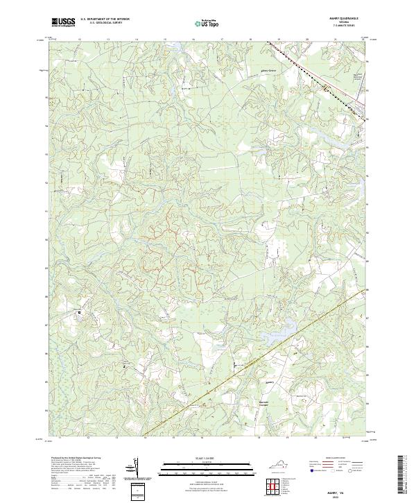 2022 Manry2022 Print · USGSSussex and Southampton counties are mapped here in the early 2020s, revealing a landscape shaped by vast swamp networks and rural outposts. Researchers can trace family history at Union Hill Cem or locate old water-industry sites like Laniers Millpond and Brittles Mill Pond.
End of results
Showing maps 1-1 of 1
Top cities near Manry
- Franklin historical maps
- Waverly historical maps
- Courtland historical maps
- Wakefield historical maps
- Camptown historical maps
- Sedley historical maps
See more
Frequently asked questions
- What are the different types of historical maps available for Manry?
- What is the oldest map of Manry?
- Where can I purchase historical maps of Manry for my home or office?
- Where can I download high-res historical maps of Manry?
- Are there historical topographic maps available for Manry?
- Is there historical aerial imagery available for Manry?
- Where are historical maps of Manry sourced from?