1940s Maps of Brooke, Virginia
Explore 3 historic maps of Brooke from the 1940s. These maps offer a rare glimpse into what life looked like during the 1940s — showing old roads, neighborhoods, homes, and landmarks that have changed or disappeared over time.
Whether you're researching your family's past, planning a metal detecting trip, or studying how Brooke's landscape evolved across the 1940s, these high-resolution maps are a powerful tool for exploring the history of this region.
- Focus on a specific era: All maps on this page are from the 1940s, giving you a focused view of this time period.
- See what’s changed: Compare century-old streets, trails, and buildings to today's modern landscape using overlays and satellite layers.
- Research with precision: Use these maps for genealogy, historical research, land use analysis, or educational projects.
- View, download, or print: Maps are fully viewable online in high resolution, and can be downloaded or printed for your own records.
Start exploring Brooke's history through authentic maps from the 1940s. This is your window into the past.
Brooke, VA maps
(3)- 1944 Map of Stafford
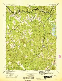 1944 Stafford1944 Print · USGSStafford and its surrounding crossroads communities appear here during the mid-forties, showing a landscape of small farms, churches, and early highway corridors. Genealogists can trace family landmarks like Sheltons Shop, Stafford Training Sch, and Aquia Ch.
 - 1946 Map of Stafford
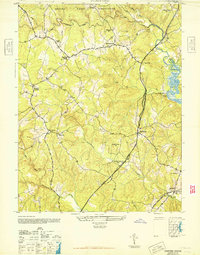 1946 Stafford1946 Print · USGSStafford County at the end of the Second World War shows a rural landscape increasingly shaped by its proximity to major transportation corridors and military grounds. Researchers can trace the local rail-and-road economy through Brooke on the Richmond Fredericksburg and Potomac and historic sites like Aquia Ch.
 - 1948 Map of Washington
 1948 Washington1948 Print · USGSThe Potomac and Chesapeake regions in the late 1940s reveal a landscape of expanding military reach and deep-rooted Tidewater settlements. Trace old rail corridors like the Richmond Fredericksburg & Potomac RR or locate landmarks like the Wakefield Washington Monument and St. Marys College.2 unique versions available
End of results
Showing maps 1-3 of 3
Top cities near Brooke
- Stafford historical maps
- Fredericksburg historical maps
- Cherry Hill historical maps
- Montclair historical maps
- Leesylvania historical maps
- Triangle historical maps
See more
Frequently asked questions
- What are the different types of historical maps available for Brooke?
- What is the oldest map of Brooke?
- Where can I purchase historical maps of Brooke for my home or office?
- Where can I download high-res historical maps of Brooke?
- Are there historical topographic maps available for Brooke?
- Is there historical aerial imagery available for Brooke?
- Where are historical maps of Brooke sourced from?