Old Maps of South Quay, Virginia for Hiking & Exploration
Hike through history with 11 historic maps of South Quay. Explore old trails, ghost towns, and forgotten backroads — perfect for outdoor adventurers and local explorers.
- Rediscover forgotten places: Map out old mining camps, roads, and footpaths that no longer exist on modern maps.
- Layer with modern tools: Combine with LiDAR or satellite views to plan hikes through historical terrain.
- Made for exploration: Popular among hikers, overlanders, and local history lovers.
Use these maps to find adventure and explore the hidden past of South Quay.
South Quay, VA maps
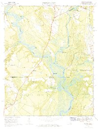
(11)- 1920 Map of Holland
 1920 Holland1920 Print · USGSCoastal plain life at the end of the Great War centers on the river-and-rail hubs of Franklin and Holland. Genealogists can trace family footprints across dozens of country schools like Holmes School and river crossings such as Joyners Bridge and Manning Ferry.2 unique versions available
 - 1943 Map of Holland
 1943 Holland1943 Print · USGSThe Virginia and North Carolina borderlands come alive in this mid-century survey of the Chowan River basin. Local historians can trace a network of river landings and rural schools, from Manning Ferry to the community around Stony Branch Church.
 - 1953 Map of Norfolk, 1954 Print
 1953 Norfolk1954 Print · USGSCoastal Virginia and northeastern North Carolina appear here during the post-war industrial boom, showing the critical rail-and-sea connections of Hampton Roads. Genealogists can trace family roots through rural landmarks like Gethsemane Ch, the Caledonia State Prison Farm, and the vast interior of the Dismal Swamp.4 unique versions available
 - 1957 Map of Holland, 1958 Print
 1957 Holland1958 Print · USGSThe Virginia and North Carolina borderlands come into focus in the mid-fifties, centered on the river city of Franklin and the agricultural community of Holland. Researchers can trace early river crossings like Manning Ferry (Site) and find family roots at Oberry Sch Cem or St Matthews Ch.
 - 1967 Map of Riverdale, 1970 Print
 1967 Riverdale1970 Print · USGSThe convergence of the Blackwater and Nottoway Rivers at the Virginia-North Carolina border defines this late-1960s landscape. Researchers can trace the legacy of river commerce and local genealogy through numerous sites like Cobbs Wharf, Riddicksville, and Diamond Grove Ch.3 unique versions available
 - 1985 Map of Norfolk, 1986 Print
 1985 Norfolk1986 Print · USGSThe Tidewater region in the mid-eighties shows the dense urban expansion of the coastal cities alongside the preservation of the Great Dismal Swamp. Researchers can trace rural family-named crossroads and historic transit routes like the Seaboard Coast Line or find Somerton and Lake Drummond.3 unique versions available
 - 2010 Map of Riverdale, 2010 Print
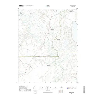
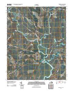 2010 Riverdale2010 Print · USGSCovers South Quay, including Como, Cherry Grove, and other nearby areas
 - 2013 Map of Riverdale, 2013 Print
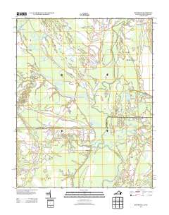 2013 Riverdale2013 Print · USGSCovers South Quay, including Como, Cherry Grove, and other nearby areas
 - 2016 Map of Riverdale, 2016 Print
 2016 Riverdale2016 Print · USGSCovers South Quay, including Como, Cherry Grove, and other nearby areas
 - 2019 Map of Riverdale, 2019 Print
 2019 Riverdale2019 Print · USGSCovers South Quay, including Como, Cherry Grove, and other nearby areas
 - 2022 Map of Riverdale, 2022 Print
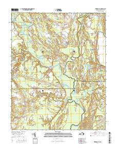
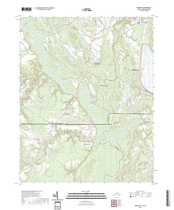 2022 Riverdale2022 Print · USGSThe Virginia-North Carolina border comes alive in this 2022 survey, showcasing the confluence of the Nottoway River and Blackwater River. Genealogists can trace family locations across the state line near Riddicksville, South Quay, and the river crossing at Riverdale.
End of results
Showing maps 1-11 of 11
Top cities near South Quay
- Franklin historical maps
- Murfreesboro historical maps
- Windsor historical maps
- Courtland historical maps
- Winton historical maps
- Camptown historical maps
See more
Frequently asked questions
- What are the different types of historical maps available for South Quay?
- What is the oldest map of South Quay?
- Where can I purchase historical maps of South Quay for my home or office?
- Where can I download high-res historical maps of South Quay?
- Are there historical topographic maps available for South Quay?
- Is there historical aerial imagery available for South Quay?
- Where are historical maps of South Quay sourced from?