2020s Maps of Drowning Ford, Virginia
Explore 1 historic maps of Drowning Ford from the 2020s. These maps offer a rare glimpse into what life looked like during the 2020s — showing old roads, neighborhoods, homes, and landmarks that have changed or disappeared over time.
Whether you're researching your family's past, planning a metal detecting trip, or studying how Drowning Ford's landscape evolved across the 2020s, these high-resolution maps are a powerful tool for exploring the history of this region.
- Focus on a specific era: All maps on this page are from the 2020s, giving you a focused view of this time period.
- See what’s changed: Compare century-old streets, trails, and buildings to today's modern landscape using overlays and satellite layers.
- Research with precision: Use these maps for genealogy, historical research, land use analysis, or educational projects.
- View, download, or print: Maps are fully viewable online in high resolution, and can be downloaded or printed for your own records.
Start exploring Drowning Ford's history through authentic maps from the 2020s. This is your window into the past.
Drowning Ford, VA maps
(1)- 2022 Map of Damascus, 2022 Print
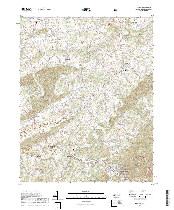 2022 Damascus2022 Print · USGSDamascus and the surrounding hollows of Washington County are shown here in the 2020s as they border the National Forest. Researchers can trace ancestral lands near Drowning Ford, locate family plots at Mount Olivet Church Cem, or find old milling sites like Mock Mill.
End of results
Showing maps 1-1 of 1
Top cities near Drowning Ford
- Abingdon historical maps
- Mountain City historical maps
- Saltville historical maps
- Chilhowie historical maps
- Glade Spring historical maps
- Emory historical maps
See more
Frequently asked questions
- What are the different types of historical maps available for Drowning Ford?
- What is the oldest map of Drowning Ford?
- Where can I purchase historical maps of Drowning Ford for my home or office?
- Where can I download high-res historical maps of Drowning Ford?
- Are there historical topographic maps available for Drowning Ford?
- Is there historical aerial imagery available for Drowning Ford?
- Where are historical maps of Drowning Ford sourced from?