2020s Maps of Williamsburg, Virginia
Explore 2 historic maps of Williamsburg from the 2020s. These maps offer a rare glimpse into what life looked like during the 2020s — showing old roads, neighborhoods, homes, and landmarks that have changed or disappeared over time.
Whether you're researching your family's past, planning a metal detecting trip, or studying how Williamsburg's landscape evolved across the 2020s, these high-resolution maps are a powerful tool for exploring the history of this region.
- Focus on a specific era: All maps on this page are from the 2020s, giving you a focused view of this time period.
- See what’s changed: Compare century-old streets, trails, and buildings to today's modern landscape using overlays and satellite layers.
- Research with precision: Use these maps for genealogy, historical research, land use analysis, or educational projects.
- View, download, or print: Maps are fully viewable online in high resolution, and can be downloaded or printed for your own records.
Start exploring Williamsburg's history through authentic maps from the 2020s. This is your window into the past.
Williamsburg, VA maps
(2)- 2022 Map of Williamsburg, 2022 Print
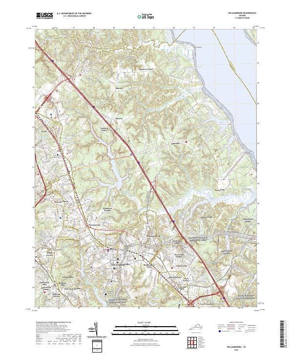 2022 Williamsburg2022 Print · USGSThe historic heart of WILLIAMSBURG and the College of William and Mary are documented here in the early 2020s. Genealogists and historians can locate the Galt Family Cem, Eastern State Hospital Cem, and military sites like CHEATHAM ANNEX.
 - 2022 Map of Hog Island, 2022 Print
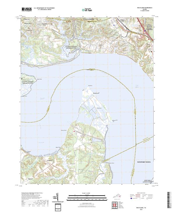 2022 Hog Island2022 Print · USGSThe James River and the marshes of Hog Island dominate this coastal landscape during the early 2020s. Genealogists and historians can trace family sites at Travis Cem, locate the Little Zion Baptist Church near Grove, or explore the boundaries of Chippokes.
End of results
Showing maps 1-2 of 2
Top cities of Williamsburg
Frequently asked questions
- What are the different types of historical maps available for Williamsburg?
- What is the oldest map of Williamsburg?
- Where can I purchase historical maps of Williamsburg for my home or office?
- Where can I download high-res historical maps of Williamsburg?
- Are there historical topographic maps available for Williamsburg?
- Is there historical aerial imagery available for Williamsburg?
- Where are historical maps of Williamsburg sourced from?