Old Maps of Grahams Landing, Washington
Explore 10 old maps of Grahams Landing, spanning from 1946 to today. These high-resolution historic maps reveal how streets, neighborhoods, landmarks, and natural features evolved over time — perfect for genealogy, metal detecting, research, and local history exploration.
What you can do with these maps:
- See how Grahams Landing changed over time: Compare historical maps to modern-day views to trace roads, homesites, rail lines & more.
- View detailed metadata: Each map includes creators, publishers, year, scale, and archive source.
- Overlay maps with satellite & LiDAR: Visualize the past alongside modern tools to explore terrain & human change.
- Trusted historical sources: Maps sourced from the USGS, Library of Congress, and other archives.
- Access maps your way: View online, download high-res files, or order prints for personal or research use.
Start exploring old maps of Grahams Landing to uncover forgotten places, hidden landmarks, and the deep history beneath your feet.
Grahams Landing, WA maps
(10)- 1946 Map of Limekiln Rapids
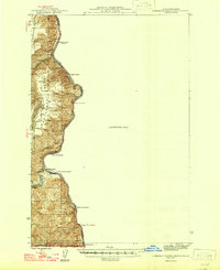 1946 Limekiln Rapids1946 Print · USGSThe Snake River canyon at the junction of Washington, Oregon, and Idaho is captured here just after the war. Local historians can trace the river economy through Rogersburg and sites like Captain John Ferry or Brahams Landing.
 - 1955 Map of Pullman, 1963 Print
 1955 Pullman1963 Print · USGSThe Palouse and Clearwater regions are captured here in the mid-1950s, showing the height of the rail-and-river economy. Genealogists and historians can trace rail lines like the Camas Prairie RR, find local landmarks like Whitman County Memorial Cem, and locate early academic centers at Washington State University and the University of Idaho.3 unique versions available
 - 1958 Map of Pullman
 1958 Pullman1958 Print · USGSThe Palouse and Clearwater regions are captured here in the late fifties, showing the vital river-and-rail connection between eastern Washington and northern Idaho. Local historians can trace the paths of the Camas Prairie RR and Union Pacific RR as they serve towns like Colfax, Kamiah, and Nezperce.2 unique versions available
 - 1968 Map of Captain John Rapids, 1971 Print
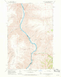 1968 Captain John Rapids1971 Print · USGSThe Snake River canyonlands come alive in this late-sixties survey of the border between Idaho and Washington. Researchers can trace the river's navigational history through Captain John Rapids, Grahams Landing, and the Captain John Ferry.2 unique versions available
 - 1981 Map of Orofino, 1982 Print
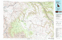 1981 Orofino1982 Print · USGSNorth central Idaho comes into focus in the early eighties, showing the deep river canyons and agricultural plateaus of the Nez Perce Indian Reservation. Genealogists and historians can trace the Camas Prairie rail line through rural hubs like Ferdinand, Mohler, and Reubens.
 - 2011 Map of Captain John Rapids, 2011 Print
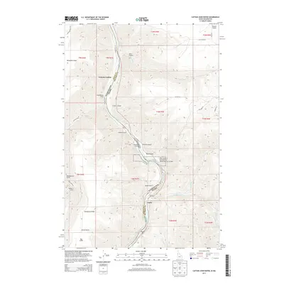
 2011 Captain John Rapids2011 Print · USGSCovers Grahams Landing, including Nez Perce County, Asotin County, and other nearby areas
 - 2013 Map of Captain John Rapids, 2013 Print
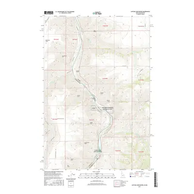
 2013 Captain John Rapids2013 Print · USGSCovers Grahams Landing, including Nez Perce County, Asotin County, and other nearby areas
 - 2017 Map of Captain John Rapids, 2017 Print
 2017 Captain John Rapids2017 Print · USGSCovers Grahams Landing, including Nez Perce County, Asotin County, and other nearby areas
 - 2020 Map of Captain John Rapids, 2020 Print
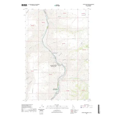 2020 Captain John Rapids2020 Print · USGSCovers Grahams Landing, including Nez Perce County, Asotin County, and other nearby areas
 - 2024 Map of Captain John Rapids, 2024 Print
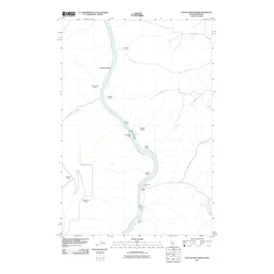
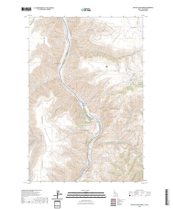 2024 Captain John Rapids2024 Print · USGSThe river border between Idaho and Washington comes alive in this contemporary map of the Snake River canyon. Researchers can trace the boundaries of the Nez Perce National Historical Park and locate landmarks like Steamboat Island and Bobcat Bar.
End of results
Showing maps 1-10 of 10
Top cities near Grahams Landing
Frequently asked questions
- What are the different types of historical maps available for Grahams Landing?
- What is the oldest map of Grahams Landing?
- Where can I purchase historical maps of Grahams Landing for my home or office?
- Where can I download high-res historical maps of Grahams Landing?
- Are there historical topographic maps available for Grahams Landing?
- Is there historical aerial imagery available for Grahams Landing?
- Where are historical maps of Grahams Landing sourced from?