2000s (21st Century) Maps of Merritt, Washington
Explore 6 historic maps of Merritt from the 2000s (21st Century). These maps offer a rare glimpse into what life looked like during the 2000s — showing old roads, neighborhoods, homes, and landmarks that have changed or disappeared over time.
Whether you're researching your family's past, planning a metal detecting trip, or studying how Merritt's landscape evolved across the 2000s, these high-resolution maps are a powerful tool for exploring the history of this region.
- Focus on a specific era: All maps on this page are from the 2000s, giving you a focused view of this time period.
- See what’s changed: Compare century-old streets, trails, and buildings to today's modern landscape using overlays and satellite layers.
- Research with precision: Use these maps for genealogy, historical research, land use analysis, or educational projects.
- View, download, or print: Maps are fully viewable online in high resolution, and can be downloaded or printed for your own records.
Start exploring Merritt's history through authentic maps from the 2000s. This is your window into the past.
Merritt, WA maps
(6)- 2004 Map of Lake Wenatchee, 2008 Print
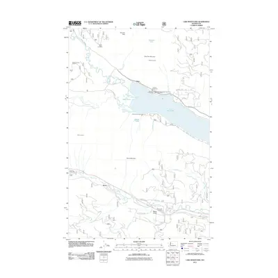
 2004 Lake Wenatchee2008 Print · USGSThe North Cascades wilderness near the turn of the millennium is centered here on the confluence of the White River and Lake Wenatchee. Researchers can trace old transport routes through Merritt or locate high-country landmarks like Alpine Lookout and Camp Zanika Lache.
 - 2011 Map of Lake Wenatchee, 2011 Print
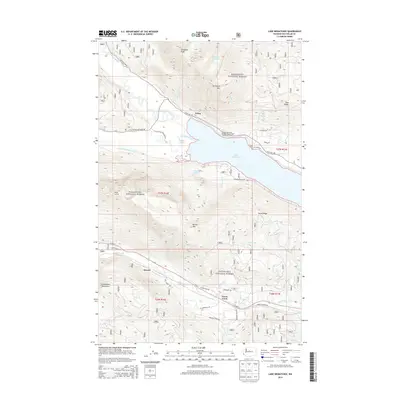
 2011 Lake Wenatchee2011 Print · USGSCovers Merritt, including Telma, Chelan County, and other nearby areas
 - 2014 Map of Lake Wenatchee, 2014 Print
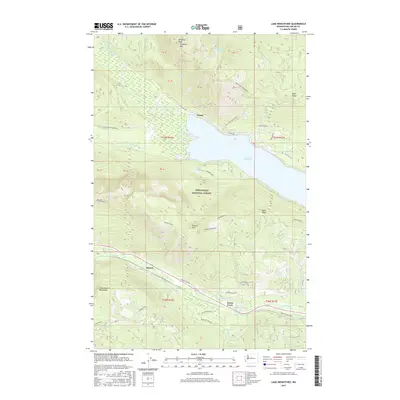
 2014 Lake Wenatchee2014 Print · USGSCovers Merritt, including Telma, Chelan County, and other nearby areas
 - 2017 Map of Lake Wenatchee, 2017 Print
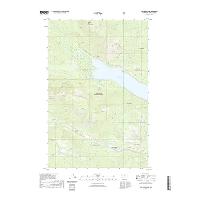
 2017 Lake Wenatchee2017 Print · USGSCovers Merritt, including Telma, Chelan County, and other nearby areas
 - 2020 Map of Lake Wenatchee, 2020 Print
 2020 Lake Wenatchee2020 Print · USGSCovers Merritt, including Telma, Chelan County, and other nearby areas
 - 2023 Map of Lake Wenatchee, 2023 Print
 2023 Lake Wenatchee2023 Print · USGSChelan County and the Wenatchee National Forest are shown in high detail in this recent survey of the North Cascades. Local historians and hikers can trace the routes between Telma and Merritt, or follow trails to Hidden Lake and Dirtyface Mtn.
End of results
Showing maps 1-6 of 6
Top cities near Merritt
Frequently asked questions
- What are the different types of historical maps available for Merritt?
- What is the oldest map of Merritt?
- Where can I purchase historical maps of Merritt for my home or office?
- Where can I download high-res historical maps of Merritt?
- Are there historical topographic maps available for Merritt?
- Is there historical aerial imagery available for Merritt?
- Where are historical maps of Merritt sourced from?