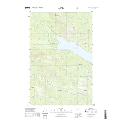
2020 Map of Lake Wenatchee
USGS Topo · Published 2020About this map
Lake Wenatchee and the surrounding peaks of the Chiwaukum Mountains dominate this 2020 landscape in the Wenatchee National Forest. The map documents a rugged section of Chelan County where the White River and Little Wenatchee River feed into the lake's western shore near the small settlement of Telma. To the south, the community of Merritt sits along the corridor formed by Nason Creek, a vital drainage that separates the high elevations of Nason Ridge from the southern peaks like Round Mtn.
Find a feature on this map
44 named features on this map. Tap any name to fly to it.
Don’t see what you’re looking for? This feature index may not catch every label — zoom into the map to look around manually.
Map Details
Editions of this 2020 Lake Wenatchee Map
This is the sole edition of this map. No revisions or reprints were ever made.
Other maps of this area

1901 · Chiwaukum
USGS Topo · 1:125,000

1904 · Chiwaukum
USGS Topo · 1:125,000

1957 · Wenatchee
USGS Topo · 1:250,000

1964 · Leavenworth
USGS Topo · 1:62,500

1965 · Chiwaukum Mts
USGS Topo · 1:62,500

1965 · Wenatchee Lake
USGS Topo · 1:62,500
1968 · Plain
USGS Topo · 1:24,000
1968 · Chikamin Creek
USGS Topo · 1:24,000
1975 · Chelan
USGS Topo · 1:100,000
1989 · Big Jim Mountain
USGS Topo · 1:24,000