Old Maps of Washougal River, Clark County for Genealogy
Trace your family roots with 27 historic maps of Washougal River. These high-res maps reveal old neighborhoods, homesites, landmarks, and streets — helping you uncover where your ancestors lived and how the area evolved over time.
- Explore historic neighborhoods: Identify where your relatives may have lived in the 1800s or 1900s.
- Compare maps over time: Trace the changes in streets, buildings, and landmarks for multi-generational research.
- Perfect for genealogy & ancestry research: Used by family historians and researchers to map out lineage and migration.
These maps are an incredible resource for exploring your personal connection to Washougal River's past.
Washougal River, Clark County maps
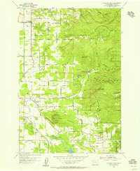
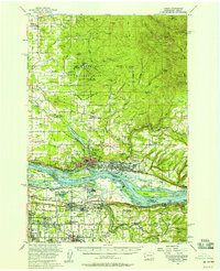
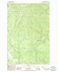
(27)- 1918 Map of Troutdale
 1918 Troutdale1918 Print · USGSCovers Washougal River, including Portland, Vancouver, and other nearby areas2 unique versions available
 - 1934 Map of Troutdale
 1934 Troutdale1934 Print · USGSCovers Washougal River, including Portland, Vancouver, and other nearby areas
 - 1941 Map of Camas
 1941 Camas1941 Print · USGSCovers Washougal River, including Portland, Vancouver, and other nearby areas
 - 1942 Map of Camas
 1942 Camas1942 Print · USGSCovers Washougal River, including Portland, Vancouver, and other nearby areas2 unique versions available
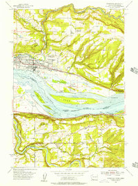
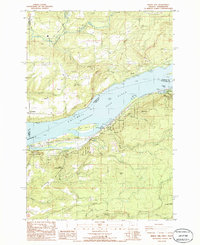
 - 1948 Map of Vancouver, 1957 Print
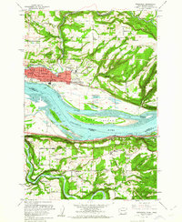
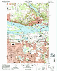
 1948 Vancouver1957 Print · USGSCovers Washougal River, including Portland, Vancouver, and other nearby areas
 - 1950 Map of Vancouver
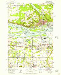
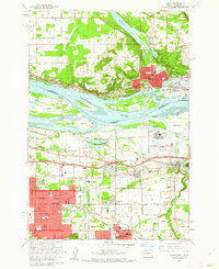
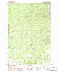
 1950 Vancouver1950 Print · USGSCovers Washougal River, including Portland, Vancouver, and other nearby areas
 - 1950 Map of Vancouver, 1951 Print
 1950 Vancouver1951 Print · USGSCovers Washougal River, including Portland, Vancouver, and other nearby areas
 - 1954 Map of Lacamas Creek, 1956 Print
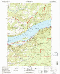
 1954 Lacamas Creek1956 Print · USGSCovers Washougal River, including Vancouver, Camas, and other nearby areas4 unique versions available
 - 1954 Map of Washougal, 1957 Print
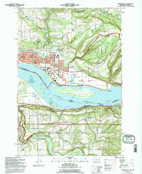
 1954 Washougal1957 Print · USGSCovers Washougal River, including Camas, Springdale, and other nearby areas
 - 1954 Map of Camas, 1957 Print
 1954 Camas1957 Print · USGSCovers Washougal River, including Portland, Vancouver, and other nearby areas
 - 1954 Map of Bridal Veil, 1958 Print
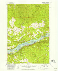 1954 Bridal Veil1958 Print · USGSCovers Washougal River, including North Bonneville, Warrendale, and other nearby areas4 unique versions available
 - 1954 Map of Camas, 1958 Print
 1954 Camas1958 Print · USGSCovers Washougal River, including Portland, Vancouver, and other nearby areas3 unique versions available
 - 1958 Map of Vancouver, 1968 Print
 1958 Vancouver1968 Print · USGSCovers Washougal River, including Portland, Vancouver, and other nearby areas3 unique versions available
 - 1961 Map of Washougal
 1961 Washougal1961 Print · USGSCovers Washougal River, including Camas, Springdale, and other nearby areas4 unique versions available
 - 1961 Map of Camas, 1962 Print
 1961 Camas1962 Print · USGSCovers Washougal River, including Portland, Vancouver, and other nearby areas3 unique versions available
 - 1964 Map of Vancouver
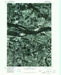
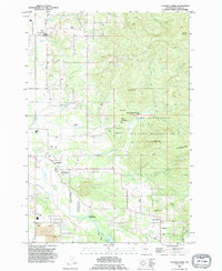
 1964 Vancouver1964 Print · USGSCovers Washougal River, including Portland, Vancouver, and other nearby areas
 - 1975 Map of Camas, 1977 Print
 1975 Camas1977 Print · USGSCovers Washougal River, including Portland, Vancouver, and other nearby areas
 - 1979 Map of Vancouver, 1980 Print
 1979 Vancouver1980 Print · USGSCovers Washougal River, including Portland, Vancouver, and other nearby areas2 unique versions available
 - 1986 Map of Bobs Mountain
 1986 Bobs Mountain1986 Print · USGSCovers Washougal River, including Clark County, Skamania County, and other nearby areas2 unique versions available
 - 1986 Map of Bridal Veil
 1986 Bridal Veil1986 Print · USGSCovers Washougal River, including Prindle, Latourell, and other nearby areas2 unique versions available
 - 1986 Map of Larch Mtn
 1986 Larch Mtn1986 Print · USGSCovers Washougal River, including Ireland, Creswell Heights, and other nearby areas2 unique versions available
 - 1990 Map of Lacamas Creek, 1995 Print
 1990 Lacamas Creek1995 Print · USGSCovers Washougal River, including Vancouver, Camas, and other nearby areas
 - 1993 Map of Camas, 1996 Print
 1993 Camas1996 Print · USGSCovers Washougal River, including Portland, Vancouver, and other nearby areas
 - 1994 Map of Bridal Veil, 1996 Print
 1994 Bridal Veil1996 Print · USGSCovers Washougal River, including Prindle, Latourell, and other nearby areas
 - 1994 Map of Washougal, 1996 Print
 1994 Washougal1996 Print · USGSCovers Washougal River, including Camas, Springdale, and other nearby areas
Showing maps 1-25 of 27
Frequently asked questions
- What are the different types of historical maps available for Washougal River?
- What is the oldest map of Washougal River?
- Where can I purchase historical maps of Washougal River for my home or office?
- Where can I download high-res historical maps of Washougal River?
- Are there historical topographic maps available for Washougal River?
- Is there historical aerial imagery available for Washougal River?
- Where are historical maps of Washougal River sourced from?