1900s (20th Century) Maps of Coulee City, Washington
Explore 6 historic maps of Coulee City from the 1900s (20th Century). These maps offer a rare glimpse into what life looked like during the 1900s — showing old roads, neighborhoods, homes, and landmarks that have changed or disappeared over time.
Whether you're researching your family's past, planning a metal detecting trip, or studying how Coulee City's landscape evolved across the 1900s, these high-resolution maps are a powerful tool for exploring the history of this region.
- Focus on a specific era: All maps on this page are from the 1900s, giving you a focused view of this time period.
- See what’s changed: Compare century-old streets, trails, and buildings to today's modern landscape using overlays and satellite layers.
- Research with precision: Use these maps for genealogy, historical research, land use analysis, or educational projects.
- View, download, or print: Maps are fully viewable online in high resolution, and can be downloaded or printed for your own records.
Start exploring Coulee City's history through authentic maps from the 1900s. This is your window into the past.
Coulee City, WA maps
(6)- 1930 Map of Grand Coulee Sheet 3
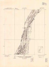 1930 Grand Coulee Sheet 31930 Print · USGSGrant County is captured during a period of transition in the late twenties, showing the area's complex geology before major development. Researchers can trace local landmarks like the Grand View Sch and the significant geological formation of the Bacon Monocline.
 - 1953 Map of Ritzville, 1966 Print
 1953 Ritzville1966 Print · USGSEastern Washington was undergoing a massive agricultural and industrial transformation in the mid-fifties as irrigation from the Grand Coulee Dam reached the plateau. Researchers can trace the mid-century rail network of the Great Northern and locate vital local sites like Larson Air Force Base and Odessa.3 unique versions available
 - 1959 Map of Ritzville
 1959 Ritzville1959 Print · USGSEastern Washington in the late fifties reveals a landscape transformed by massive irrigation projects and postwar growth. Genealogists and historians can trace rail-line communities from Ritzville to Davenport and locate landmarks like Larson Air Force Base and Telford Station.
 - 1965 Map of Ritzville
 1965 Ritzville1965 Print · USGSCentral Washington during the mid-sixties shows a landscape shaped by massive irrigation projects and the Cold War. Genealogists and historians can trace rail-town life and military presence through Ephrata Air Base, the Telford Station, and local schools.
 - 1965 Map of Mold, 1967 Print
 1965 Mold1967 Print · USGSMid-century Douglas County is captured here during a period of significant water management and transit shifts. Genealogists and historians can trace the foundations of Mold, locate the Mold Cem, and follow the Old Railroad Grade as it winds toward Fordair.
 - 1965 Map of Coulee City, 1967 Print
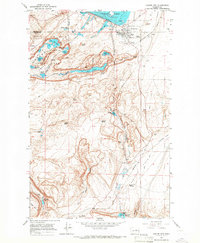 1965 Coulee City1967 Print · USGSCoulee City sits at the threshold of the spectacular Grand Coulee during the mid-sixties, a period of significant hydroelectric and agricultural development. Genealogists and historians can trace the Northern Pacific rail line through Odair or locate family-named landmarks like McEntee Spring and Arbuckle Draw.3 unique versions available
End of results
Showing maps 1-6 of 6
Top cities near Coulee City
Frequently asked questions
- What are the different types of historical maps available for Coulee City?
- What is the oldest map of Coulee City?
- Where can I purchase historical maps of Coulee City for my home or office?
- Where can I download high-res historical maps of Coulee City?
- Are there historical topographic maps available for Coulee City?
- Is there historical aerial imagery available for Coulee City?
- Where are historical maps of Coulee City sourced from?