Old Maps of Royal Camp, Washington for Metal Detecting
Plan your next treasure hunt with 12 historic maps of Royal Camp. Find old homesites, ghost towns, trails, and gathering spots that may be lost to time — perfect for identifying promising metal detecting locations.
- Locate forgotten sites: Uncover places like long-lost settlements, abandoned rail lines, or gathering spots.
- Plan better hunts: Use map overlays combined with LiDAR or satellite views to narrow in on historically rich areas.
- Made for detectorists: Thousands of hobbyists use these maps to discover relics, coins, and hidden history.
Use these historic maps to boost your research and find new opportunities beneath the surface of Royal Camp.
Royal Camp, WA maps
(12)- 1923 Map of Corfu
 1923 Corfu1923 Print · USGSThe high desert of Grant and Adams counties comes into focus in the early twenties, during the height of the transcontinental rail era. Genealogists and historians can locate rural landmarks like Hope Valley School and the rail stops at Corfu and Taunton.
 - 1951 Map of Corfu
 1951 Corfu1951 Print · USGSCentral Washington is seen here during the mid-century irrigation boom as the landscape began to shift under new water projects. Researchers can trace the original rail stops of Corfu and Taunton along the Chicago Milwaukee St Paul and Pacific line before the rising waters behind O'Sullivan Dam transformed the region.
 - 1953 Map of Walla Walla, 1964 Print
 1953 Walla Walla1964 Print · USGSSoutheast Washington enters the atomic and hydroelectric age in the mid-twentieth century as new dams reshape the desert landscape. You can trace the development of the Hanford Works, identify remote rail stops like Novara Siding, and locate the historic Dry Creek Cem.3 unique versions available
 - 1958 Map of Walla Walla
 1958 Walla Walla1958 Print · USGSThe Tri-Cities and Walla Walla region are captured here during the mid-century expansion of atomic energy and river infrastructure. Genealogists and historians can trace the early layout of Richland (AEC), the rural Hatton and Washtucna settlements, and landmarks like Palouse Falls State Park.
 - 1965 Map of Corfu, 1966 Print
 1965 Corfu1966 Print · USGSThe high desert of Grant and Adams counties comes into focus in the mid-1960s, showing a landscape reshaped by massive irrigation projects. Researchers can trace the Milwaukee Road rail line through Corfu and Taunton or locate the Hope Cem near the Saddle Mountains.2 unique versions available
 - 1979 Map of Priest Rapids
 1979 Priest Rapids1979 Print · USGSThe Columbia River basin in the late seventies reveals a landscape shaped by massive federal projects and rail expansion. Trace the Hanford Works perimeter, the Priest Rapids Dam, and the early growth of Royal City and Othello.2 unique versions available
 - 1986 Map of Royal Camp
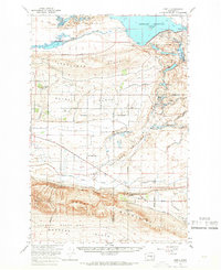
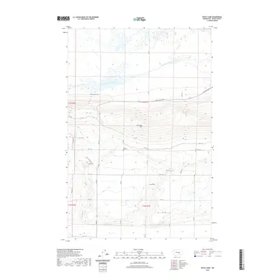
 1986 Royal Camp1986 Print · USGSGrant County’s agricultural and conservation landscape is documented here during the mid-eighties, centered on the settlement of Royal Camp. Trace the intricate irrigation networks of the West Canal and the water management of the Potholes Reservoir.
 - 2011 Map of Royal Camp, 2011 Print
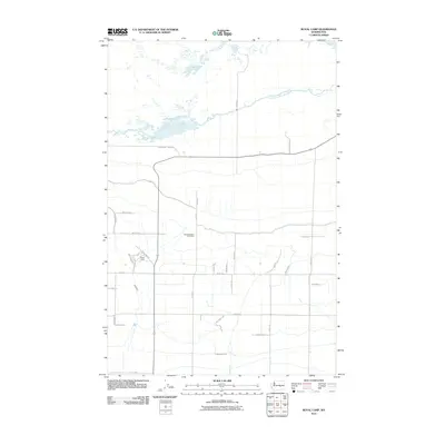 2011 Royal Camp2011 Print · USGSCovers Royal Camp, including Grant County, United States, and other nearby areas
 - 2013 Map of Royal Camp, 2013 Print
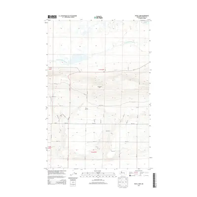 2013 Royal Camp2013 Print · USGSCovers Royal Camp, including Grant County, United States, and other nearby areas
 - 2017 Map of Royal Camp, 2017 Print
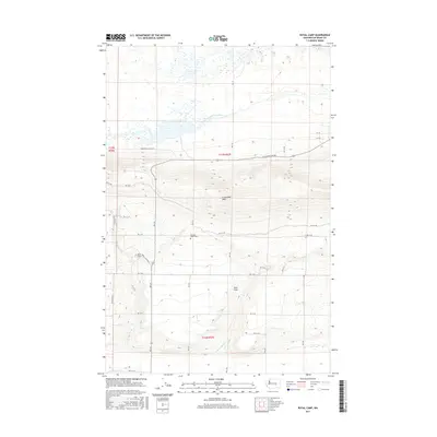 2017 Royal Camp2017 Print · USGSCovers Royal Camp, including Grant County, United States, and other nearby areas
 - 2020 Map of Royal Camp, 2020 Print
 2020 Royal Camp2020 Print · USGSCovers Royal Camp, including Grant County, United States, and other nearby areas
 - 2023 Map of Royal Camp, 2023 Print
 2023 Royal Camp2023 Print · USGSCentral Grant County is defined here by the managed waters of the Columbia Basin Project and the rising ridge of the Frenchman Hills. Genealogists and local researchers can locate Pleasant Valley Cem or trace irrigation routes like West Canal and Crab Creek Lateral.
End of results
Showing maps 1-12 of 12
Top cities near Royal Camp
Frequently asked questions
- What are the different types of historical maps available for Royal Camp?
- What is the oldest map of Royal Camp?
- Where can I purchase historical maps of Royal Camp for my home or office?
- Where can I download high-res historical maps of Royal Camp?
- Are there historical topographic maps available for Royal Camp?
- Is there historical aerial imagery available for Royal Camp?
- Where are historical maps of Royal Camp sourced from?