Old Maps of Qui-nai-elt Village, Washington for Academic Research
Study the evolution of Qui-nai-elt Village with 12 high-resolution historic maps. Whether you're teaching, researching, or modeling changes in land use, these maps provide essential visual documentation of urban, environmental, and geographic change.
- Analyze long-term change: Track patterns in development, transportation, and natural features.
- Ideal for environmental or urban studies: Support academic projects with primary historical map data.
- Use in the classroom or lab: Educators and researchers rely on these maps to bring historical context to life.
These maps are a powerful tool for teaching, research, and visualizing how Qui-nai-elt Village has changed over the decades.
Qui-nai-elt Village, WA maps
(12)- 1943 Map of Copalis Beach
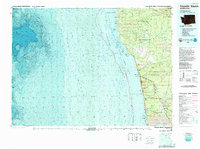
 1943 Copalis Beach1943 Print · USGSThe Washington coast in the 1940s is detailed here from the Olympic Peninsula to the Columbia River. Trace old beach settlements like Moclips and Copalis Beach alongside landmarks like the Willapa Bay Lighthouse.
 - 1951 Map of Copalis Beach
 1951 Copalis Beach1951 Print · USGSThe Olympic Peninsula's rugged coast and tribal lands are meticulously detailed in the early 1950s. Genealogists and historians can trace the foundations of coastal communities from Taholah to La Push or locate early markers like the James Island Lighthouse.
 - 1955 Map of Macafee Hill, 1957 Print
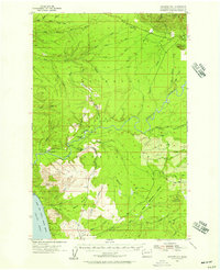 1955 Macafee Hill1957 Print · USGSCoastal Washington's timber country is documented here in the mid-1950s, showing the intersection of tribal lands and national forest. Researchers can trace historical timber operations through the Logging Railroad and State Log Scaling Station or locate family-named sites like Baker Prairie and Macafee Hill.3 unique versions available
 - 1957 Map of Copalis Beach, 1968 Print
 1957 Copalis Beach1968 Print · USGSThe Washington coast during the late fifties reveals a landscape of tribal reservations and timber towns linked by the Northern Pacific RR. Trace family history and land patterns near Forks Cemetery, the shingle mill, or coastal landings like Taholah and Oysterville.2 unique versions available
 - 1963 Map of Copalis Beach
 1963 Copalis Beach1963 Print · USGSThe Washington coast in the early sixties reveals a landscape of massive timber reserves, indigenous lands, and quiet seaside villages. Genealogists and historians can trace the foundations of coastal life through sites like Lone Fir Cemetery, the Dismantled RR, and the historic oyster beds of Oysterville.
 - 1980 Map of Copalis Beach, 1988 Print
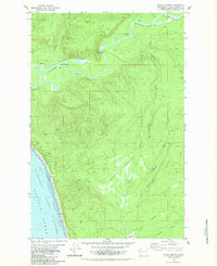
 1980 Copalis Beach1988 Print · USGSThe Grays Harbor coast in the early eighties shows a landscape defined by the Quinault Indian Reservation and seaside rail history. Researchers can trace the Burlington Northern route through Moclips, Aloha, and Copalis Crossing.
 - 1982 Map of Shale Slough
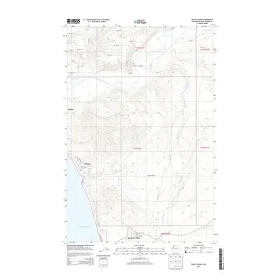
 1982 Shale Slough1982 Print · USGSThe Quinault Indian Reservation coast appears here in the early eighties, where the Quinault River meets the Pacific. Trace local landmarks like the Chow Chow Bridge, the Old Railroad Grade, and the Copalis National Wildlife Refuge.2 unique versions available
 - 2011 Map of Shale Slough, 2011 Print
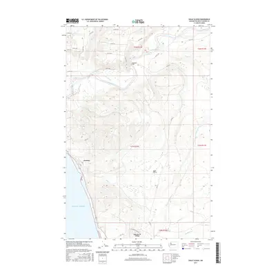
 2011 Shale Slough2011 Print · USGSCovers Qui-nai-elt Village, including Santiago, Grays Harbor County, and other nearby areas
 - 2014 Map of Shale Slough, 2014 Print
 2014 Shale Slough2014 Print · USGSCovers Qui-nai-elt Village, including Santiago, Grays Harbor County, and other nearby areas
 - 2017 Map of Shale Slough, 2017 Print
 2017 Shale Slough2017 Print · USGSCovers Qui-nai-elt Village, including Santiago, Grays Harbor County, and other nearby areas
 - 2020 Map of Shale Slough, 2020 Print
 2020 Shale Slough2020 Print · USGSCovers Qui-nai-elt Village, including Santiago, Grays Harbor County, and other nearby areas
 - 2023 Map of Shale Slough, 2023 Print
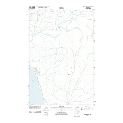
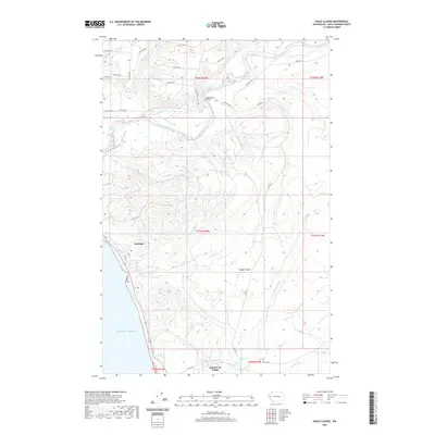
 2023 Shale Slough2023 Print · USGSCoastal Grays Harbor County is documented in this recent survey, showing the traditional lands and waterways of the Quinault Reservation. Local historians can trace the shoreline between Taholah and Santiago, or locate the inland expanse of Baker Prairie.
End of results
Showing maps 1-12 of 12
Top cities near Qui-nai-elt Village
Frequently asked questions
- What are the different types of historical maps available for Qui-nai-elt Village?
- What is the oldest map of Qui-nai-elt Village?
- Where can I purchase historical maps of Qui-nai-elt Village for my home or office?
- Where can I download high-res historical maps of Qui-nai-elt Village?
- Are there historical topographic maps available for Qui-nai-elt Village?
- Is there historical aerial imagery available for Qui-nai-elt Village?
- Where are historical maps of Qui-nai-elt Village sourced from?