
1955 Map of Macafee Hill
USGS Topo · Published 1957About this map
The Quinault Indian Reservation and the Olympic Nat For define the character of this mid-1950s coastal landscape, where timber management and tribal lands meet. The industrial footprint of the Pacific Northwest's logging heritage is evident through the winding paths of the Logging RR and the State Log Scaling Station located along the upper reaches of the Quinnault River. Unlike the densely forested slopes of Thimble Mtn or Macafee Hill, several distinct open spaces such as O'Took Prairie, Baker Prairie, and Chow Chow Prairie are noted, suggesting unique ecological pockets within the heavy canopy.
Find a feature on this map
45 named features on this map. Tap any name to fly to it.
Don’t see what you’re looking for? This feature index may not catch every label — zoom into the map to look around manually.
Map Details
Editions of this 1955 Macafee Hill Map
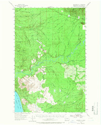
Other maps of this area

1921 · Quinault Lake
USGS Topo · 1:62,500

1938 · Moclips
USGS Topo · 1:62,500

1941 · Moclips
USGS Topo · 1:62,500

1943 · Humptulips
USGS Topo · 1:62,500

1943 · Copalis Beach
USGS Topo · 1:250,000

1951 · Copalis Beach
USGS Topo · 1:250,000

1955 · Taholah
USGS Topo · 1:62,500

1955 · Humptulips
USGS Topo · 1:62,500

1955 · Quinault Lake
USGS Topo · 1:62,500

1955 · Carlisle
USGS Topo · 1:24,000