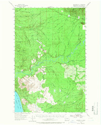
1955 Map of Macafee Hill
USGS Topo · Published 1966About this map
The Quinault Indian Reservation dominates the central portion of this mid-century landscape, where the Quinault River snakes westward toward the Pacific Ocean. This survey captures a region defined by commercial timber extraction and federal land management just before the large-scale modernization of backcountry access. A complex industrial network is visible through the extensive Logging RR and Logging Railroad spurs that penetrate the deep drainages of the Moclips River and Cook Creek.
Find a feature on this map
41 named features on this map. Tap any name to fly to it.
Don’t see what you’re looking for? This feature index may not catch every label — zoom into the map to look around manually.
Map Details
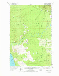
Editions of this 1955 Macafee Hill Map
Other maps of this area

1921 · Quinault Lake
USGS Topo · 1:62,500

1938 · Moclips
USGS Topo · 1:62,500

1941 · Moclips
USGS Topo · 1:62,500

1943 · Humptulips
USGS Topo · 1:62,500

1943 · Copalis Beach
USGS Topo · 1:250,000

1951 · Copalis Beach
USGS Topo · 1:250,000

1955 · Taholah
USGS Topo · 1:62,500

1955 · Macafee Hill
USGS Topo · 1:62,500

1955 · Humptulips
USGS Topo · 1:62,500

1955 · Quinault Lake
USGS Topo · 1:62,500