Old Maps of Krain, Washington for Academic Research
Study the evolution of Krain with these high-resolution historic maps. Whether you're teaching, researching, or modeling changes in land use, these maps provide essential visual documentation of urban, environmental, and geographic change.
- Analyze long-term change: Track patterns in development, transportation, and natural features.
- Ideal for environmental or urban studies: Support academic projects with primary historical map data.
- Use in the classroom or lab: Educators and researchers rely on these maps to bring historical context to life.
These maps are a powerful tool for teaching, research, and visualizing how Krain has changed over the decades.
Krain, WA maps
- 1913 Map of Cedar Lake
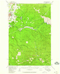
 1913 Cedar Lake1913 Print · USGSThe foothills and peaks of the Cascades appear here just before World War I as industry pushed into the wilderness. Trace early timber and rail history through Kerriston, Selleck, and the Cedar Falls Power Plant.5 unique versions available
 - 1956 Map of Enumclaw, 1958 Print
 1956 Enumclaw1958 Print · USGSThe area around Enumclaw in the mid-1950s shows a landscape of massive civil engineering and industrial logging. Trace the Pacific Northern Logging RR or find remote sites like the Copper King Mine and Rainier State Sch.3 unique versions available
 - 1956 Map of Enumclaw, 1958 Print
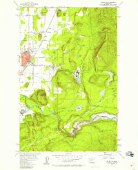 1956 Enumclaw1958 Print · USGSThe plateau around Enumclaw is captured here in the mid-fifties, showing a landscape defined by timber processing and river management. Researchers can trace the Pacific Northern Railroad and locate local landmarks like Upper Mill and the Rainier State School.5 unique versions available
 - 1957 Map of Wenatchee, 1973 Print
 1957 Wenatchee1973 Print · USGSThe northern Cascades and Columbia River valley appear here in the mid-fifties, showing the region's critical rail and transit corridors. Researchers can trace the routes of the Great Northern RR and Milwaukee Road through settlements like Skykomish, Baring, and Dryden.2 unique versions available
 - 1975 Map of Snoqualmie Pass, 1977 Print
 1975 Snoqualmie Pass1977 Print · USGSThe central Cascades are shown here in the mid-seventies, just as the regional balance between industrial timber, rail transport, and recreation was shifting. Genealogists and hikers can trace old rail stops like Lester and Nagrom, or follow the Pacific Crest National Scenic Trail past Keechelus Lake.
 - 1993 Map of Enumclaw
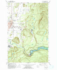 1993 Enumclaw1993 Print · USGSThe foothills of the Cascades near Enumclaw and Buckley are shown in the early nineties, centered on the White River corridor. Genealogists and historians can locate family landmarks like Pinnacle Peak, schools such as Byron Kibler Sch, and the massive Mud Mountain Dam infrastructure.
 - 1997 Map of Enumclaw, 2003 Print
 1997 Enumclaw2003 Print · USGSEnumclaw and Buckley are shown during the late 1990s as the regional hub for the White River valley. Trace local history through the Rainier State School, the Old Grade Railroad, and engineered landmarks like the Mud Mountain Dam.
 - 2023 Map of Enumclaw, 2023 Print
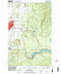
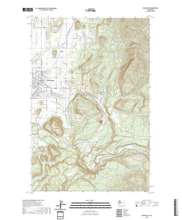 2023 Enumclaw2023 Print · USGSThe foothills of the Cascades meet the plateau in the early 2020s, showing a landscape defined by timber, water, and cross-county travel. Trace local history through the grids of Enumclaw and Buckley or locate sites like Upper Mill and Bergseth Field.
End of results
Showing maps 1-8
Top cities near Krain
- Kent historical maps
- Renton historical maps
- Auburn historical maps
- Maple Valley historical maps
- Bonney Lake historical maps
- Covington historical maps
See more
Frequently asked questions
- What are the different types of historical maps available for Krain?
- What is the oldest map of Krain?
- Where can I purchase historical maps of Krain for my home or office?
- Where can I download high-res historical maps of Krain?
- Are there historical topographic maps available for Krain?
- Is there historical aerial imagery available for Krain?
- Where are historical maps of Krain sourced from?