Old Maps of Enumclaw, Washington
Explore 28 old maps of Enumclaw, spanning from 1897 to today. These high-resolution historic maps reveal how streets, neighborhoods, landmarks, and natural features evolved over time — perfect for genealogy, metal detecting, research, and local history exploration.
What you can do with these maps:
- See how Enumclaw changed over time: Compare historical maps to modern-day views to trace roads, homesites, rail lines & more.
- View detailed metadata: Each map includes creators, publishers, year, scale, and archive source.
- Overlay maps with satellite & LiDAR: Visualize the past alongside modern tools to explore terrain & human change.
- Trusted historical sources: Maps sourced from the USGS, Library of Congress, and other archives.
- Access maps your way: View online, download high-res files, or order prints for personal or research use.
Start exploring old maps of Enumclaw to uncover forgotten places, hidden landmarks, and the deep history beneath your feet.
Enumclaw, WA maps
(28)- 1897 Map of Tacoma
 1897 Tacoma1897 Print · USGSPuget Sound and the Tacoma waterfront come alive in the late 1890s, when coal railroads and river valleys drove regional growth. Genealogists can trace family roots in early island settlements like Chautauqua or inland rail towns such as Black Diamond and Wilkeson.2 unique versions available
 - 1900 Map of Tacoma
 1900 Tacoma1900 Print · USGSThe Puget Sound region was a hive of rail and maritime activity at the end of the Victorian era. Researchers can trace early settlements like Chautauqua, identify tribal lands at the Muckleshoot Indian Reservation, and locate mining towns such as Black Diamond.9 unique versions available
 - 1913 Map of Cedar Lake
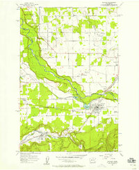
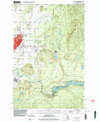
 1913 Cedar Lake1913 Print · USGSThe foothills and peaks of the Cascades appear here just before World War I as industry pushed into the wilderness. Trace early timber and rail history through Kerriston, Selleck, and the Cedar Falls Power Plant.5 unique versions available
 - 1942 Map of Lake Tapps, 1962 Print
 1942 Lake Tapps1962 Print · USGSThe foothills of the Cascades meet the Puyallup Valley in the 1940s, showing a landscape defined by logging and coal extraction. Genealogists can locate family names on markers like Spar Pole Hill or trace rural social hubs like the Sunrise Grange Hall.3 unique versions available
 - 1944 Map of Lake Tapps
 1944 Lake Tapps1944 Print · USGSPierce County during the early 1940s reveals a landscape of industrial river towns and hill-country resource extraction. Genealogists can trace family roots through the Kelly Lake Sch, Coal Mines near Wilkeson, and the Sunrise Grange Hall.3 unique versions available
 - 1956 Map of Buckley, 1958 Print
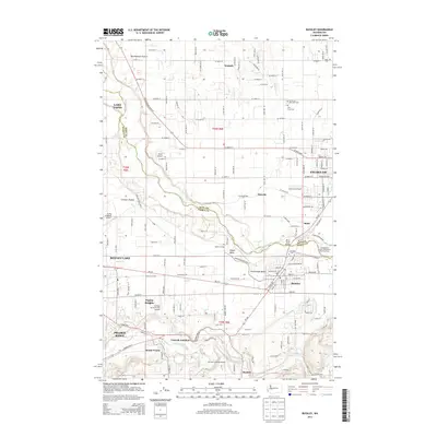
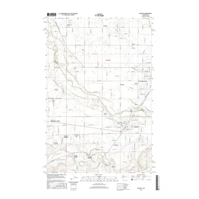
 1956 Buckley1958 Print · USGSPierce and King counties in the mid-fifties reveal a landscape of river-valley farms and emerging towns connected by the Northern Pacific. Genealogists can locate family sites near Krain Cem, South Prairie, and community hubs like Sunrise Grange.4 unique versions available
 - 1956 Map of Enumclaw, 1958 Print
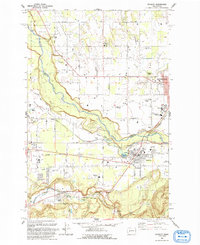
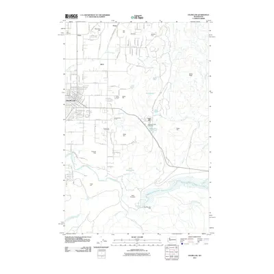
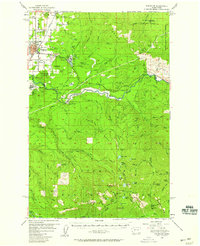 1956 Enumclaw1958 Print · USGSThe area around Enumclaw in the mid-1950s shows a landscape of massive civil engineering and industrial logging. Trace the Pacific Northern Logging RR or find remote sites like the Copper King Mine and Rainier State Sch.3 unique versions available
 - 1956 Map of Enumclaw, 1958 Print
 1956 Enumclaw1958 Print · USGSThe plateau around Enumclaw is captured here in the mid-fifties, showing a landscape defined by timber processing and river management. Researchers can trace the Pacific Northern Railroad and locate local landmarks like Upper Mill and the Rainier State School.5 unique versions available
 - 1957 Map of Wenatchee, 1973 Print
 1957 Wenatchee1973 Print · USGSThe northern Cascades and Columbia River valley appear here in the mid-fifties, showing the region's critical rail and transit corridors. Researchers can trace the routes of the Great Northern RR and Milwaukee Road through settlements like Skykomish, Baring, and Dryden.2 unique versions available
 - 1958 Map of Seattle, 1966 Print
 1958 Seattle1966 Print · USGSThe Puget Sound region in the mid-fifties showcases a balance of urban growth and Olympic wilderness. Trace the industrial waterfronts of Tacoma, old naval facilities like Keyport Naval Res, and mountain peaks like Mount Constance.3 unique versions available
 - 1962 Map of Seattle
 1962 Seattle1962 Print · USGSThe Puget Sound region and Olympic Peninsula are shown at a peak of mid-century growth. Genealogists and historians can trace rail lines like the Pacific Coast RR or locate landmarks such as Fort Lawton and the Bothell Power Station.
 - 1975 Map of Snoqualmie Pass, 1977 Print
 1975 Snoqualmie Pass1977 Print · USGSThe central Cascades are shown here in the mid-seventies, just as the regional balance between industrial timber, rail transport, and recreation was shifting. Genealogists and hikers can trace old rail stops like Lester and Nagrom, or follow the Pacific Crest National Scenic Trail past Keechelus Lake.
 - 1975 Map of Tacoma, 1977 Print
 1975 Tacoma1977 Print · USGSThe Puget Sound region in the mid-seventies reveals a landscape of growing urban centers and massive federal installations. Genealogists and historians can trace the development of Tacoma and Olympia, or locate landmarks like the McNeil Island Penitentiary and Fort Lewis Military Reservation.
 - 1991 Map of Tacoma
 1991 Tacoma1991 Print · USGSThe South Sound and Tacoma waterfront appear here in the early nineties, showing a landscape defined by deep-water inlets and massive federal installations. Researchers can trace the development of Lakewood Center or locate the historic rail lines of the Burlington Northern Railroad and Union Pacific Railroad.
 - 1993 Map of Enumclaw
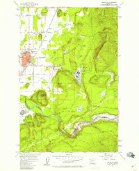
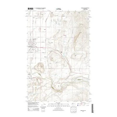
 1993 Enumclaw1993 Print · USGSThe foothills of the Cascades near Enumclaw and Buckley are shown in the early nineties, centered on the White River corridor. Genealogists and historians can locate family landmarks like Pinnacle Peak, schools such as Byron Kibler Sch, and the massive Mud Mountain Dam infrastructure.
 - 1993 Map of Buckley
 1993 Buckley1993 Print · USGSThe White River valley and the high prairies of Pierce and King counties are captured here in the early nineties. Researchers can trace the layout of Enumclaw and Buckley, locate the Krain Cemetery, and follow the Old RR Grade south toward Burnett.
 - 1997 Map of Enumclaw, 2003 Print
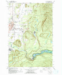
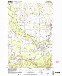
 1997 Enumclaw2003 Print · USGSEnumclaw and Buckley are shown during the late 1990s as the regional hub for the White River valley. Trace local history through the Rainier State School, the Old Grade Railroad, and engineered landmarks like the Mud Mountain Dam.
 - 1997 Map of Buckley, 2003 Print
 1997 Buckley2003 Print · USGSThe foothills of King and Pierce counties are captured here in the late nineties as timber and rail heritage meets modern growth. Researchers can trace historic landmarks like Finn Hall, the Old RR Grade, and the grounds of the Rainier State School.
 - 2011 Map of Buckley, 2011 Print
 2011 Buckley2011 Print · USGSCovers Enumclaw, including Bonney Lake, Prairie Ridge, and other nearby areas
 - 2011 Map of Enumclaw, 2011 Print
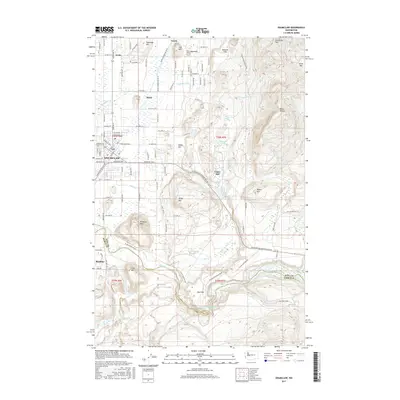
 2011 Enumclaw2011 Print · USGSCovers Enumclaw, including Buckley, Krain, and other nearby areas
 - 2014 Map of Enumclaw, 2014 Print
 2014 Enumclaw2014 Print · USGSCovers Enumclaw, including Buckley, Krain, and other nearby areas
 - 2014 Map of Buckley, 2014 Print
 2014 Buckley2014 Print · USGSCovers Enumclaw, including Bonney Lake, Prairie Ridge, and other nearby areas
 - 2017 Map of Buckley, 2017 Print
 2017 Buckley2017 Print · USGSCovers Enumclaw, including Bonney Lake, Prairie Ridge, and other nearby areas
 - 2017 Map of Enumclaw, 2017 Print
 2017 Enumclaw2017 Print · USGSCovers Enumclaw, including Buckley, Krain, and other nearby areas
 - 2020 Map of Enumclaw, 2020 Print
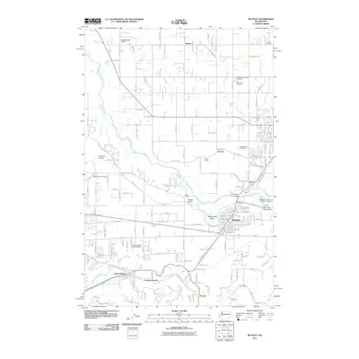
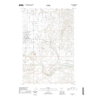 2020 Enumclaw2020 Print · USGSCovers Enumclaw, including Buckley, Krain, and other nearby areas
Showing maps 1-25 of 28
Top cities near Enumclaw
- Kent historical maps
- Renton historical maps
- Auburn historical maps
- Maple Valley historical maps
- Bonney Lake historical maps
- Covington historical maps
See more
Top neighborhoods of Enumclaw
- Pinnacle Peak historical maps
- Rainier Trails historical maps
- Crystalaire historical maps
- Crystal Mountain Residences historical maps
- Watson Place Apartments historical maps
- Stonebrook historical maps
See more
Frequently asked questions
- What are the different types of historical maps available for Enumclaw?
- What is the oldest map of Enumclaw?
- Where can I purchase historical maps of Enumclaw for my home or office?
- Where can I download high-res historical maps of Enumclaw?
- Are there historical topographic maps available for Enumclaw?
- Is there historical aerial imagery available for Enumclaw?
- Where are historical maps of Enumclaw sourced from?