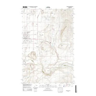
2014 Map of Enumclaw
USGS Topo · Published 2014About this map
Enumclaw sits as a regional anchor on this 2014 survey, where the suburban grid meets the rising foothills of the Cascades. The map details a landscape transitioning from the residential core of the city to the industrial and natural features of the east and south, including the Upper Mill and the King County Fairgrounds. Notable elevations such as Pinnacle Peak and Enumclaw Mtn define the local topography, while the White River marks the southern boundary between King and Pierce counties.
Find a feature on this map
73 named features on this map. Tap any name to fly to it.
Don’t see what you’re looking for? This feature index may not catch every label — zoom into the map to look around manually.
Map Details
Editions of this 2014 Enumclaw Map
This is the sole edition of this map. No revisions or reprints were ever made.
Other maps of this area

1897 · Tacoma
USGS Topo · 1:125,000

1900 · Tacoma
USGS Topo · 1:125,000

1913 · Cedar Lake
USGS Topo · 1:125,000

1942 · Lake Tapps
USGS Topo · 1:62,500

1944 · Lake Tapps
USGS Topo · 1:62,500

1949 · Black Diamond
USGS Topo · 1:24,000

1953 · Eagle Gorge
USGS Topo · 1:24,000

1953 · Cumberland
USGS Topo · 1:24,000
1956 · Buckley
USGS Topo · 1:24,000
1956 · Wilkeson
USGS Topo · 1:24,000