Old Maps of Bristol, Washington
Explore 13 old maps of Bristol, spanning from 1897 to today. These high-resolution historic maps reveal how streets, neighborhoods, landmarks, and natural features evolved over time — perfect for genealogy, metal detecting, research, and local history exploration.
What you can do with these maps:
- See how Bristol changed over time: Compare historical maps to modern-day views to trace roads, homesites, rail lines & more.
- View detailed metadata: Each map includes creators, publishers, year, scale, and archive source.
- Overlay maps with satellite & LiDAR: Visualize the past alongside modern tools to explore terrain & human change.
- Trusted historical sources: Maps sourced from the USGS, Library of Congress, and other archives.
- Access maps your way: View online, download high-res files, or order prints for personal or research use.
Start exploring old maps of Bristol to uncover forgotten places, hidden landmarks, and the deep history beneath your feet.
Bristol, WA maps
(13)- 1897 Map of Mount Stuart
 1897 Mount Stuart1897 Print · USGSThe Kittitas Valley and Wenatchee Mountains are captured here at the end of the nineteenth century as coal and gold mining began to transform the frontier. Researchers can trace the early rail networks of the Northern Pacific and locate historic mining camps like Liberty, Meaghersville, and the remote Blewett station.2 unique versions available
 - 1902 Map of Mount Stuart, 1908 Print
 1902 Mount Stuart1908 Print · USGSThe Kittitas Valley and Wenatchee Mountains are shown here during the height of the early twentieth-century rail and mining era. Researchers can trace the industrial landscape through the Roslyn Branch and mountain camps like Liberty and Blewett.5 unique versions available
 - 1957 Map of Wenatchee, 1973 Print
 1957 Wenatchee1973 Print · USGSThe northern Cascades and Columbia River valley appear here in the mid-fifties, showing the region's critical rail and transit corridors. Researchers can trace the routes of the Great Northern RR and Milwaukee Road through settlements like Skykomish, Baring, and Dryden.2 unique versions available
 - 1958 Map of Cle Elum, 1960 Print
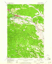 1958 Cle Elum1960 Print · USGSKittitas County coal and rail hubs come alive in this mid-century survey of the Yakima River corridor. Local historians can trace the operations of No 5 Mine, locate old cemeteries near Roslyn, and follow the competing tracks of the Northern Pacific and Milwaukee Road.3 unique versions available
 - 1975 Map of Wenatchee, 1977 Print
 1975 Wenatchee1977 Print · USGSCentral Washington in the mid-seventies shows a landscape of deep mountain valleys and bustling river towns. Trace the industrial and agricultural backbone of the region along the Yakima River and Columbia River, from the mining history of Roslyn to the rail hubs at Cle Elum and Appleyard.
 - 1985 Map of Teanaway
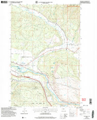
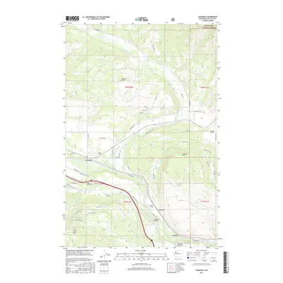
 1985 Teanaway1985 Print · USGSThe Yakima River valley was a bustling transport corridor in the mid-eighties, defined by rail lines and river junctions. You can trace the path of the Burlington Northern through settlements like Bristol and explore landmarks like Indian John Hill and Swauk Prairie.2 unique versions available
 - 1989 Map of Teanaway
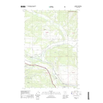
 1989 Teanaway1989 Print · USGSKittitas County high country is shown in detail during the late 1980s, centered on the complex drainage system of the Teanaway River. Researchers can locate the historical Casland (Site) and trace the paths of the Middle Fork Teanaway River and West Fork Teanaway River through the timber of Wenatchee National Forest.
 - 2003 Map of Teanaway, 2006 Print
 2003 Teanaway2006 Print · USGSKittitas County at the turn of the millennium shows a landscape defined by the meeting of the Wenatchee forest and the Yakima valley. Researchers can trace the water infrastructure of The Main Canal and locate rural landmarks like Indian John Hill and the De Vere Field airstrip.
 - 2011 Map of Teanaway, 2011 Print
 2011 Teanaway2011 Print · USGSCovers Bristol, including Teanaway, Horlick, and other nearby areas
 - 2014 Map of Teanaway, 2014 Print
 2014 Teanaway2014 Print · USGSCovers Bristol, including Teanaway, Horlick, and other nearby areas
 - 2017 Map of Teanaway, 2017 Print
 2017 Teanaway2017 Print · USGSCovers Bristol, including Teanaway, Horlick, and other nearby areas
 - 2020 Map of Teanaway, 2020 Print
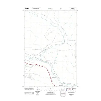
 2020 Teanaway2020 Print · USGSCovers Bristol, including Teanaway, Horlick, and other nearby areas
 - 2023 Map of Teanaway, 2023 Print
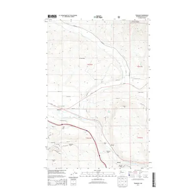
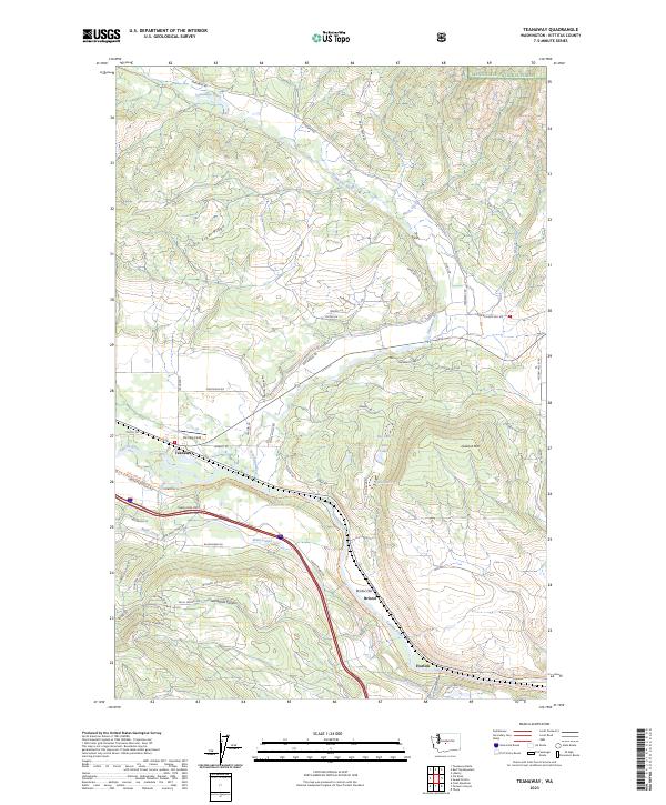 2023 Teanaway2023 Print · USGSThe Teanaway and Yakima river valleys are captured here in the early twenty-first century, showing the meeting point of forest and irrigation. Researchers can trace the path of the John Wayne Trl through settlements like Bristol and Horlick, or locate the rural De Vere Field.
End of results
Showing maps 1-13 of 13
Top cities near Bristol
- Ellensburg historical maps
- Cle Elum historical maps
- Roslyn historical maps
- South Cle Elum historical maps
- Thorp historical maps
Frequently asked questions
- What are the different types of historical maps available for Bristol?
- What is the oldest map of Bristol?
- Where can I purchase historical maps of Bristol for my home or office?
- Where can I download high-res historical maps of Bristol?
- Are there historical topographic maps available for Bristol?
- Is there historical aerial imagery available for Bristol?
- Where are historical maps of Bristol sourced from?