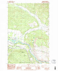
1985 Map of Teanaway
USGS Topo · Published 1985About this map
Teanaway River and the Yakima River converge in this mid-1980s landscape, marking a vital water corridor in Kittitas County. The terrain is defined by the massive Cle Elum Ridge to the north and the expansive L T Murray State Wildlife Recreation Area to the south. Small settlements like Teanaway and Bristol sit alongside the Burlington Northern railroad, reflecting the historic transportation network of the region. Between the river bends, the land transitions from the high elevations of Lookout Mountain and Indian John Hill to the agricultural reaches of Swauk Prairie. This 1985 survey captures the area’s industrial and conservation footprint, showing various resource extraction points such as a Gravel Pit and several quarries, as well as the path of an Old Railroad Grade that speaks to earlier logistical routes through Horseshoe Canyon.
Find a feature on this map
36 named features on this map. Tap any name to fly to it.
Don’t see what you’re looking for? This feature index may not catch every label — zoom into the map to look around manually.
Map Details
Editions of this 1985 Teanaway Map
2 editions found
Other maps of this area

1897 · Mount Stuart
USGS Topo · 1:125,000

1902 · Mount Stuart
USGS Topo · 1:125,000

1957 · Wenatchee
USGS Topo · 1:250,000

1958 · Thorp
USGS Topo · 1:24,000

1958 · Thorp
USGS Topo · 1:62,500

1958 · Cle Elum
USGS Topo · 1:62,500

1961 · Liberty
USGS Topo · 1:62,500

1961 · Mount Stuart
USGS Topo · 1:62,500

1975 · Wenatchee
USGS Topo · 1:100,000
1984 · Cle Elum
USGS Topo · 1:24,000