
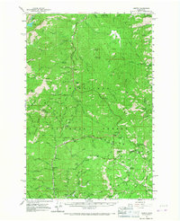
1961 Map of Liberty
USGS Topo · Published 1963About this map
Liberty and the former location of Blewett anchor this mid-century look at the high country spanning the Chelan and Kittitas county line. This 1961 field-checked survey reveals a landscape defined by the drainage of Peshastin Creek and Swauk Creek, where resource extraction and recreation meet. The map identifies specific local markers like the Grave south of Culver Springs, the Mineral Springs Resort, and several USFS facilities including a Guard Station and multiple lookouts. From the granite peaks of the Stuart Range and the Three Brothers to the high alpine basins of Snow Lakes and Nada Lake, the map traces a network of trails and jeep tracks through the Wenatchee National Forest. It captures the transit corridor over Swauk Pass and provides a record of early logging and mining infrastructure through numerous named gulches like Lion Gulch and Billy Goat Gulch.
Find a feature on this map
95 named features on this map. Tap any name to fly to it.
Don’t see what you’re looking for? This feature index may not catch every label — zoom into the map to look around manually.
Map Details
Editions of this 1961 Liberty Map
2 editions found
Other maps of this area

1897 · Mount Stuart
USGS Topo · 1:125,000

1901 · Chelan
USGS Topo · 1:125,000

1901 · Chiwaukum
USGS Topo · 1:125,000

1902 · Mount Stuart
USGS Topo · 1:125,000

1904 · Chiwaukum
USGS Topo · 1:125,000

1913 · Wenatchee
USGS Topo · 1:62,500

1915 · Wenatchee
USGS Topo · 1:62,500

1920 · Colockum Pass
USGS Topo · 1:125,000

1922 · Colockum Pass
USGS Topo · 1:125,000

1957 · Wenatchee
USGS Topo · 1:250,000