
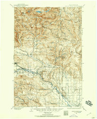
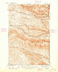
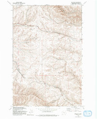
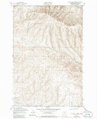
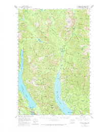
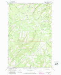
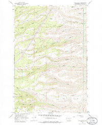
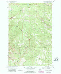
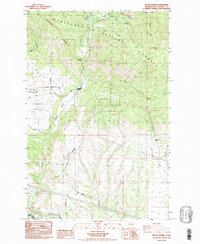
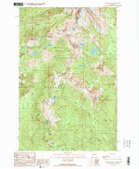
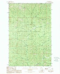
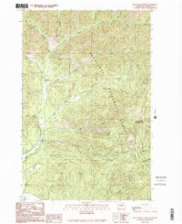
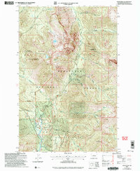
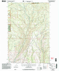
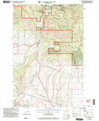
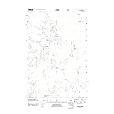
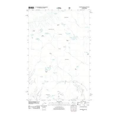
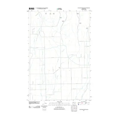
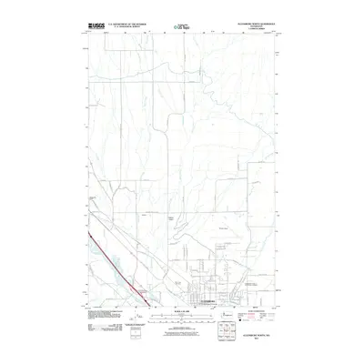
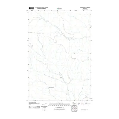
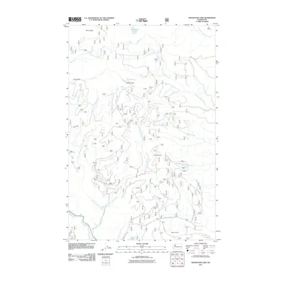
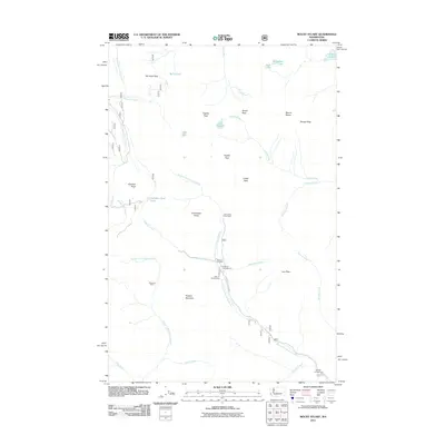
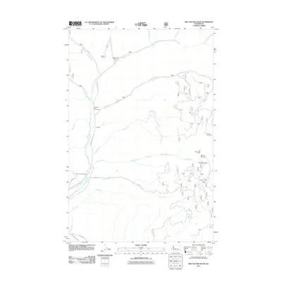
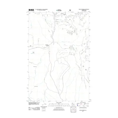
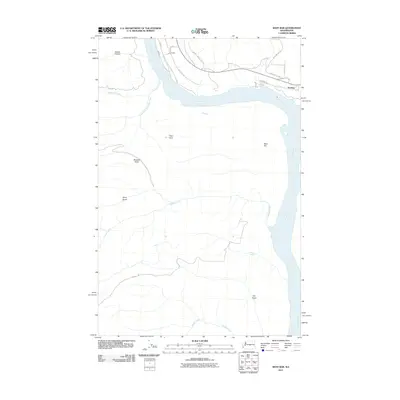
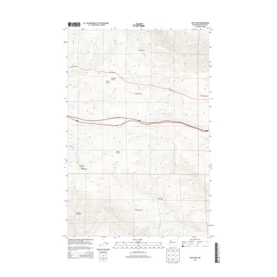
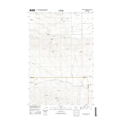
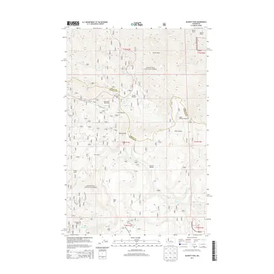
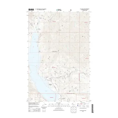
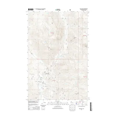
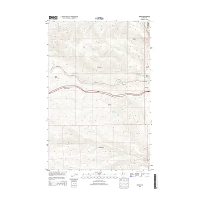
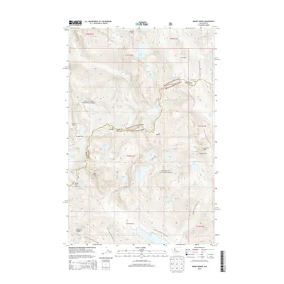
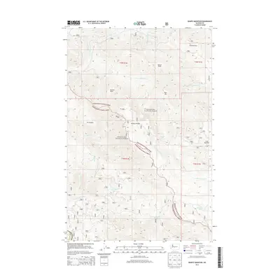
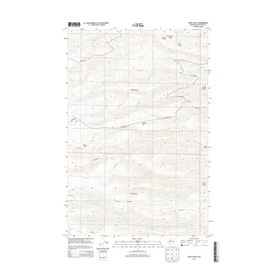
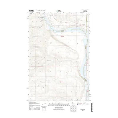
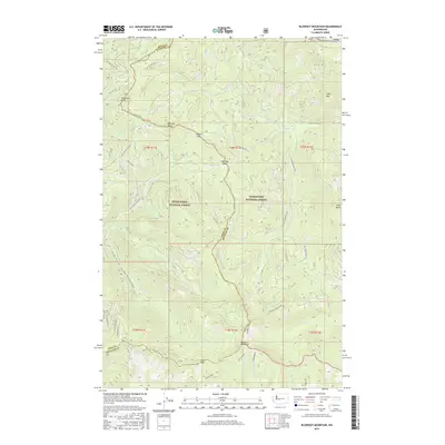
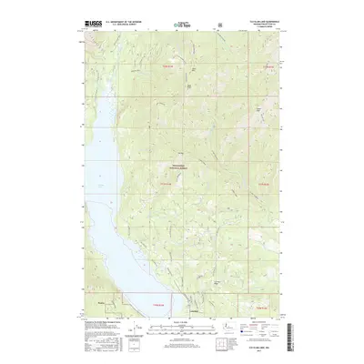
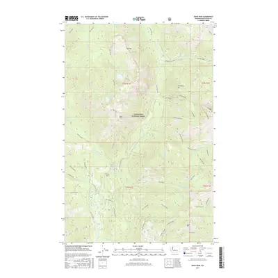
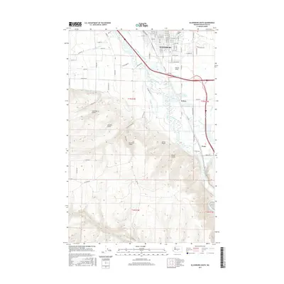
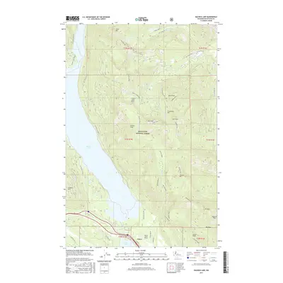
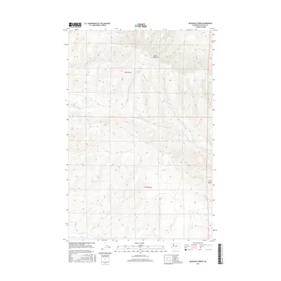
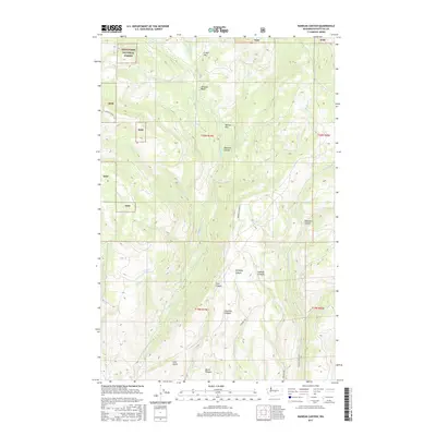
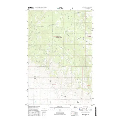
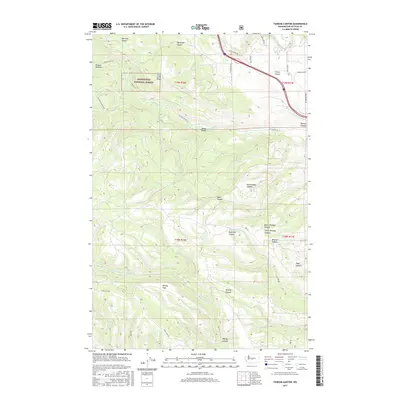
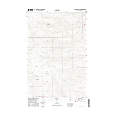
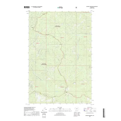
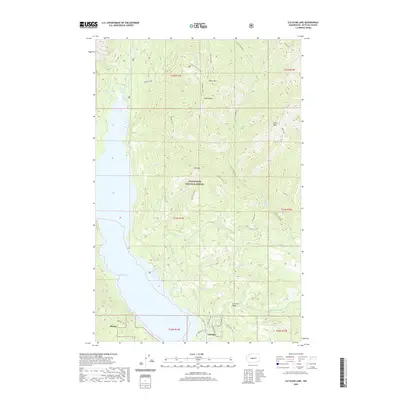
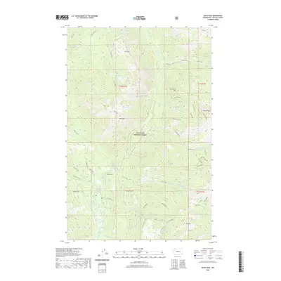
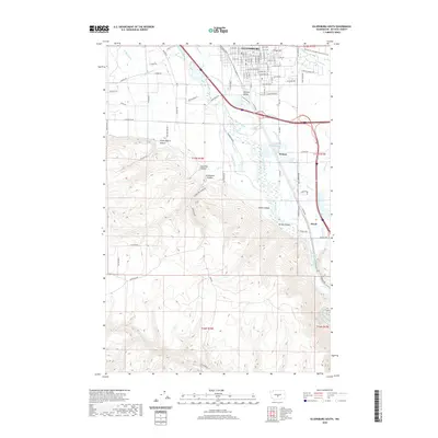
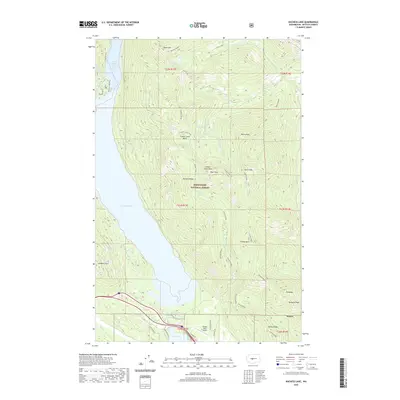
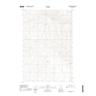
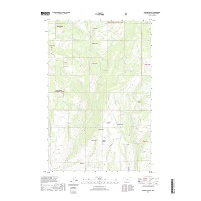
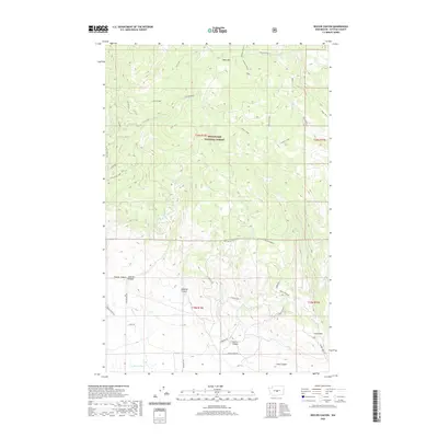
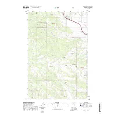
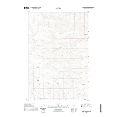
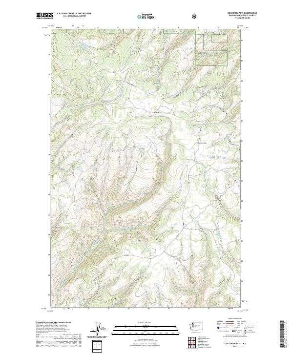
1922 Map of Colockum Pass
USGS Topo · Published 1922About this map
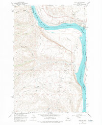
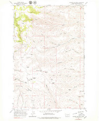
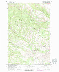
The Wenatchee Mountains and the high ridge of Colockum Pass dominate this 1920s-era landscape, where the rugged terrain of eastern Washington drops toward the banks of the Columbia River. The map reveals a remote ranching and rural agricultural economy, punctuated by isolated schools such as the Tarpiscan School and Whisky Dick School. Numerous family-named homesteads including the Sheridan Ranch and Osborn Ranch are clustered near the vital water sources of Colockum Creek and Naneum Creek.
Find a feature on this map
51 named features on this map. Tap any name to fly to it.
Don’t see what you’re looking for? This feature index may not catch every label — zoom into the map to look around manually.
Map Details
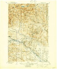
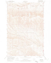
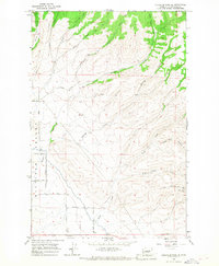
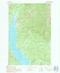
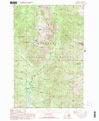
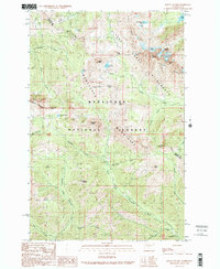
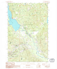
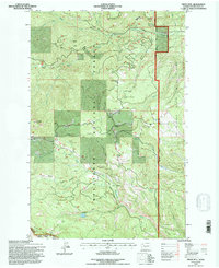
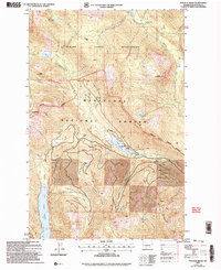
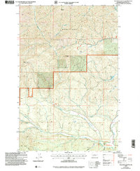
Editions of this 1922 Colockum Pass Map
2 editions found
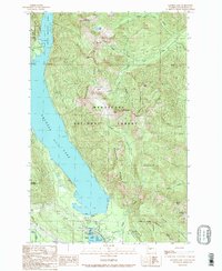
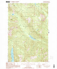
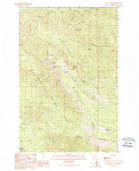
Historical Maps of Wenatchee Through Time
270 maps found
1897 Mount Stuart
Kittitas County, WA
1902 Mount Stuart
Kittitas County, WA

1920 Colockum Pass
Kittitas County, WA
1922 Colockum Pass
Kittitas County, WA

1938 Badger Pocket
Kittitas County, WA

1939 Boylston
Kittitas County, WA
1943 Badger Pocket
Kittitas County, WA
1943 Boylston
Kittitas County, WA
1953 Badger Gap
Kittitas County, WA
1953 Badger Pocket
Kittitas County, WA
1953 Boylston
Kittitas County, WA
1953 Boylston
Kittitas County, WA
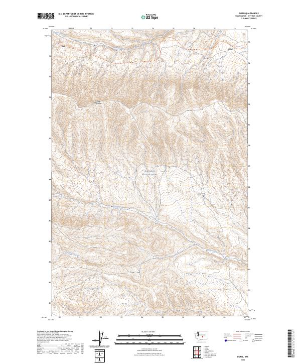
1953 Doris
Kittitas County, WA
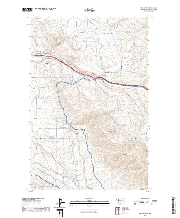
1953 East Kittitas
Kittitas County, WA
1953 Ginkgo
Kittitas County, WA
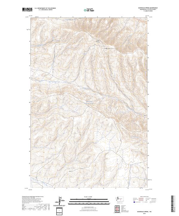
1953 Mc Donald Spring
Kittitas County, WA
1953 Wymer
Kittitas County, WA
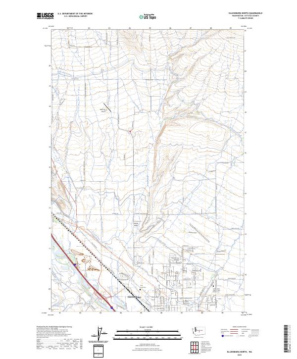
1958 Ellensburg North
Kittitas County, WA
1958 Ellensburg South
Kittitas County, WA
1961 Kachess Lake
Kittitas County, WA
1961 Mount Stuart
Kittitas County, WA

1965 Badger Pocket
Kittitas County, WA
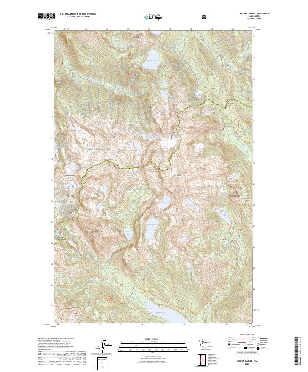
1965 Mount Daniel
Kittitas County, WA
1966 Cape Horn SE
Kittitas County, WA
1966 Colockum Pass
Kittitas County, WA
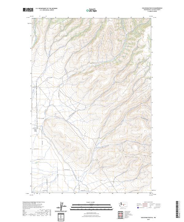
1966 Colockum Pass SE
Kittitas County, WA
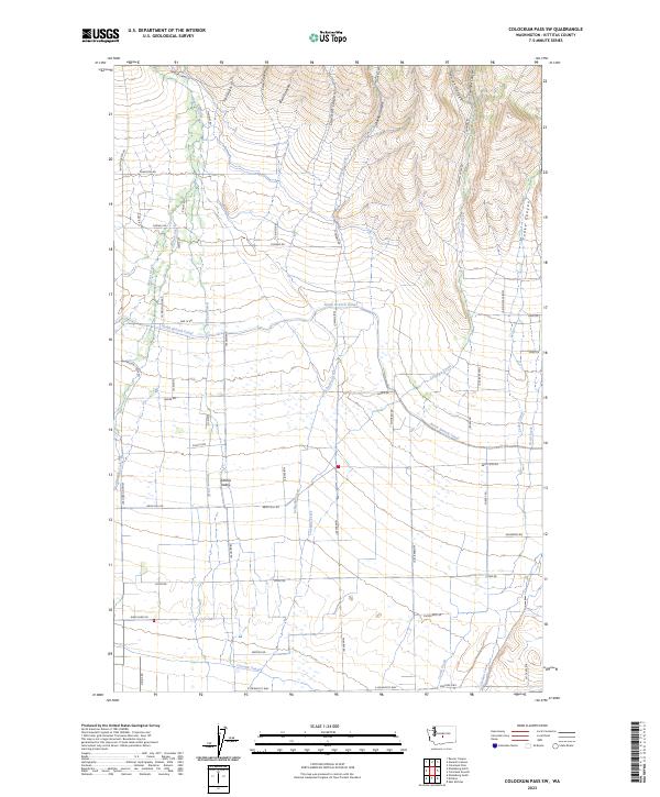
1966 Colockum Pass SW
Kittitas County, WA
1966 Naneum Canyon
Kittitas County, WA
1966 Stray Gulch
Kittitas County, WA
1966 West Bar
Kittitas County, WA
1966 Whiskey Dick Mtn.
Kittitas County, WA
1971 Hudson Creek
Kittitas County, WA
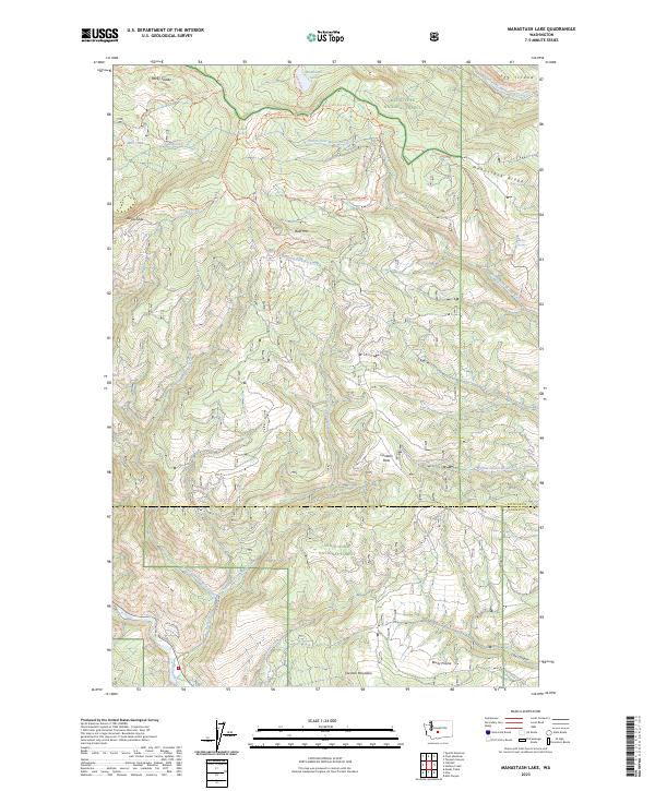
1971 Manastash Lake
Kittitas County, WA
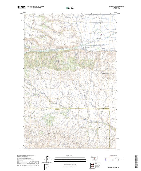
1984 Manastash Creek
Kittitas County, WA
1985 Frost Mtn
Kittitas County, WA
1985 Reecer Canyon
Kittitas County, WA
1985 Swauk Prairie
Kittitas County, WA
1985 Taneum Canyon
Kittitas County, WA

1985 Teanaway
Kittitas County, WA
1989 Blewett Pass
Kittitas County, WA
1989 Blowout Mountain
Kittitas County, WA
1989 Chikamin Peak
Kittitas County, WA
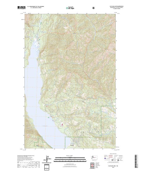
1989 Cle Elum Lake
Kittitas County, WA
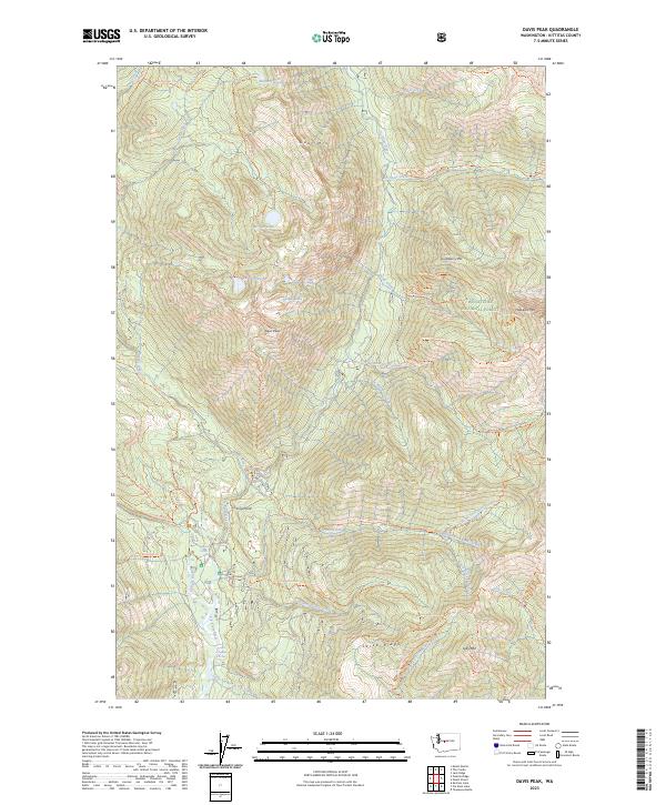
1989 Davis Peak
Kittitas County, WA
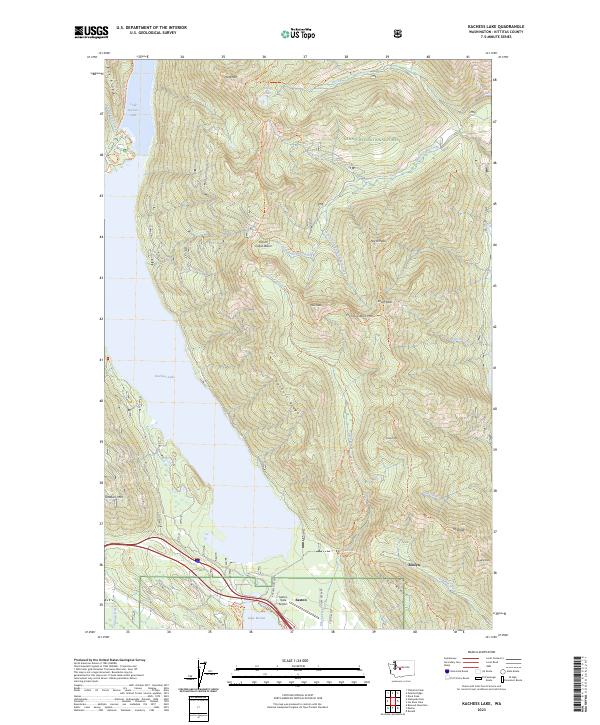
1989 Kachess Lake
Kittitas County, WA
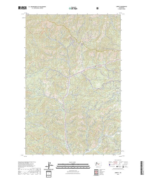
1989 Liberty
Kittitas County, WA
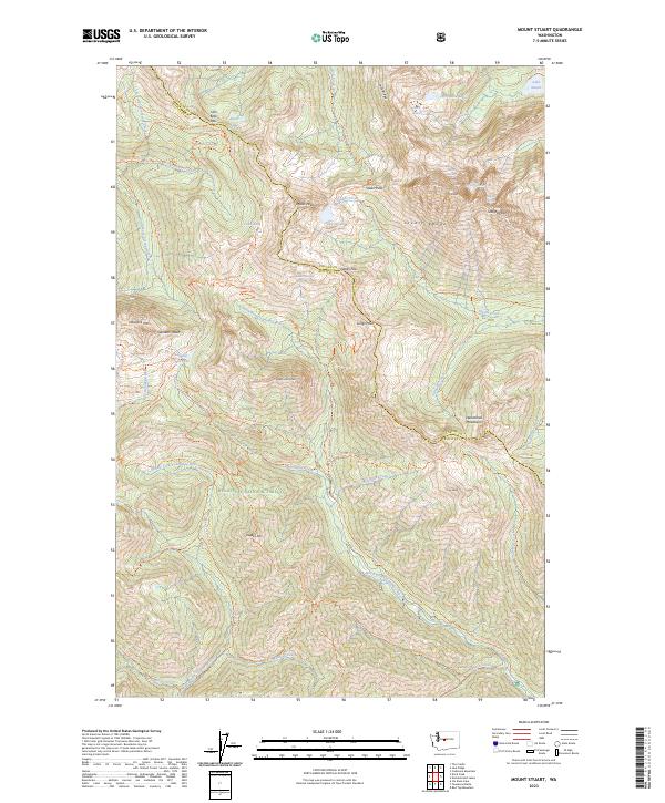
1989 Mount Stuart
Kittitas County, WA
1989 Polallie Ridge
Kittitas County, WA
1989 Quartz Mountain
Kittitas County, WA
1989 Red Top Mountain
Kittitas County, WA
1989 Stampede Pass
Kittitas County, WA

1989 Teanaway
Kittitas County, WA
1992 Frost Mtn
Kittitas County, WA

1992 Manastash Lake
Kittitas County, WA

2000 Manastash Lake
Kittitas County, WA
2003 Blewett Pass
Kittitas County, WA

2003 Cle Elum Lake
Kittitas County, WA
2003 Davis Peak
Kittitas County, WA
2003 Frost Mountain
Kittitas County, WA
2003 Kachess Lake
Kittitas County, WA

2003 Liberty
Kittitas County, WA
2003 Mount Stuart
Kittitas County, WA
2003 Naneum Canyon
Kittitas County, WA
2003 Polallie Ridge
Kittitas County, WA
2003 Red Top Mountain
Kittitas County, WA
2003 Reecer Canyon
Kittitas County, WA
2003 Swauk Prairie
Kittitas County, WA

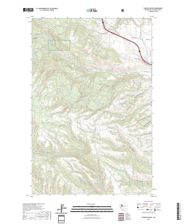
2003 Taneum Canyon
Kittitas County, WA
2003 Teanaway Butte
Kittitas County, WA
2003 Teanaway
Kittitas County, WA
2011 Badger Gap
Kittitas County, WA
2011 Blewett Pass
Kittitas County, WA
2011 Blowout Mountain
Kittitas County, WA
2011 Boylston
Kittitas County, WA
2011 Cape Horn SE
Kittitas County, WA
2011 Chikamin Peak
Kittitas County, WA
2011 Cle Elum Lake
Kittitas County, WA
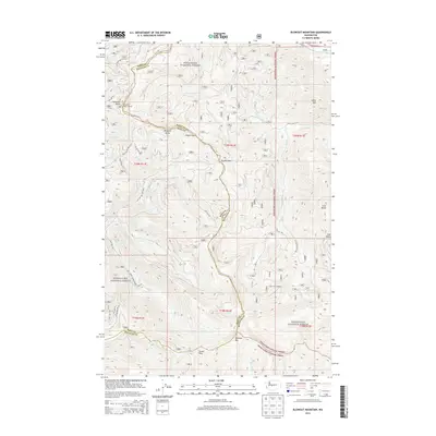
2011 Colockum Pass
Kittitas County, WA
2011 Colockum Pass SE
Kittitas County, WA
2011 Colockum Pass SW
Kittitas County, WA
2011 Davis Peak
Kittitas County, WA
2011 Doris
Kittitas County, WA
2011 East Kittitas
Kittitas County, WA
2011 Ellensburg North
Kittitas County, WA
2011 Ellensburg South
Kittitas County, WA
2011 Frost Mountain
Kittitas County, WA
2011 Ginkgo
Kittitas County, WA
2011 Hudson Creek
Kittitas County, WA
2011 Kachess Lake
Kittitas County, WA
2011 Liberty
Kittitas County, WA
2011 Manastash Creek
Kittitas County, WA
2011 Manastash Lake
Kittitas County, WA
2011 McDonald Spring
Kittitas County, WA
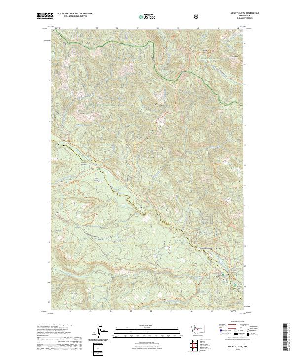
2011 Mount Clifty
Kittitas County, WA
2011 Mount Daniel
Kittitas County, WA
2011 Mount Stuart
Kittitas County, WA
2011 Naneum Canyon
Kittitas County, WA
2011 Polallie Ridge
Kittitas County, WA
2011 Quartz Mountain
Kittitas County, WA
2011 Red Top Mountain
Kittitas County, WA
2011 Reecer Canyon
Kittitas County, WA
2011 Stampede Pass
Kittitas County, WA
2011 Stray Gulch
Kittitas County, WA
2011 Swauk Prairie
Kittitas County, WA
2011 Taneum Canyon
Kittitas County, WA
2011 Teanaway Butte
Kittitas County, WA
2011 Teanaway
Kittitas County, WA
2011 West Bar
Kittitas County, WA
2011 Whiskey Dick Mountain
Kittitas County, WA
2011 Wymer
Kittitas County, WA
2013 Badger Gap
Kittitas County, WA
2013 Boylston
Kittitas County, WA
2013 Doris
Kittitas County, WA
2013 Ellensburg South
Kittitas County, WA
2013 Hudson Creek
Kittitas County, WA
2013 Manastash Creek
Kittitas County, WA
2013 Manastash Lake
Kittitas County, WA
2013 McDonald Spring
Kittitas County, WA
2013 Wymer
Kittitas County, WA
2014 Blewett Pass
Kittitas County, WA
2014 Blowout Mountain
Kittitas County, WA
2014 Cape Horn SE
Kittitas County, WA
2014 Chikamin Peak
Kittitas County, WA
2014 Cle Elum Lake
Kittitas County, WA
2014 Colockum Pass
Kittitas County, WA
2014 Colockum Pass SE
Kittitas County, WA
2014 Colockum Pass SW
Kittitas County, WA
2014 Davis Peak
Kittitas County, WA
2014 East Kittitas
Kittitas County, WA
2014 Ellensburg North
Kittitas County, WA
2014 Frost Mountain
Kittitas County, WA
2014 Ginkgo
Kittitas County, WA
2014 Kachess Lake
Kittitas County, WA
2014 Liberty
Kittitas County, WA
2014 Mount Clifty
Kittitas County, WA
2014 Mount Daniel
Kittitas County, WA
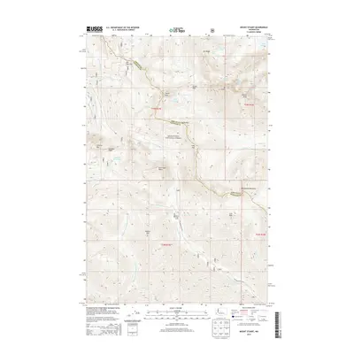
2014 Mount Stuart
Kittitas County, WA
2014 Naneum Canyon
Kittitas County, WA
2014 Polallie Ridge
Kittitas County, WA
2014 Quartz Mountain
Kittitas County, WA
2014 Red Top Mountain
Kittitas County, WA
2014 Reecer Canyon
Kittitas County, WA
2014 Stampede Pass
Kittitas County, WA
2014 Stray Gulch
Kittitas County, WA
2014 Swauk Prairie
Kittitas County, WA

2014 Taneum Canyon
Kittitas County, WA
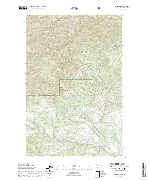
2014 Teanaway Butte
Kittitas County, WA
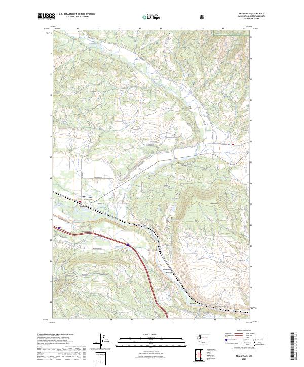
2014 Teanaway
Kittitas County, WA
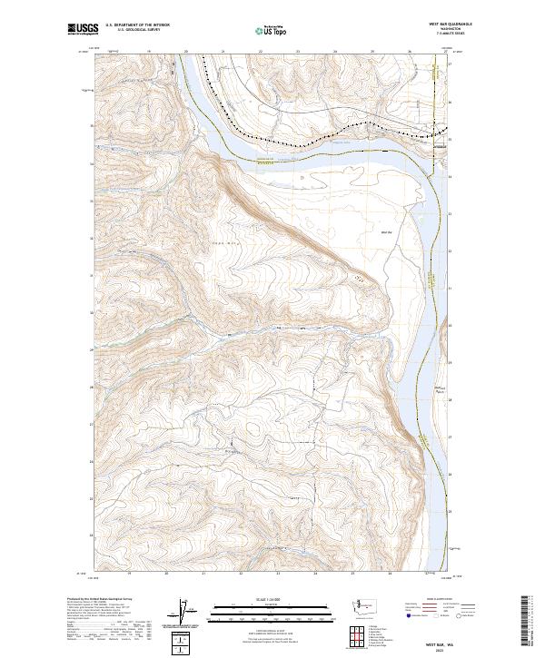
2014 West Bar
Kittitas County, WA
2014 Whiskey Dick Mountain
Kittitas County, WA
2017 Badger Gap
Kittitas County, WA
2017 Blewett Pass
Kittitas County, WA
2017 Blowout Mountain
Kittitas County, WA
2017 Boylston
Kittitas County, WA
2017 Cape Horn SE
Kittitas County, WA
2017 Chikamin Peak
Kittitas County, WA
2017 Cle Elum Lake
Kittitas County, WA
2017 Colockum Pass
Kittitas County, WA
2017 Colockum Pass SE
Kittitas County, WA
2017 Colockum Pass SW
Kittitas County, WA
2017 Davis Peak
Kittitas County, WA
2017 Doris
Kittitas County, WA
2017 East Kittitas
Kittitas County, WA
2017 Ellensburg North
Kittitas County, WA
2017 Ellensburg South
Kittitas County, WA
2017 Frost Mountain
Kittitas County, WA
2017 Ginkgo
Kittitas County, WA
2017 Hudson Creek
Kittitas County, WA
2017 Kachess Lake
Kittitas County, WA
2017 Liberty
Kittitas County, WA
2017 Manastash Creek
Kittitas County, WA
2017 Manastash Lake
Kittitas County, WA
2017 McDonald Spring
Kittitas County, WA
2017 Mount Clifty
Kittitas County, WA
2017 Mount Daniel
Kittitas County, WA
2017 Mount Stuart
Kittitas County, WA
2017 Naneum Canyon
Kittitas County, WA
2017 Polallie Ridge
Kittitas County, WA
2017 Quartz Mountain
Kittitas County, WA
2017 Red Top Mountain
Kittitas County, WA
2017 Reecer Canyon
Kittitas County, WA
2017 Stampede Pass
Kittitas County, WA
2017 Stray Gulch
Kittitas County, WA
2017 Swauk Prairie
Kittitas County, WA
2017 Taneum Canyon
Kittitas County, WA
2017 Teanaway Butte
Kittitas County, WA
2017 Teanaway
Kittitas County, WA
2017 West Bar
Kittitas County, WA
2017 Whiskey Dick Mountain
Kittitas County, WA
2017 Wymer
Kittitas County, WA
2020 Badger Gap
Kittitas County, WA
2020 Blewett Pass
Kittitas County, WA
2020 Blowout Mountain
Kittitas County, WA
2020 Boylston
Kittitas County, WA
2020 Cape Horn SE
Kittitas County, WA
2020 Chikamin Peak
Kittitas County, WA
2020 Cle Elum Lake
Kittitas County, WA
2020 Colockum Pass
Kittitas County, WA
2020 Colockum Pass SE
Kittitas County, WA
2020 Colockum Pass SW
Kittitas County, WA
2020 Davis Peak
Kittitas County, WA
2020 Doris
Kittitas County, WA
2020 East Kittitas
Kittitas County, WA
2020 Ellensburg North
Kittitas County, WA
2020 Ellensburg South
Kittitas County, WA
2020 Frost Mountain
Kittitas County, WA
2020 Ginkgo
Kittitas County, WA
2020 Hudson Creek
Kittitas County, WA
2020 Kachess Lake
Kittitas County, WA
2020 Liberty
Kittitas County, WA
2020 Manastash Creek
Kittitas County, WA
2020 Manastash Lake
Kittitas County, WA
2020 McDonald Spring
Kittitas County, WA
2020 Mount Clifty
Kittitas County, WA
2020 Mount Daniel
Kittitas County, WA
2020 Mount Stuart
Kittitas County, WA
2020 Naneum Canyon
Kittitas County, WA
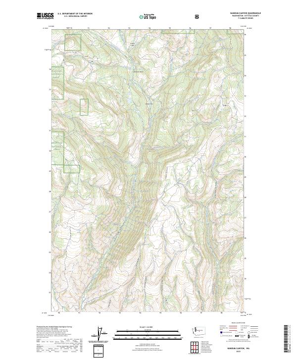
2020 Polallie Ridge
Kittitas County, WA
2020 Quartz Mountain
Kittitas County, WA
2020 Red Top Mountain
Kittitas County, WA
2020 Reecer Canyon
Kittitas County, WA
2020 Stampede Pass
Kittitas County, WA
2020 Stray Gulch
Kittitas County, WA
2020 Swauk Prairie
Kittitas County, WA
2020 Taneum Canyon
Kittitas County, WA
2020 Teanaway Butte
Kittitas County, WA
2020 Teanaway
Kittitas County, WA
2020 West Bar
Kittitas County, WA
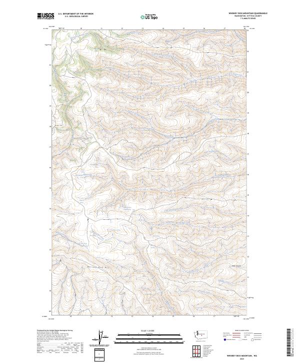
2020 Whiskey Dick Mountain
Kittitas County, WA
2020 Wymer
Kittitas County, WA
2023 Badger Gap
Kittitas County, WA
2023 Blewett Pass
Kittitas County, WA
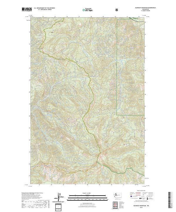
2023 Blowout Mountain
Kittitas County, WA
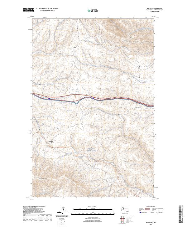
2023 Boylston
Kittitas County, WA
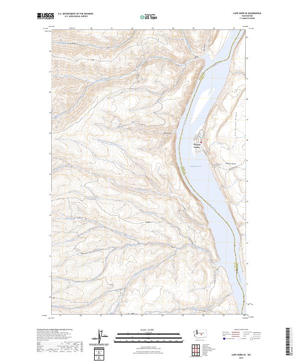
2023 Cape Horn SE
Kittitas County, WA
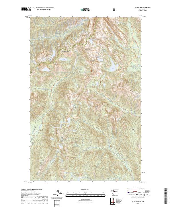
2023 Chikamin Peak
Kittitas County, WA
2023 Cle Elum Lake
Kittitas County, WA
2023 Colockum Pass
Kittitas County, WA
2023 Colockum Pass SE
Kittitas County, WA
2023 Colockum Pass SW
Kittitas County, WA
2023 Davis Peak
Kittitas County, WA
2023 Doris
Kittitas County, WA
2023 East Kittitas
Kittitas County, WA
2023 Ellensburg North
Kittitas County, WA
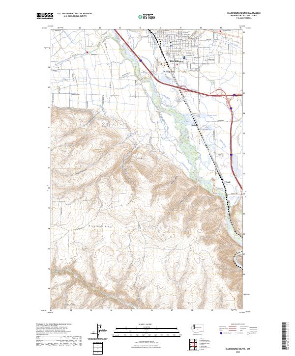
2023 Ellensburg South
Kittitas County, WA
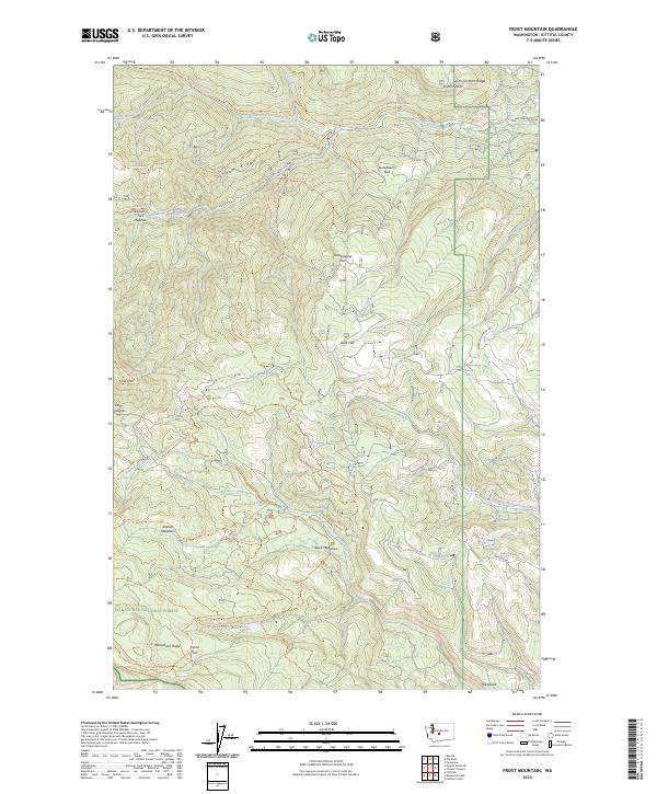
2023 Frost Mountain
Kittitas County, WA
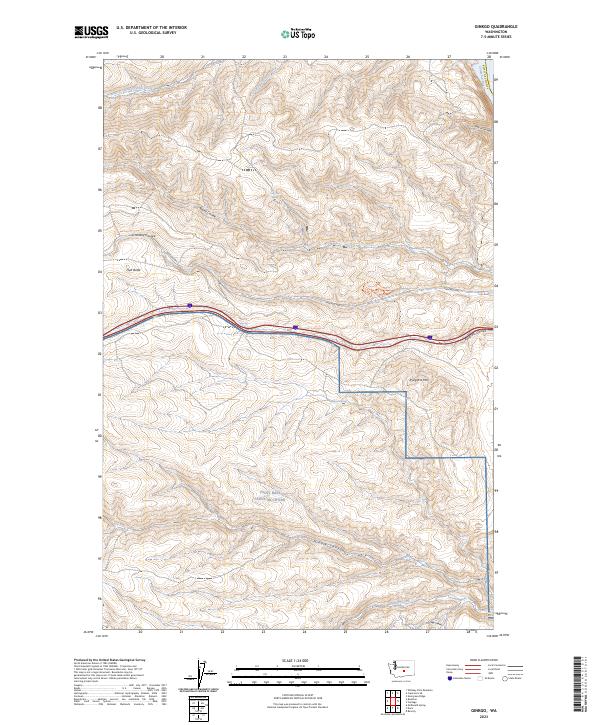
2023 Ginkgo
Kittitas County, WA
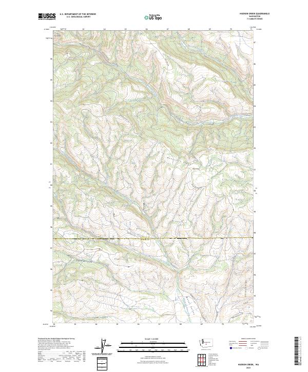
2023 Hudson Creek
Kittitas County, WA
2023 Kachess Lake
Kittitas County, WA
2023 Liberty
Kittitas County, WA
2023 Manastash Creek
Kittitas County, WA
2023 Manastash Lake
Kittitas County, WA
2023 McDonald Spring
Kittitas County, WA
2023 Mount Clifty
Kittitas County, WA
2023 Mount Daniel
Kittitas County, WA
2023 Mount Stuart
Kittitas County, WA
2023 Naneum Canyon
Kittitas County, WA
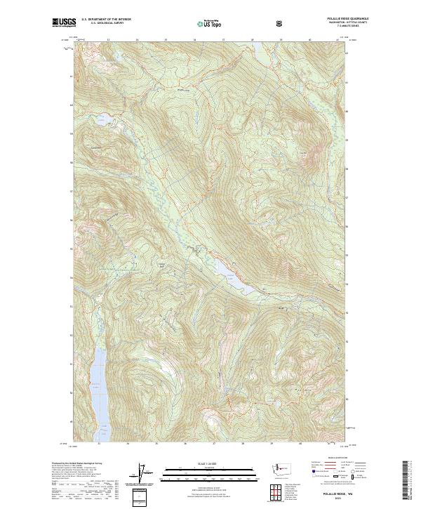
2023 Polallie Ridge
Kittitas County, WA
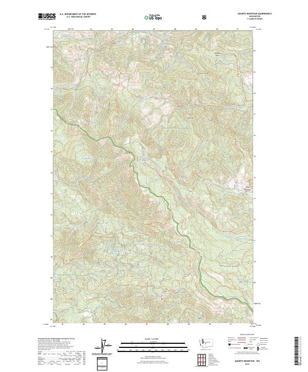
2023 Quartz Mountain
Kittitas County, WA
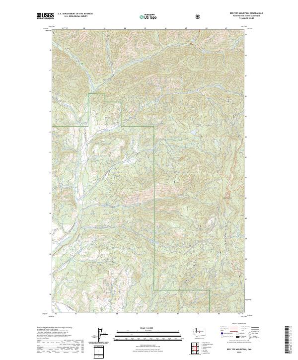
2023 Red Top Mountain
Kittitas County, WA
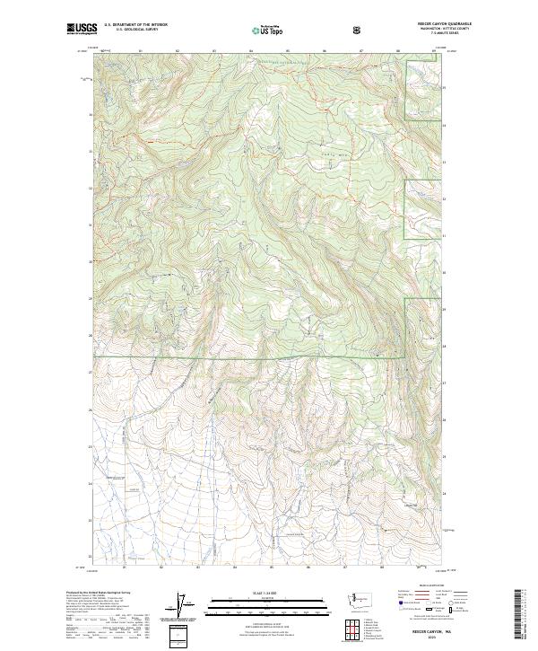
2023 Reecer Canyon
Kittitas County, WA
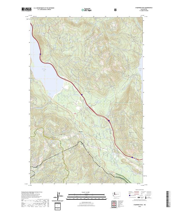
2023 Stampede Pass
Kittitas County, WA
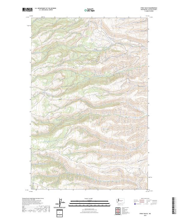
2023 Stray Gulch
Kittitas County, WA
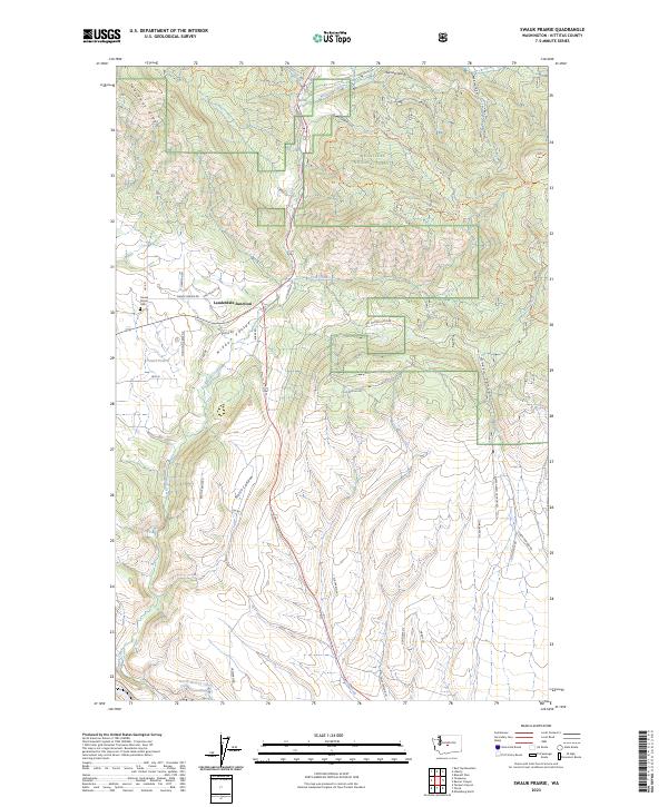
2023 Swauk Prairie
Kittitas County, WA
2023 Taneum Canyon
Kittitas County, WA
2023 Teanaway Butte
Kittitas County, WA
2023 Teanaway
Kittitas County, WA
2023 West Bar
Kittitas County, WA
2023 Whiskey Dick Mountain
Kittitas County, WA
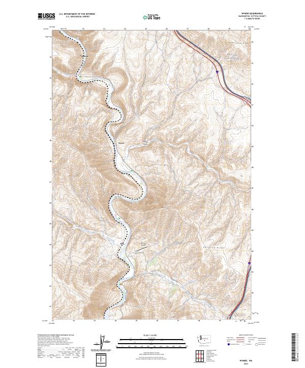
2023 Wymer
Kittitas County, WA