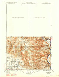
1922 Map of Colockum Pass
USGS Topo · Published 1947About this map
The Wenatchee Mountains and the high desert canyons of Kittitas dominate this 1922 edition, which captures the era's reliance on isolated ranching and localized schooling before modern road networks. Settlement is concentrated along the western valley floors and the banks of the Columbia River, where the Trinidad Ferry provided a critical crossing point. High-elevation landmarks like Colockum Pass and Jumpoff Ridge overlook a landscape carved by numerous drainages, including Tarpiscan Creek and Whisky Dick Creek.
Find a feature on this map
59 named features on this map. Tap any name to fly to it.
Don’t see what you’re looking for? This feature index may not catch every label — zoom into the map to look around manually.
Map Details
Editions of this 1922 Colockum Pass Map
2 editions found

Other maps of this area

1897 · Mount Stuart
USGS Topo · 1:125,000

1899 · Ellensburg
USGS Topo · 1:125,000

1901 · Chelan
USGS Topo · 1:125,000

1901 · Ellensburg
USGS Topo · 1:125,000

1901 · Chiwaukum
USGS Topo · 1:125,000

1902 · Mount Stuart
USGS Topo · 1:125,000

1904 · Chiwaukum
USGS Topo · 1:125,000

1909 · Quincy
USGS Topo · 1:62,500

1910 · Quincy
USGS Topo · 1:62,500

1912 · Beverly
USGS Topo · 1:62,500