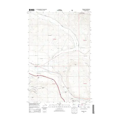
2014 Map of Teanaway
USGS Topo · Published 2014About this map
The Teanaway River and Yakima River converge in this high-country landscape of central Washington, where the Wenatchee National Forest meets the developed valley floor. This 2014 survey captures a network of small settlements and transportation corridors, including Bristol, Horlick, and Teanaway. The terrain is defined by prominent elevations such as Cle Elum Ridge and Indian John Hill, with the lower reaches featuring agricultural and infrastructure landmarks like the Main Canal. Aviation and recreation are represented by the De Vere Field Airport, while the proximity to the forest suggests a landscape shaped by timber and watershed management. Local roads like Teanaway Rd and Red Bridge Rd provide access to the disparate pockets of settlement, from the open Swauk Prairie to the sheltered Horseshoe Canyon.
Find a feature on this map
55 named features on this map. Tap any name to fly to it.
Don’t see what you’re looking for? This feature index may not catch every label — zoom into the map to look around manually.
Map Details
Editions of this 2014 Teanaway Map
This is the sole edition of this map. No revisions or reprints were ever made.
Other maps of this area

1897 · Mount Stuart
USGS Topo · 1:125,000

1902 · Mount Stuart
USGS Topo · 1:125,000

1957 · Wenatchee
USGS Topo · 1:250,000

1958 · Thorp
USGS Topo · 1:24,000

1958 · Thorp
USGS Topo · 1:62,500

1958 · Cle Elum
USGS Topo · 1:62,500

1961 · Liberty
USGS Topo · 1:62,500

1961 · Mount Stuart
USGS Topo · 1:62,500

1975 · Wenatchee
USGS Topo · 1:100,000
1984 · Cle Elum
USGS Topo · 1:24,000