Old Maps of Almira, Washington for Hiking & Exploration
Hike through history with 6 historic maps of Almira. Explore old trails, ghost towns, and forgotten backroads — perfect for outdoor adventurers and local explorers.
- Rediscover forgotten places: Map out old mining camps, roads, and footpaths that no longer exist on modern maps.
- Layer with modern tools: Combine with LiDAR or satellite views to plan hikes through historical terrain.
- Made for exploration: Popular among hikers, overlanders, and local history lovers.
Use these maps to find adventure and explore the hidden past of Almira.
Almira, WA maps
(6)- 1953 Map of Ritzville, 1966 Print
 1953 Ritzville1966 Print · USGSEastern Washington was undergoing a massive agricultural and industrial transformation in the mid-fifties as irrigation from the Grand Coulee Dam reached the plateau. Researchers can trace the mid-century rail network of the Great Northern and locate vital local sites like Larson Air Force Base and Odessa.3 unique versions available
 - 1959 Map of Ritzville
 1959 Ritzville1959 Print · USGSEastern Washington in the late fifties reveals a landscape transformed by massive irrigation projects and postwar growth. Genealogists and historians can trace rail-line communities from Ritzville to Davenport and locate landmarks like Larson Air Force Base and Telford Station.
 - 1965 Map of Ritzville
 1965 Ritzville1965 Print · USGSCentral Washington during the mid-sixties shows a landscape shaped by massive irrigation projects and the Cold War. Genealogists and historians can trace rail-town life and military presence through Ephrata Air Base, the Telford Station, and local schools.
 - 1969 Map of Almira, 1972 Print
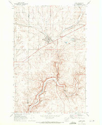 1969 Almira1972 Print · USGSAlmira and the surrounding Coulee Country are captured here in the late sixties as the wheat-farming landscape continued its rail-centered development. Researchers can trace local landmarks like Almira Cemetery, the Burlington Northern railroad, and natural features such as Tracys Cave.
 - 1983 Map of Coulee Dam
 1983 Coulee Dam1983 Print · USGSThe high plateau and deep coulees of central Washington are captured here in the early eighties, centered on the massive Franklin D Roosevelt Lake and the towns of Coulee Dam and Grand Coulee. Researchers can trace the Burlington Northern rail corridor through old stops at Govan and Mondovi or locate the historic Fort Spokane.2 unique versions available
 - 2023 Map of Almira, 2023 Print
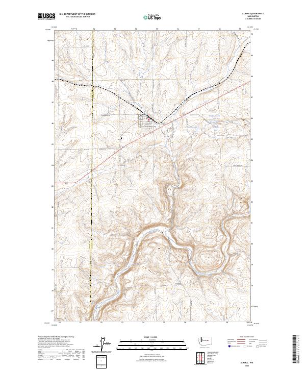 2023 Almira2023 Print · USGSAlmira and the high wheat country of the Columbia Plateau are documented in this recent survey. Local historians can trace family plots at Almira Cem or locate geographical landmarks like Wilson Creek Falls and the aptly named Slaughterhouse Lake.
End of results
Showing maps 1-6 of 6
Top cities near Almira
- Electric City historical maps
- Grand Coulee historical maps
- Wilbur historical maps
- Hartline historical maps
Frequently asked questions
- What are the different types of historical maps available for Almira?
- What is the oldest map of Almira?
- Where can I purchase historical maps of Almira for my home or office?
- Where can I download high-res historical maps of Almira?
- Are there historical topographic maps available for Almira?
- Is there historical aerial imagery available for Almira?
- Where are historical maps of Almira sourced from?